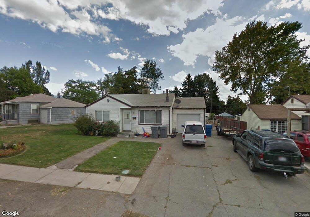
80 Maple Ln Pleasant Grove, UT 84062
Estimated Value: $380,000 - $434,000
2
Beds
1
Bath
770
Sq Ft
$528/Sq Ft
Est. Value
About This Home
This home is located at 80 Maple Ln, Pleasant Grove, UT 84062 and is currently estimated at $406,659, approximately $528 per square foot. 80 Maple Ln is a home located in Utah County with nearby schools including Mount Mahogany School, Pleasant Grove Junior High School, and Pleasant Grove High School.
Ownership History
Date
Name
Owned For
Owner Type
Purchase Details
Closed on
Aug 16, 2006
Sold by
Newman Amy and Newman Paul M
Bought by
Beardall Wade and Beardall Keylee
Current Estimated Value
Purchase Details
Closed on
Nov 11, 2004
Sold by
Duke Lori L
Bought by
Newman Amy
Home Financials for this Owner
Home Financials are based on the most recent Mortgage that was taken out on this home.
Original Mortgage
$96,000
Interest Rate
6.25%
Mortgage Type
New Conventional
Purchase Details
Closed on
Oct 29, 2004
Sold by
Duke Lori L and Stainley Billy N
Bought by
Duke Lori L
Home Financials for this Owner
Home Financials are based on the most recent Mortgage that was taken out on this home.
Original Mortgage
$96,000
Interest Rate
6.25%
Mortgage Type
New Conventional
Purchase Details
Closed on
Sep 29, 2004
Sold by
Newman Amy
Bought by
Newman Paul M and Newman Amy
Home Financials for this Owner
Home Financials are based on the most recent Mortgage that was taken out on this home.
Original Mortgage
$96,000
Interest Rate
6.25%
Mortgage Type
New Conventional
Purchase Details
Closed on
Nov 12, 2003
Sold by
Duke Lori L and Stailey Lori L
Bought by
Duke Lori L and Stailey Billy N
Home Financials for this Owner
Home Financials are based on the most recent Mortgage that was taken out on this home.
Original Mortgage
$114,518
Interest Rate
5.72%
Mortgage Type
FHA
Purchase Details
Closed on
Jun 22, 1998
Sold by
Bennett Boyd R and Bennett Melissa A
Bought by
Stailey Lori L
Home Financials for this Owner
Home Financials are based on the most recent Mortgage that was taken out on this home.
Original Mortgage
$119,268
Interest Rate
7.17%
Mortgage Type
FHA
Create a Home Valuation Report for This Property
The Home Valuation Report is an in-depth analysis detailing your home's value as well as a comparison with similar homes in the area
Home Values in the Area
Average Home Value in this Area
Purchase History
| Date | Buyer | Sale Price | Title Company |
|---|---|---|---|
| Beardall Wade | -- | Equity Title Orem Blvd | |
| Newman Amy | -- | Horizon Title Insurance | |
| Duke Lori L | -- | Horizon Title Insurance | |
| Newman Paul M | -- | -- | |
| Duke Lori L | -- | Lone Peak Title Insurance | |
| Stailey Lori L | -- | Signature Title |
Source: Public Records
Mortgage History
| Date | Status | Borrower | Loan Amount |
|---|---|---|---|
| Previous Owner | Newman Paul M | $96,000 | |
| Previous Owner | Duke Lori L | $114,518 | |
| Previous Owner | Stailey Lori L | $119,268 | |
| Closed | Newman Paul M | $24,000 |
Source: Public Records
Tax History
| Year | Tax Paid | Tax Assessment Tax Assessment Total Assessment is a certain percentage of the fair market value that is determined by local assessors to be the total taxable value of land and additions on the property. | Land | Improvement |
|---|---|---|---|---|
| 2025 | $1,558 | $201,300 | -- | -- |
| 2024 | $1,558 | $185,955 | $0 | $0 |
| 2023 | $1,535 | $187,495 | $0 | $0 |
| 2022 | $1,733 | $210,705 | $0 | $0 |
| 2021 | $1,493 | $276,400 | $148,000 | $128,400 |
| 2020 | $1,371 | $248,800 | $132,100 | $116,700 |
| 2019 | $1,188 | $222,900 | $121,400 | $101,500 |
| 2018 | $1,122 | $199,000 | $110,700 | $88,300 |
| 2017 | $1,014 | $95,755 | $0 | $0 |
| 2016 | $1,002 | $91,410 | $0 | $0 |
| 2015 | $1,058 | $91,410 | $0 | $0 |
| 2014 | $1,055 | $90,255 | $0 | $0 |
Source: Public Records
Map
Nearby Homes
- 412 S 350 E
- 435 E 790 S Unit 8
- 165 S 200 E
- 190 E 100 S
- 494 E Apple Blossom Dr
- 35 S 100 E
- 46 S 100 W Unit 1
- 77 N Main St
- 590 N Buffalo Grass Ln
- 588 N Buffalo Grass Ln
- 582 N Buffalo Grass Ln
- 578 N Buffalo Grass Ln
- 576 N Buffalo Grass Ln
- 572 N Buffalo Grass Ln
- 570 N Buffalo Grass Ln
- 574 N Buffalo Grass Ln
- 568 N Buffalo Grass Ln
- 566 N Buffalo Grass Ln
- 564 N Buffalo Grass Ln Unit 1250
- 560 N Buffalo Grass Ln
Your Personal Tour Guide
Ask me questions while you tour the home.