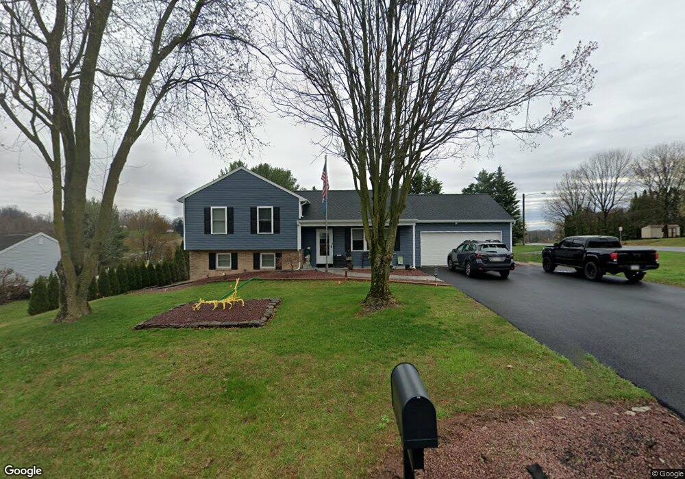
80 N King St Denver, PA 17517
Estimated Value: $266,051 - $316,000
3
Beds
1
Bath
1,380
Sq Ft
$207/Sq Ft
Est. Value
About This Home
This home is located at 80 N King St, Denver, PA 17517 and is currently estimated at $285,013, approximately $206 per square foot. 80 N King St is a home located in Lancaster County with nearby schools including Cocalico Senior High School, Reamstown Mennonite School, and Springville Mennonite School.
Ownership History
Date
Name
Owned For
Owner Type
Purchase Details
Closed on
Apr 21, 2017
Sold by
Burkholder Wellis R and Burkholder Anna Mary
Bought by
Miller Mervin L
Current Estimated Value
Home Financials for this Owner
Home Financials are based on the most recent Mortgage that was taken out on this home.
Original Mortgage
$55,000
Outstanding Balance
$45,881
Interest Rate
4.3%
Mortgage Type
Future Advance Clause Open End Mortgage
Estimated Equity
$239,132
Create a Home Valuation Report for This Property
The Home Valuation Report is an in-depth analysis detailing your home's value as well as a comparison with similar homes in the area
Home Values in the Area
Average Home Value in this Area
Purchase History
| Date | Buyer | Sale Price | Title Company |
|---|---|---|---|
| Miller Mervin L | $110,000 | None Available |
Source: Public Records
Mortgage History
| Date | Status | Borrower | Loan Amount |
|---|---|---|---|
| Open | Miller Mervin L | $55,000 |
Source: Public Records
Tax History Compared to Growth
Tax History
| Year | Tax Paid | Tax Assessment Tax Assessment Total Assessment is a certain percentage of the fair market value that is determined by local assessors to be the total taxable value of land and additions on the property. | Land | Improvement |
|---|---|---|---|---|
| 2025 | $3,055 | $122,100 | $46,400 | $75,700 |
| 2024 | $3,055 | $122,100 | $46,400 | $75,700 |
| 2023 | $2,984 | $122,100 | $46,400 | $75,700 |
| 2022 | $2,905 | $122,100 | $46,400 | $75,700 |
| 2021 | $2,905 | $122,100 | $46,400 | $75,700 |
| 2020 | $2,905 | $122,100 | $46,400 | $75,700 |
| 2019 | $2,871 | $122,100 | $46,400 | $75,700 |
| 2018 | $3,405 | $122,100 | $46,400 | $75,700 |
| 2016 | $3,252 | $113,200 | $26,300 | $86,900 |
| 2015 | $669 | $113,200 | $26,300 | $86,900 |
| 2014 | $2,527 | $113,200 | $26,300 | $86,900 |
Source: Public Records
Map
Nearby Homes
- 1265L Swamp Bridge Rd
- 505 Hertzog Valley Rd
- 755 Poplar St
- 125 Indiantown Rd
- 627 Pine St
- 540 Horseshoe Trail Rd
- 514 N 6th St
- 210 Stevens Rd
- 35 Bonview Dr
- 490 Weidmansville Rd
- 0 Weidmansville Rd
- 675 S Ridge Rd
- 131 Sunrise Ln
- 144 Sunrise Ln
- Amberbrook Plan at Wyndale
- Northfield Plan at Wyndale
- Logan Plan at Wyndale
- Stonecroft Plan at Wyndale
- Darien Plan at Wyndale
- Atworth Plan at Wyndale