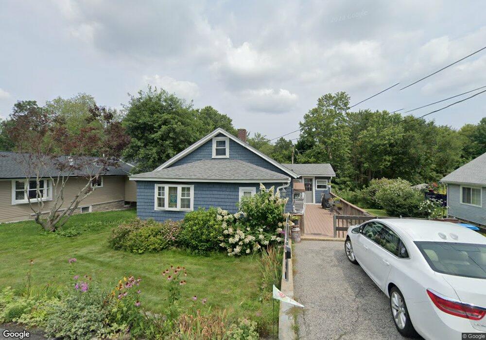
80 Nelson St Unit 1 Holden, MA 01520
Estimated Value: $322,000 - $383,299
2
Beds
1
Bath
970
Sq Ft
$361/Sq Ft
Est. Value
About This Home
This home is located at 80 Nelson St Unit 1, Holden, MA 01520 and is currently estimated at $350,325, approximately $361 per square foot. 80 Nelson St Unit 1 is a home located in Worcester County with nearby schools including Wachusett Regional High School, Abby Kelley Foster Charter Public School, and Bancroft School.
Ownership History
Date
Name
Owned For
Owner Type
Purchase Details
Closed on
Dec 2, 2014
Sold by
Beriau Yolande
Bought by
Beriau Irt
Current Estimated Value
Purchase Details
Closed on
Mar 18, 2013
Sold by
Diep Quang and Diep Tran
Bought by
Beriau Paul L and Beriau Yolande
Create a Home Valuation Report for This Property
The Home Valuation Report is an in-depth analysis detailing your home's value as well as a comparison with similar homes in the area
Home Values in the Area
Average Home Value in this Area
Purchase History
| Date | Buyer | Sale Price | Title Company |
|---|---|---|---|
| Beriau Irt | -- | -- | |
| Beriau Yolande | -- | -- | |
| Beriau Paul L | $125,000 | -- |
Source: Public Records
Tax History Compared to Growth
Tax History
| Year | Tax Paid | Tax Assessment Tax Assessment Total Assessment is a certain percentage of the fair market value that is determined by local assessors to be the total taxable value of land and additions on the property. | Land | Improvement |
|---|---|---|---|---|
| 2025 | $4,348 | $313,700 | $121,500 | $192,200 |
| 2024 | $3,871 | $273,600 | $117,900 | $155,700 |
| 2023 | $3,870 | $258,200 | $102,500 | $155,700 |
| 2022 | $3,746 | $226,200 | $80,100 | $146,100 |
| 2021 | $3,499 | $201,100 | $76,300 | $124,800 |
| 2020 | $3,332 | $196,000 | $72,600 | $123,400 |
| 2019 | $3,181 | $182,300 | $72,600 | $109,700 |
| 2018 | $2,950 | $167,500 | $69,200 | $98,300 |
| 2017 | $2,800 | $159,200 | $69,200 | $90,000 |
| 2016 | $2,689 | $155,900 | $65,900 | $90,000 |
| 2015 | $2,504 | $138,200 | $65,900 | $72,300 |
| 2014 | $2,453 | $138,200 | $65,900 | $72,300 |
Source: Public Records
Map
Nearby Homes