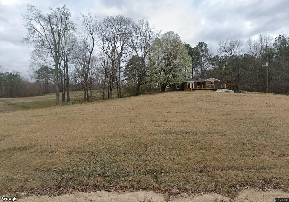
80 Old Bruceton Rd Bruceton, TN 38317
Estimated Value: $121,000 - $488,000
--
Bed
2
Baths
1,748
Sq Ft
$138/Sq Ft
Est. Value
About This Home
This home is located at 80 Old Bruceton Rd, Bruceton, TN 38317 and is currently estimated at $241,463, approximately $138 per square foot. 80 Old Bruceton Rd is a home located in Benton County with nearby schools including Camden Elementary School, Briarwood School, and Camden Junior High School.
Ownership History
Date
Name
Owned For
Owner Type
Purchase Details
Closed on
Jun 30, 2022
Sold by
Reed Thomas O and Reed Rachel
Bought by
Lampers Nicole Charlotte and Wheeler Michael Jay
Current Estimated Value
Home Financials for this Owner
Home Financials are based on the most recent Mortgage that was taken out on this home.
Original Mortgage
$148,000
Outstanding Balance
$140,998
Interest Rate
5.25%
Mortgage Type
New Conventional
Estimated Equity
$100,465
Purchase Details
Closed on
Jul 26, 1979
Bought by
Reed Thomas
Purchase Details
Closed on
Jun 8, 1972
Create a Home Valuation Report for This Property
The Home Valuation Report is an in-depth analysis detailing your home's value as well as a comparison with similar homes in the area
Home Values in the Area
Average Home Value in this Area
Purchase History
| Date | Buyer | Sale Price | Title Company |
|---|---|---|---|
| Lampers Nicole Charlotte | $288,000 | None Listed On Document | |
| Reed Thomas | -- | -- | |
| -- | -- | -- |
Source: Public Records
Mortgage History
| Date | Status | Borrower | Loan Amount |
|---|---|---|---|
| Open | Lampers Nicole Charlotte | $148,000 |
Source: Public Records
Tax History Compared to Growth
Tax History
| Year | Tax Paid | Tax Assessment Tax Assessment Total Assessment is a certain percentage of the fair market value that is determined by local assessors to be the total taxable value of land and additions on the property. | Land | Improvement |
|---|---|---|---|---|
| 2024 | $790 | $28,975 | $4,325 | $24,650 |
| 2023 | $790 | $28,975 | $4,325 | $24,650 |
| 2022 | $790 | $28,975 | $4,325 | $24,650 |
| 2021 | $782 | $28,675 | $4,325 | $24,350 |
| 2020 | $783 | $28,675 | $4,325 | $24,350 |
| 2019 | $844 | $28,600 | $4,325 | $24,275 |
| 2018 | $844 | $28,600 | $4,325 | $24,275 |
| 2017 | $844 | $28,600 | $4,325 | $24,275 |
| 2016 | $844 | $28,600 | $4,325 | $24,275 |
| 2015 | $855 | $28,600 | $4,325 | $24,275 |
| 2014 | $742 | $28,600 | $4,325 | $24,275 |
| 2013 | $742 | $25,228 | $0 | $0 |
Source: Public Records
Map
Nearby Homes
- 217 Sunnyfield Ln
- 0 Sawyers Mill Rd
- 1785 Old Bruceton Rd
- 65 Sandy Point Rd
- 106 Wyatt St N
- 571 Cheatham St
- 210 Lankford St
- 204 Lankford St
- 126 Carroll St S
- 138 Carroll St S
- 148 Highland St
- 1600 Eden Farm Rd
- 114 Elm St
- 420 General Forrest Dr
- 0 Firetower Rd
- 0 Highway 70 E
- 26295 Highway 70 E
- 180 Hillcrest Dr
- 104 Rowland Ave
- 2642 Mount Carmel Rd
- 70 Old Bruceton Rd
- 170 Old Bruceton Rd
- 20 Old Bruceton Rd
- 300 Old Bruceton Rd
- 205 Stigall Rd
- 350 Old Bruceton Rd
- 350 Old Bruceton Rd
- 350 Old Bruceton Rd
- 200 Stigall Rd
- 295 Old Bruceton Rd
- 6010 Hwy 70 W
- 380 Old Bruceton Rd
- 285 Stigall Rd
- 305 Old Bruceton Rd
- 6010 W Highway 192
- 400 Old Bruceton Rd
- 6055 Highway 70 W
- 345 Stigall Rd
- 485 Stigall Rd
- 6035 W 70 W