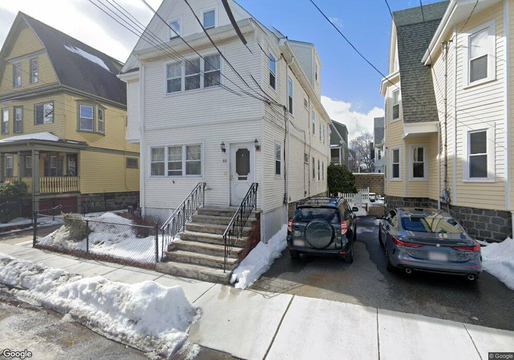
80 Pearson Rd Somerville, MA 02144
Estimated Value: $1,281,000 - $1,732,490
7
Beds
2
Baths
3,323
Sq Ft
$470/Sq Ft
Est. Value
About This Home
This home is located at 80 Pearson Rd, Somerville, MA 02144 and is currently estimated at $1,560,623, approximately $469 per square foot. 80 Pearson Rd is a home located in Middlesex County with nearby schools including Somerville High School, St. Clement Elementary School, and St. Joseph School.
Ownership History
Date
Name
Owned For
Owner Type
Purchase Details
Closed on
Mar 23, 2022
Sold by
Murphy Robert A and Alves Christine E
Bought by
80 Pearson Road Rt
Current Estimated Value
Purchase Details
Closed on
Sep 29, 1995
Sold by
Ditucci Ft and Ditucci Thomas C
Bought by
Murphy Robert A and Alves Christine E
Create a Home Valuation Report for This Property
The Home Valuation Report is an in-depth analysis detailing your home's value as well as a comparison with similar homes in the area
Purchase History
| Date | Buyer | Sale Price | Title Company |
|---|---|---|---|
| 80 Pearson Road Rt | -- | None Available | |
| Murphy Robert A | $240,000 | -- |
Source: Public Records
Mortgage History
| Date | Status | Borrower | Loan Amount |
|---|---|---|---|
| Previous Owner | Murphy Robert A | $100,000 | |
| Previous Owner | Murphy Robert A | $182,500 | |
| Previous Owner | Murphy Robert A | $48,500 | |
| Previous Owner | Murphy Robert A | $15,000 |
Source: Public Records
Tax History
| Year | Tax Paid | Tax Assessment Tax Assessment Total Assessment is a certain percentage of the fair market value that is determined by local assessors to be the total taxable value of land and additions on the property. | Land | Improvement |
|---|---|---|---|---|
| 2025 | $14,750 | $1,352,000 | $694,100 | $657,900 |
| 2024 | $14,099 | $1,340,200 | $694,100 | $646,100 |
| 2023 | $13,398 | $1,295,700 | $694,100 | $601,600 |
| 2022 | $12,614 | $1,239,100 | $661,000 | $578,100 |
| 2021 | $12,249 | $1,202,100 | $656,200 | $545,900 |
| 2020 | $11,457 | $1,135,500 | $656,600 | $478,900 |
| 2019 | $10,848 | $1,008,200 | $597,700 | $410,500 |
| 2018 | $9,975 | $882,000 | $543,400 | $338,600 |
| 2017 | $9,781 | $838,100 | $512,700 | $325,400 |
| 2016 | $9,449 | $754,100 | $457,800 | $296,300 |
| 2015 | $9,034 | $716,400 | $422,800 | $293,600 |
Source: Public Records
Map
Nearby Homes
- 111 Pearson Rd
- 15 Colby St
- 228 Harvard St
- 1004 Broadway Unit 3
- 55 Packard Ave Unit 1
- 42 Packard Ave Unit 42
- 69 Electric Ave Unit 3
- 68 Winslow Ave
- 74 Pearson Ave
- 43 Grove St
- 16 Rogers Ave
- 106 Electric Ave Unit 3
- 595 Broadway Unit 302
- 595 Broadway Unit 102
- 595 Broadway Unit 202
- 595 Broadway Unit 101
- 595 Broadway Unit 301
- 288 Cedar St
- 371 Highland Ave
- 12 Upland Rd
- 80 Pearson Rd Unit 1
- 80 Pearson Rd Unit 2
- 84 Pearson Rd
- 84 Pearson Rd Unit 1
- 84 Pearson Rd Unit 2
- 76 Pearson Rd
- 76 Pearson Rd Unit A
- 88 Pearson Rd
- 79 Pearson Rd Unit 79
- 79 Pearson Rd
- 79 Pearson Rd Unit 1
- 53 Bromfield Rd
- 53 Bromfield Rd Unit 1
- 57 Bromfield Rd
- 57 Bromfield Rd Unit 2
- 49 Bromfield Rd
- 72 Pearson Rd Unit 2
- 72 Pearson Rd
- 77 Pearson Rd Unit pearson rd
- 77 Pearson Rd Unit 4
Your Personal Tour Guide
Ask me questions while you tour the home.