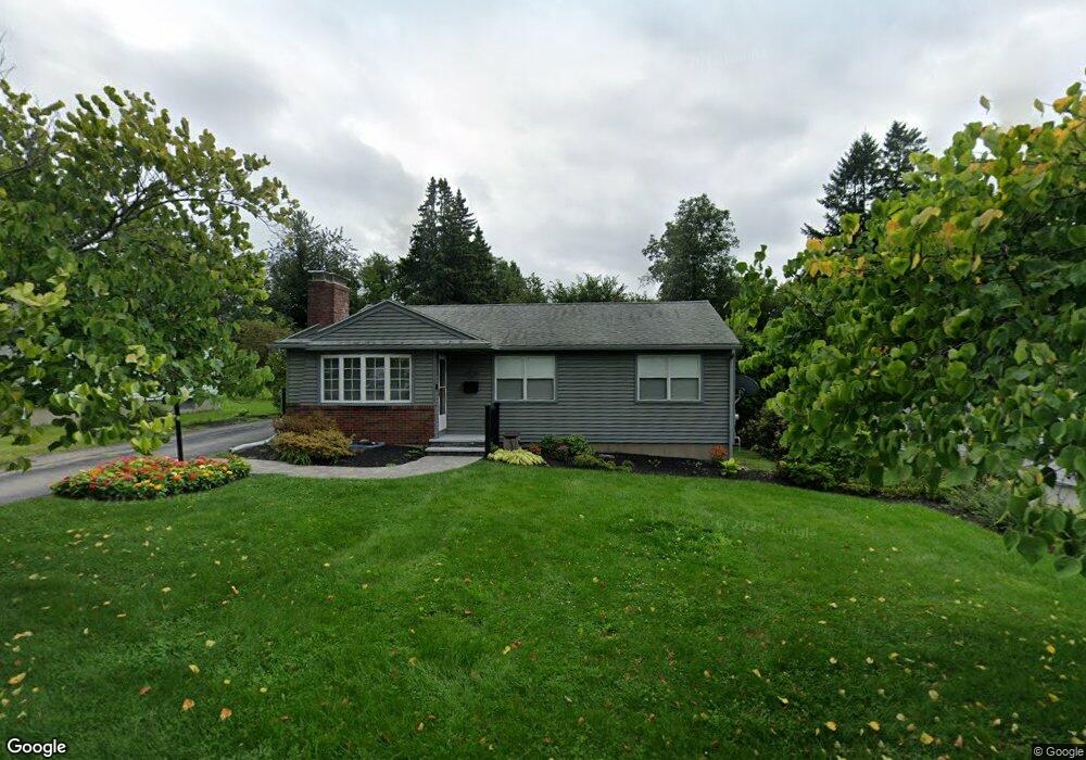
80 Randall St Worcester, MA 01606
Greendale NeighborhoodEstimated Value: $431,953 - $474,000
3
Beds
1
Bath
1,332
Sq Ft
$337/Sq Ft
Est. Value
About This Home
This home is located at 80 Randall St, Worcester, MA 01606 and is currently estimated at $448,738, approximately $336 per square foot. 80 Randall St is a home located in Worcester County with nearby schools including Jacob Hiatt Magnet School, Chandler Magnet, and Thorndyke Road School.
Create a Home Valuation Report for This Property
The Home Valuation Report is an in-depth analysis detailing your home's value as well as a comparison with similar homes in the area
Home Values in the Area
Average Home Value in this Area
Tax History
| Year | Tax Paid | Tax Assessment Tax Assessment Total Assessment is a certain percentage of the fair market value that is determined by local assessors to be the total taxable value of land and additions on the property. | Land | Improvement |
|---|---|---|---|---|
| 2025 | $5,298 | $401,700 | $119,000 | $282,700 |
| 2024 | $5,178 | $376,600 | $119,000 | $257,600 |
| 2023 | $5,018 | $349,900 | $103,400 | $246,500 |
| 2022 | $4,457 | $293,000 | $82,800 | $210,200 |
| 2021 | $4,415 | $271,200 | $66,200 | $205,000 |
| 2020 | $4,231 | $248,900 | $66,200 | $182,700 |
| 2019 | $3,980 | $221,100 | $59,700 | $161,400 |
| 2018 | $3,848 | $203,500 | $59,700 | $143,800 |
| 2017 | $3,911 | $203,500 | $59,700 | $143,800 |
| 2016 | $3,858 | $187,200 | $44,400 | $142,800 |
| 2015 | $3,757 | $187,200 | $44,400 | $142,800 |
| 2014 | $3,658 | $187,200 | $44,400 | $142,800 |
Source: Public Records
Map
Nearby Homes
- 100 Assumption Ave
- 26 Fales St
- 336 Burncoat St
- 78 Leeds St
- 15 Birmingham Rd
- 36 Rowena St
- 86 Saint Nicholas Ave
- 85 Kalmar St
- 521 Burncoat St
- 29R E Mountain St
- 3 Enaya Cir
- 53 Barber Ave
- 10 Malden St
- 328 Brooks St
- 223 Beverly Rd
- 1 Basswood Blvd Unit 1
- 125 Indian Hill Rd
- 1 Brookhaven Rd
- 6 Idalla Ave
- 117 Malden St
Your Personal Tour Guide
Ask me questions while you tour the home.