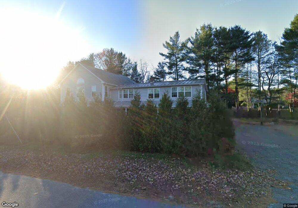
80 Us Route 1 Falmouth, ME 04105
Estimated Value: $1,127,000 - $1,822,000
5
Beds
5
Baths
4,554
Sq Ft
$297/Sq Ft
Est. Value
About This Home
This home is located at 80 Us Route 1, Falmouth, ME 04105 and is currently estimated at $1,352,808, approximately $297 per square foot. 80 Us Route 1 is a home located in Cumberland County with nearby schools including Falmouth Middle School, Falmouth High School, and Baxter Academy for Tech & Sciences.
Ownership History
Date
Name
Owned For
Owner Type
Purchase Details
Closed on
Sep 6, 2006
Sold by
Elinor L Soule T and Soule Elinor L
Bought by
Le Phu P and Nguyen Taunh
Current Estimated Value
Home Financials for this Owner
Home Financials are based on the most recent Mortgage that was taken out on this home.
Original Mortgage
$168,000
Outstanding Balance
$113,016
Interest Rate
9%
Mortgage Type
Adjustable Rate Mortgage/ARM
Estimated Equity
$1,239,792
Create a Home Valuation Report for This Property
The Home Valuation Report is an in-depth analysis detailing your home's value as well as a comparison with similar homes in the area
Home Values in the Area
Average Home Value in this Area
Purchase History
| Date | Buyer | Sale Price | Title Company |
|---|---|---|---|
| Le Phu P | -- | -- |
Source: Public Records
Mortgage History
| Date | Status | Borrower | Loan Amount |
|---|---|---|---|
| Open | Le Phu P | $168,000 |
Source: Public Records
Tax History Compared to Growth
Tax History
| Year | Tax Paid | Tax Assessment Tax Assessment Total Assessment is a certain percentage of the fair market value that is determined by local assessors to be the total taxable value of land and additions on the property. | Land | Improvement |
|---|---|---|---|---|
| 2024 | $9,825 | $734,300 | $182,100 | $552,200 |
| 2023 | $9,255 | $732,200 | $182,100 | $550,100 |
| 2022 | $8,728 | $732,200 | $182,100 | $550,100 |
| 2021 | $7,474 | $428,800 | $113,400 | $315,400 |
| 2020 | $7,311 | $428,800 | $113,400 | $315,400 |
| 2019 | $7,234 | $428,800 | $113,400 | $315,400 |
| 2018 | $7,062 | $428,800 | $113,400 | $315,400 |
| 2017 | $6,698 | $428,800 | $113,400 | $315,400 |
| 2016 | $7,537 | $499,500 | $113,400 | $386,100 |
| 2015 | $3,134 | $214,200 | $113,400 | $100,800 |
| 2014 | $3,020 | $214,200 | $113,400 | $100,800 |
| 2012 | -- | $214,200 | $113,400 | $100,800 |
Source: Public Records
Map
Nearby Homes
- 1038 Ocean Ave
- 242 Veranda St
- 53 Waites Landing Rd
- 11 Osprey Terrace
- 21 Marigold Ln
- 38 Wellstone Dr
- 2 Wellstone Dr
- 118 Providence St
- 16 Veronica Ln
- 2 Apple Ledge Dr Unit A
- 605 Washington Ave
- 109 Foreside Rd
- 35 Presumpscot St W Unit A
- 35 Presumpscot St W Unit B
- 41 Presumpscot St W Unit C
- 41 Presumpscot St W Unit A
- 41 Presumpscot St W Unit D
- 41 Presumpscot St W Unit E
- 41 Presumpscot St W Unit B
- 41 Presumpscot St W Unit F
- 80 Us Rt One
- 5 Foreside Common Unit 5
- 5 Foreside Common Dr
- 2 Cobblestone St Unit 59
- 7 Cobblestone St Unit 54
- 8 Cobblestone St Unit 58
- 2 Cobblestone St Unit 59
- 6 Foreside Common Dr
- 6 Foreside Common
- 4 Foreside Common
- 4 Foreside Common Dr
- 7 Foreside Common Dr
- 7 Foreside Common Dr Unit 7
- 7 Foreside Common Rd
- 7 Foreside Common Rd Unit 7A
- 3 Foreside Common Rd Unit 3
- 3 Foreside Common Unit 3
- 3 Foreside Common Dr
- 8 Foreside Common Dr
- 9 Foreside Common Dr