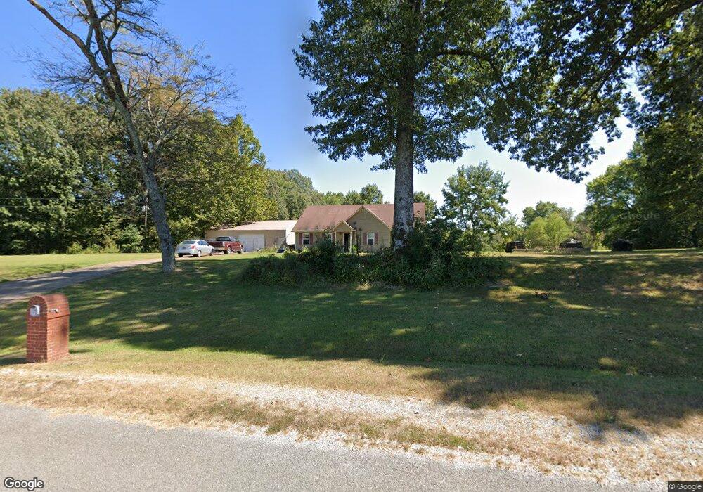
800 Brogdon Rd Ripley, TN 38063
Estimated Value: $235,000 - $250,556
--
Bed
2
Baths
1,439
Sq Ft
$170/Sq Ft
Est. Value
About This Home
This home is located at 800 Brogdon Rd, Ripley, TN 38063 and is currently estimated at $244,889, approximately $170 per square foot. 800 Brogdon Rd is a home located in Lauderdale County with nearby schools including Ripley Primary School, Ripley Elementary School, and Ripley Middle School.
Ownership History
Date
Name
Owned For
Owner Type
Purchase Details
Closed on
Jul 25, 2006
Sold by
Kees Victor L
Bought by
Martindale Billy F
Current Estimated Value
Home Financials for this Owner
Home Financials are based on the most recent Mortgage that was taken out on this home.
Original Mortgage
$116,000
Outstanding Balance
$69,208
Interest Rate
6.74%
Mortgage Type
Cash
Estimated Equity
$175,681
Purchase Details
Closed on
Sep 12, 2003
Bought by
Kees Victor Lee
Create a Home Valuation Report for This Property
The Home Valuation Report is an in-depth analysis detailing your home's value as well as a comparison with similar homes in the area
Home Values in the Area
Average Home Value in this Area
Purchase History
| Date | Buyer | Sale Price | Title Company |
|---|---|---|---|
| Martindale Billy F | $145,000 | -- | |
| Kees Victor Lee | $15,000 | -- |
Source: Public Records
Mortgage History
| Date | Status | Borrower | Loan Amount |
|---|---|---|---|
| Open | Kees Victor Lee | $116,000 | |
| Closed | Kees Victor Lee | $29,000 |
Source: Public Records
Tax History Compared to Growth
Tax History
| Year | Tax Paid | Tax Assessment Tax Assessment Total Assessment is a certain percentage of the fair market value that is determined by local assessors to be the total taxable value of land and additions on the property. | Land | Improvement |
|---|---|---|---|---|
| 2025 | $865 | $34,075 | $0 | $0 |
| 2024 | $865 | $34,075 | $6,825 | $27,250 |
| 2023 | $1,581 | $34,075 | $6,825 | $27,250 |
| 2022 | $1,581 | $34,075 | $6,825 | $27,250 |
| 2021 | $1,543 | $34,075 | $6,825 | $27,250 |
| 2020 | $1,465 | $34,075 | $6,825 | $27,250 |
| 2019 | $1,465 | $29,300 | $5,700 | $23,600 |
| 2018 | $1,464 | $29,300 | $5,700 | $23,600 |
| 2017 | $1,470 | $29,300 | $5,700 | $23,600 |
| 2016 | $1,463 | $29,150 | $5,700 | $23,450 |
| 2015 | $1,476 | $29,150 | $5,700 | $23,450 |
| 2014 | $866 | $29,850 | $5,450 | $24,400 |
Source: Public Records
Map
Nearby Homes
- 44 Martha Cove
- 50 Poplar Grove Cemetery Rd
- 0 87 Hwy Unit 10205304
- 217 Graves Ave
- 265 N Main St
- 310 Deer Run Cove
- 610 Hanna Dr
- 533 Best St
- 119 Larkwood Ave
- 469 Perkins St
- 0 Volz Rd Unit 10202715
- 300 Washington St
- 322 Sherrin Dr
- 1001 Hyde Rd
- 215 S Jefferson St
- 1240 Crutcher Rd
- 224 Kellar Ave
- 334 S Washington St
- 0 Kirkpatrick Dr
- 242 Lackey Ln
- 664 Brogdon Rd
- 4003 Chicken George Trail
- 3628 Chicken George Trail
- 608 Brogdon Rd
- 4122 Chicken George Trail
- 4140 Chicken George Trail
- 3952 Chicken George Trail
- 4174 Chicken George Trail
- 4190 Chicken George Trail
- 4202 Chicken George Trail
- 3885 Chicken George Trail
- 4214 Chicken George Trail
- 4250 Chicken George Trail
- 3900 Chicken George Trail
- 3874 Chicken George Trail
- 4280 Chicken George Trail
- 4224 Chicken George Trail
- 1084 Brogdon Rd
- 56 Martha Cove
- 3809 Chicken George Trail