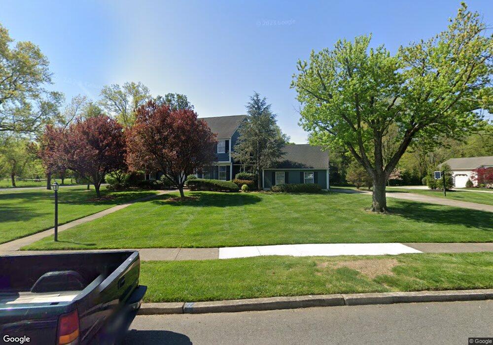
800 Fernwood Rd Moorestown, NJ 08057
Estimated Value: $878,000 - $1,094,000
--
Bed
--
Bath
3,064
Sq Ft
$316/Sq Ft
Est. Value
About This Home
This home is located at 800 Fernwood Rd, Moorestown, NJ 08057 and is currently estimated at $967,875, approximately $315 per square foot. 800 Fernwood Rd is a home located in Burlington County with nearby schools including George C. Baker Elementary School, Moorestown Upper Elementary School, and William Allen Middle School.
Ownership History
Date
Name
Owned For
Owner Type
Purchase Details
Closed on
Aug 9, 1999
Sold by
Weitzel Paul E and Weitzel Jamie H
Bought by
Clyde Rodger D and Clyde Judy K
Current Estimated Value
Home Financials for this Owner
Home Financials are based on the most recent Mortgage that was taken out on this home.
Original Mortgage
$304,000
Outstanding Balance
$84,632
Interest Rate
7.25%
Estimated Equity
$883,243
Create a Home Valuation Report for This Property
The Home Valuation Report is an in-depth analysis detailing your home's value as well as a comparison with similar homes in the area
Home Values in the Area
Average Home Value in this Area
Purchase History
| Date | Buyer | Sale Price | Title Company |
|---|---|---|---|
| Clyde Rodger D | $380,000 | Congress Title Corp |
Source: Public Records
Mortgage History
| Date | Status | Borrower | Loan Amount |
|---|---|---|---|
| Open | Clyde Rodger D | $304,000 |
Source: Public Records
Tax History Compared to Growth
Tax History
| Year | Tax Paid | Tax Assessment Tax Assessment Total Assessment is a certain percentage of the fair market value that is determined by local assessors to be the total taxable value of land and additions on the property. | Land | Improvement |
|---|---|---|---|---|
| 2025 | $14,866 | $524,000 | $197,800 | $326,200 |
| 2024 | $14,415 | $524,000 | $197,800 | $326,200 |
| 2023 | $14,415 | $524,000 | $197,800 | $326,200 |
| 2022 | $14,269 | $524,000 | $197,800 | $326,200 |
| 2021 | $14,080 | $524,000 | $197,800 | $326,200 |
| 2020 | $13,991 | $524,000 | $197,800 | $326,200 |
| 2019 | $13,745 | $524,000 | $197,800 | $326,200 |
| 2018 | $13,372 | $524,000 | $197,800 | $326,200 |
| 2017 | $13,488 | $524,000 | $197,800 | $326,200 |
| 2016 | $13,030 | $508,000 | $197,800 | $310,200 |
| 2015 | $12,873 | $508,000 | $197,800 | $310,200 |
| 2014 | $12,222 | $508,000 | $197,800 | $310,200 |
Source: Public Records
Map
Nearby Homes
- 25 Oriole Way
- 2801 Riverton Rd
- 543 Bethel Ave
- 308 Farmdale Rd
- 316 Farmdale Rd
- 493 N Church St
- 423 Park Blvd
- 863 Golf View Rd
- 313 Fairview Ave
- 2807 Hunterdon Dr
- 343 Tom Brown Rd
- 531 Covington Terrace
- 2611 Barton Ct
- 316 W 3rd St
- 347 Tom Brown Rd
- 205 Crider Ave Unit 205
- 50 E 3rd St
- 66 E 3rd St
- 15 E 2nd St
- 82 E 3rd St
- 802 Fernwood Rd
- 561 New Albany Rd
- 801 Fernwood Rd
- 580 New Albany Rd
- 804 Fernwood Rd
- 805 Fernwood Rd
- 611 New Albany Rd
- 590 New Albany Rd
- 555 New Albany Rd
- 806 Fernwood Rd
- 807 Fernwood Rd
- 553 New Albany Rd
- 610 New Albany Rd
- 615 New Albany Rd
- 551 Bartram Rd
- 550 New Albany Rd
- 809 Fernwood Rd
- 808 Fernwood Rd
- 756 Bowman Ln
- 760 Bowman Ln