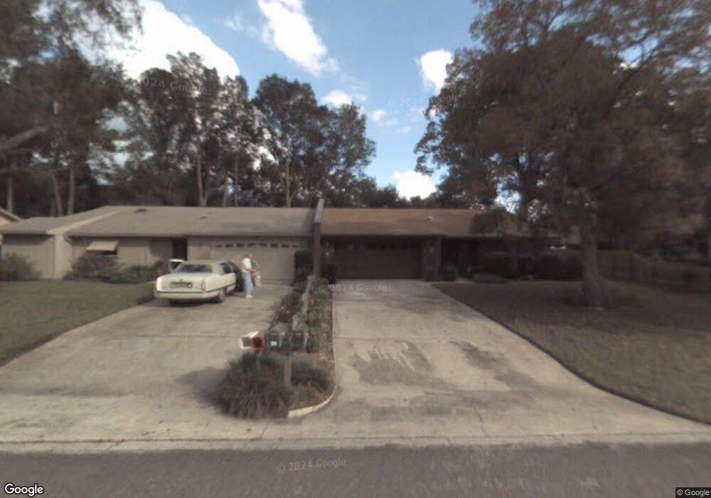
800 Lancaster Rd Deland, FL 32720
North DeLand NeighborhoodEstimated Value: $223,000 - $322,000
2
Beds
2
Baths
1,530
Sq Ft
$176/Sq Ft
Est. Value
About This Home
This home is located at 800 Lancaster Rd, Deland, FL 32720 and is currently estimated at $268,962, approximately $175 per square foot. 800 Lancaster Rd is a home with nearby schools including Deland High School, Citrus Grove Elementary, and Deland Middle School.
Ownership History
Date
Name
Owned For
Owner Type
Purchase Details
Closed on
Dec 6, 2018
Sold by
Sheak Kathleen A
Bought by
Sheak Philip J
Current Estimated Value
Purchase Details
Closed on
May 4, 1998
Sold by
Berringer William P and Berringer Ethel M
Bought by
Sheak Philip C and Sheak Anna Louise
Purchase Details
Closed on
Jun 15, 1990
Bought by
Sheak Anna Louise
Purchase Details
Closed on
Aug 15, 1980
Bought by
Sheak Anna Louise
Create a Home Valuation Report for This Property
The Home Valuation Report is an in-depth analysis detailing your home's value as well as a comparison with similar homes in the area
Home Values in the Area
Average Home Value in this Area
Purchase History
| Date | Buyer | Sale Price | Title Company |
|---|---|---|---|
| Sheak Philip J | -- | Attorney | |
| Sheak Philip C | $77,000 | -- | |
| Sheak Anna Louise | $71,500 | -- | |
| Sheak Anna Louise | $55,400 | -- |
Source: Public Records
Tax History Compared to Growth
Tax History
| Year | Tax Paid | Tax Assessment Tax Assessment Total Assessment is a certain percentage of the fair market value that is determined by local assessors to be the total taxable value of land and additions on the property. | Land | Improvement |
|---|---|---|---|---|
| 2025 | $3,341 | $204,372 | $40,000 | $164,372 |
| 2024 | $3,341 | $209,578 | $40,000 | $169,578 |
| 2023 | $3,341 | $170,309 | $28,500 | $141,809 |
| 2022 | $3,215 | $173,846 | $28,500 | $145,346 |
| 2021 | $3,044 | $137,497 | $20,000 | $117,497 |
| 2020 | $2,819 | $126,025 | $15,000 | $111,025 |
| 2019 | $2,833 | $118,624 | $15,000 | $103,624 |
| 2018 | $1,008 | $74,722 | $0 | $0 |
| 2017 | $997 | $73,185 | $0 | $0 |
| 2016 | $964 | $71,680 | $0 | $0 |
| 2015 | $984 | $71,182 | $0 | $0 |
| 2014 | $982 | $70,617 | $0 | $0 |
Source: Public Records
Map
Nearby Homes
- 2652 N Woodland Blvd
- 1075 Burgoyne Rd
- 2490 N Woodland Blvd
- 2480 N Woodland Blvd
- 336 Raintree Cir Unit 11
- 1105 Burgoyne Rd
- 2836 Shenandoah Rd
- 193 Raintree Cir Unit 88
- 300 Raintree Cir
- 348 Raintree Cir
- 2541 Parkway Dr
- 211 Raintree Cir Unit 85
- 940 Village Green Rd
- 297 Raintree Cir
- 2680 Concord Rd
- 2850 Green Mountain Rd
- 285 Raintree Cir Unit 72
- 29 Ramblewood Trail
- 920 Shady Branch Trail
- 753 Glenwood Rd
- 790 Lancaster Rd
- 810 Lancaster Rd
- 780 Lancaster Rd
- 820 Lancaster Rd
- 855 Lancaster Rd
- 770 Lancaster Rd
- 845 Lancaster Rd
- 830 Lancaster Rd
- 865 Lancaster Rd
- 840 Lancaster Rd
- 835 Lancaster Rd
- 127 Wildwood Rd
- 875 Lancaster Rd
- 850 Lancaster Rd
- 825 Lancaster Rd
- 885 Lancaster Rd
- 831 Freemans Farm Rd
- 860 Lancaster Rd
- 125 Wildwood Rd
- 821 Freemans Farm Rd