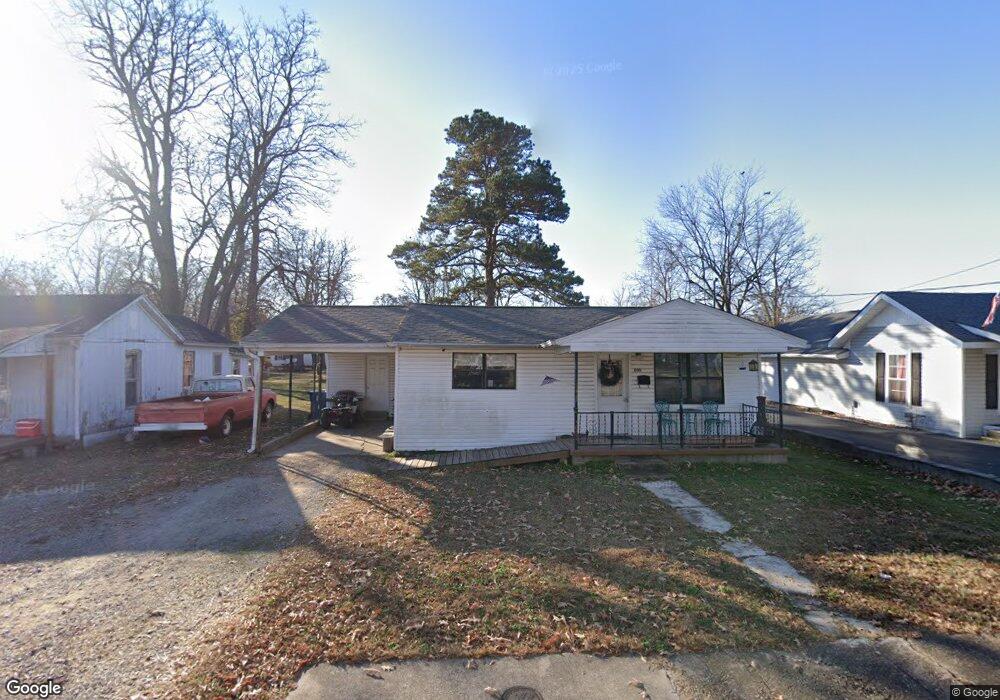
800 W Victor St Poplar Bluff, MO 63901
Estimated Value: $53,000 - $86,000
--
Bed
--
Bath
859
Sq Ft
$82/Sq Ft
Est. Value
About This Home
This home is located at 800 W Victor St, Poplar Bluff, MO 63901 and is currently estimated at $70,277, approximately $81 per square foot. 800 W Victor St is a home with nearby schools including Eugene Field Elementary School, Poplar Bluff Fifth & Sixth Grade Center, and Poplar Bluff Junior High School.
Ownership History
Date
Name
Owned For
Owner Type
Purchase Details
Closed on
Dec 7, 2021
Sold by
Lansford Rick L
Bought by
Harrison Donald
Current Estimated Value
Purchase Details
Closed on
Sep 7, 2006
Sold by
Mattingly Margie A and Lansford Margie A
Bought by
Lansford Rick L
Home Financials for this Owner
Home Financials are based on the most recent Mortgage that was taken out on this home.
Original Mortgage
$65,000
Interest Rate
6.72%
Mortgage Type
Future Advance Clause Open End Mortgage
Create a Home Valuation Report for This Property
The Home Valuation Report is an in-depth analysis detailing your home's value as well as a comparison with similar homes in the area
Home Values in the Area
Average Home Value in this Area
Purchase History
| Date | Buyer | Sale Price | Title Company |
|---|---|---|---|
| Harrison Donald | -- | None Listed On Document | |
| Lansford Rick L | -- | -- |
Source: Public Records
Mortgage History
| Date | Status | Borrower | Loan Amount |
|---|---|---|---|
| Previous Owner | Lansford Rick L | $65,000 |
Source: Public Records
Tax History Compared to Growth
Tax History
| Year | Tax Paid | Tax Assessment Tax Assessment Total Assessment is a certain percentage of the fair market value that is determined by local assessors to be the total taxable value of land and additions on the property. | Land | Improvement |
|---|---|---|---|---|
| 2024 | $3 | $5,820 | $0 | $0 |
| 2023 | $281 | $5,820 | $0 | $0 |
| 2022 | $272 | $5,640 | $0 | $0 |
| 2021 | $272 | $5,640 | $0 | $0 |
| 2020 | $267 | $5,450 | $0 | $0 |
| 2019 | $266 | $5,450 | $0 | $0 |
| 2018 | $266 | $5,450 | $0 | $0 |
| 2017 | -- | $5,450 | $0 | $0 |
| 2016 | -- | $5,450 | $0 | $0 |
| 2015 | -- | $5,450 | $0 | $0 |
| 2014 | -- | $5,080 | $0 | $0 |
| 2012 | $217 | $5,080 | $0 | $0 |
Source: Public Records
Map
Nearby Homes
- 1000 W Victor St
- 712 Nickey St
- 622 Nickey St
- 1315 S 11th St
- 1025 Delano St
- 2121 Pike St
- 1905 Kentucky Ave
- 2335 Cheshire Blvd
- 1708 Kentucky Ave
- 912 Adam St
- 2011 Arkansas Ave
- 1910 Arkansas Ave
- 2015 Arkansas Ave
- 2318 Arkansas Ave
- 803 Kendall Dr
- 2347 Arkansas Ave
- 813 Kendall Dr
- 110 Hampton Ct
- 318 E Henry St
- 251 Hampton Ct
- 722 W Victor St
- 802 W Victor St
- 720 W Victor St
- 801 W Victor St
- 806 W Victor St
- 721 W Victor St
- 725 W Victor St
- 805 W Victor St
- 717 W Victor St
- 712 W Victor St
- 803 Warren St
- 817 W Victor St
- 809 Warren St
- 813 Warren St
- 710 W Victor St
- 719 Warren St
- 715 Warren St
- 713 W Victor St
- 817 Warren St
- 900 W Victor St