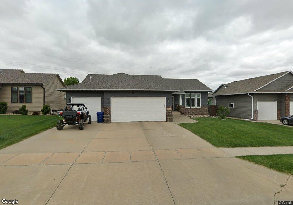
8000 W President St Sioux Falls, SD 57106
Northwest Sioux Falls NeighborhoodEstimated Value: $428,000 - $630,000
--
Bed
4
Baths
1,426
Sq Ft
$350/Sq Ft
Est. Value
About This Home
This home is located at 8000 W President St, Sioux Falls, SD 57106 and is currently estimated at $498,565, approximately $349 per square foot. 8000 W President St is a home with nearby schools including Discovery Elementary School, Memorial Middle School, and Jefferson High School - 67.
Ownership History
Date
Name
Owned For
Owner Type
Purchase Details
Closed on
Jan 11, 2021
Sold by
Sherwood Robert and Sherwood Suzette
Bought by
Sherwood Angela A
Current Estimated Value
Purchase Details
Closed on
Sep 10, 2014
Sold by
Christopher M Christopher M and Sherwood-Neuu Angela A
Bought by
Sherwood Robert and Sherwood Suzette
Purchase Details
Closed on
Dec 19, 2012
Bought by
Neu Christopher M and Sherwood-Neu Angela A
Create a Home Valuation Report for This Property
The Home Valuation Report is an in-depth analysis detailing your home's value as well as a comparison with similar homes in the area
Home Values in the Area
Average Home Value in this Area
Purchase History
| Date | Buyer | Sale Price | Title Company |
|---|---|---|---|
| Sherwood Angela A | -- | None Available | |
| Sherwood Robert | -- | -- | |
| Neu Christopher M | $250,500 | -- |
Source: Public Records
Tax History Compared to Growth
Tax History
| Year | Tax Paid | Tax Assessment Tax Assessment Total Assessment is a certain percentage of the fair market value that is determined by local assessors to be the total taxable value of land and additions on the property. | Land | Improvement |
|---|---|---|---|---|
| 2024 | $5,509 | $408,100 | $41,800 | $366,300 |
| 2023 | $5,711 | $408,100 | $41,800 | $366,300 |
| 2022 | $4,486 | $300,300 | $41,800 | $258,500 |
| 2021 | $5,160 | $261,400 | $0 | $0 |
| 2020 | $5,160 | $267,800 | $0 | $0 |
| 2019 | $5,033 | $255,633 | $0 | $0 |
| 2018 | $4,856 | $250,440 | $0 | $0 |
| 2017 | $4,448 | $246,979 | $47,925 | $199,054 |
| 2016 | $4,448 | $225,533 | $36,865 | $188,668 |
| 2015 | $4,485 | $215,106 | $35,021 | $180,085 |
| 2014 | -- | $208,113 | $35,021 | $173,092 |
Source: Public Records
Map
Nearby Homes
- 1200 S Monticello Ave
- 7809 W Stoney Creek St
- 7805 W Noah Cir
- 1301 Hyannis Port Ln
- 1315 S President Ct
- 1501 S Wheatland Ave
- 1209 S Discovery Ave
- 604 S Mary Gene Ave
- 8709 W Rathburn St
- 1612 S Meadowland Ave
- 1604 S Kinderhook Ave
- 8101 W 24th St
- 8105 W 24th St
- 8113 W 24th St
- 8905 W 18th St
- 1405 S Maria Ave
- 1500 S Kathryn Ave
- 7524 W Boysenberry St
- 7512 W Stoney Creek St
- 1508 S Kathryn Ave
- 8004 W President St
- 7912 W President St
- 7908 W President St
- 8008 W President St
- 1101 S Kinderhook Ave
- 1100 S Kinderhook Ave
- 8001 W Stoney Creek St
- 8001 W Stoney Creek St St
- 7904 W President St
- 7917 W Stoney Creek St
- 8012 W President St
- 8005 W Stoney Creek St
- 8009 W Stoney Creek St
- 1105 S Kinderhook Ave
- 7905 W Stoney Creek St
- 1104 S Kinderhook Ave
- 7909 W Stoney Creek St
- 1101 S Monticello Ave
- 1100 S Wheatland Ave
- 7900 W President St