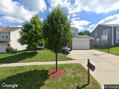
801 Williamstown Dr Carol Stream, IL 60188
Estimated Value: $521,703 - $676,000
4
Beds
3
Baths
3,272
Sq Ft
$187/Sq Ft
Est. Value
About This Home
This home is located at 801 Williamstown Dr, Carol Stream, IL 60188 and is currently estimated at $610,676, approximately $186 per square foot. 801 Williamstown Dr is a home located in DuPage County with nearby schools including Heritage Lakes Elementary School, Jay Stream Middle School, and Glenbard North High School.
Ownership History
Date
Name
Owned For
Owner Type
Purchase Details
Closed on
Feb 12, 2003
Sold by
Housour Barry K
Bought by
Housour Barry K and Housour Christine R
Current Estimated Value
Home Financials for this Owner
Home Financials are based on the most recent Mortgage that was taken out on this home.
Original Mortgage
$292,500
Interest Rate
5%
Purchase Details
Closed on
Aug 17, 2000
Sold by
Housour Cindy A
Bought by
Housour Barry K
Create a Home Valuation Report for This Property
The Home Valuation Report is an in-depth analysis detailing your home's value as well as a comparison with similar homes in the area
Home Values in the Area
Average Home Value in this Area
Purchase History
| Date | Buyer | Sale Price | Title Company |
|---|---|---|---|
| Housour Barry K | -- | Ticor | |
| Housour Barry K | -- | -- |
Source: Public Records
Mortgage History
| Date | Status | Borrower | Loan Amount |
|---|---|---|---|
| Closed | Housour Barry K | $90,000 | |
| Closed | Housour Barry K | $100,000 | |
| Closed | Housour Barry K | $250,000 | |
| Closed | Housour Barry K | $262,500 | |
| Closed | Housour Barry K | $359,500 | |
| Closed | Housour Barry K | $292,500 |
Source: Public Records
Tax History Compared to Growth
Tax History
| Year | Tax Paid | Tax Assessment Tax Assessment Total Assessment is a certain percentage of the fair market value that is determined by local assessors to be the total taxable value of land and additions on the property. | Land | Improvement |
|---|---|---|---|---|
| 2023 | $13,647 | $160,670 | $39,830 | $120,840 |
| 2022 | $13,224 | $149,320 | $37,020 | $112,300 |
| 2021 | $12,565 | $141,750 | $35,140 | $106,610 |
| 2020 | $12,301 | $137,500 | $34,090 | $103,410 |
| 2019 | $11,855 | $132,590 | $32,870 | $99,720 |
| 2018 | $11,167 | $126,880 | $31,450 | $95,430 |
| 2017 | $12,490 | $137,500 | $30,200 | $107,300 |
| 2016 | $12,274 | $131,340 | $28,850 | $102,490 |
| 2015 | $12,200 | $124,330 | $27,310 | $97,020 |
| 2014 | $12,078 | $121,180 | $26,620 | $94,560 |
| 2013 | $12,000 | $124,090 | $27,260 | $96,830 |
Source: Public Records
Map
Nearby Homes
- 620 Teton Cir
- 706 Shining Water Dr
- 601 Oswego Dr
- 534 Alton Ct
- 491 Dakota Ct Unit 2
- 942 Hill Crest Dr
- 1054 Evergreen Dr
- 440 Shelburne Dr
- 26W241 Lies Rd
- 1096 Gunsmoke Ct
- 1089 Baybrook Ln
- 806 Idaho St
- 525 Burke Dr
- 27W270 Jefferson St
- 828 Huron Ct
- 443 Indianwood Dr
- 474 Hunter Dr
- 375 Hunter Dr
- 787 Stanford Ln
- 1192 Brookstone Dr
- 801 Williamstown Dr
- 805 Williamstown Dr
- 797 Williamstown Dr
- 804 Tamarac Dr
- 800 Tamarac Dr
- 809 Williamstown Dr
- 808 Tamarac Dr
- 793 Williamstown Dr
- 804 Williamstown Dr
- 800 Williamstown Dr
- 812 Tamarac Dr
- 808 Williamstown Dr
- 796 Williamstown Dr
- 789 Williamstown Dr
- 694 Chestnut Dr
- 667 Matthew Ln
- 816 Tamarac Dr
- 665 Matthew Ln
- 792 Williamstown Dr
- 820 Williamstown Dr