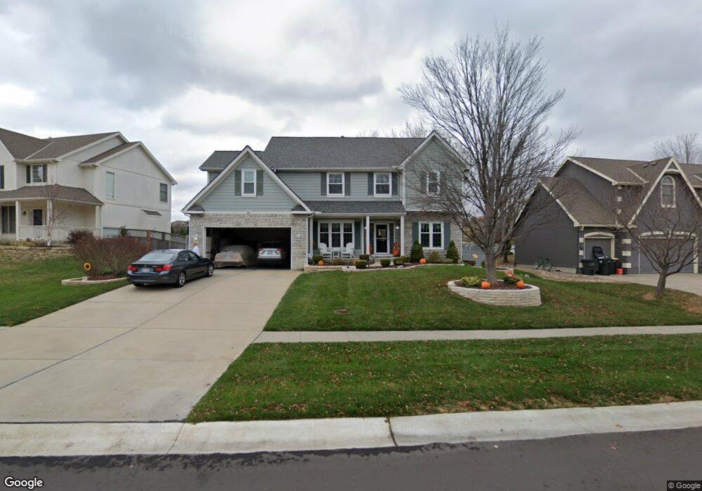
802 Cottonwood Dr Lansing, KS 66043
Estimated Value: $399,399 - $432,000
4
Beds
3
Baths
2,740
Sq Ft
$152/Sq Ft
Est. Value
About This Home
This home is located at 802 Cottonwood Dr, Lansing, KS 66043 and is currently estimated at $416,100, approximately $151 per square foot. 802 Cottonwood Dr is a home located in Leavenworth County with nearby schools including Lansing Elementary School, Lansing Middle 6-8, and Lansing High 9-12.
Ownership History
Date
Name
Owned For
Owner Type
Purchase Details
Closed on
Feb 4, 2021
Sold by
Soby Charles S and Soby Ann M
Bought by
Soby Family Living Trust
Current Estimated Value
Purchase Details
Closed on
Jun 1, 2000
Bought by
Soby Charles S and Soby Ann M
Home Financials for this Owner
Home Financials are based on the most recent Mortgage that was taken out on this home.
Original Mortgage
$50,000
Interest Rate
8.62%
Mortgage Type
New Conventional
Create a Home Valuation Report for This Property
The Home Valuation Report is an in-depth analysis detailing your home's value as well as a comparison with similar homes in the area
Home Values in the Area
Average Home Value in this Area
Purchase History
| Date | Buyer | Sale Price | Title Company |
|---|---|---|---|
| Soby Family Living Trust | -- | None Listed On Document | |
| Soby Charles S | $223,366 | -- |
Source: Public Records
Mortgage History
| Date | Status | Borrower | Loan Amount |
|---|---|---|---|
| Previous Owner | Soby Charles S | $50,000 | |
| Closed | Soby Charles S | $134,117 |
Source: Public Records
Tax History Compared to Growth
Tax History
| Year | Tax Paid | Tax Assessment Tax Assessment Total Assessment is a certain percentage of the fair market value that is determined by local assessors to be the total taxable value of land and additions on the property. | Land | Improvement |
|---|---|---|---|---|
| 2025 | $5,649 | $43,509 | $5,845 | $37,664 |
| 2024 | $5,236 | $41,835 | $5,845 | $35,990 |
| 2023 | $5,236 | $40,227 | $5,845 | $34,382 |
| 2022 | $5,034 | $36,570 | $4,908 | $31,662 |
| 2021 | $4,872 | $33,798 | $4,908 | $28,890 |
| 2020 | $4,715 | $32,188 | $4,908 | $27,280 |
| 2019 | $4,721 | $32,188 | $4,908 | $27,280 |
| 2018 | $4,719 | $32,188 | $4,908 | $27,280 |
| 2017 | $4,551 | $30,983 | $4,908 | $26,075 |
| 2016 | $4,669 | $31,763 | $4,908 | $26,855 |
| 2015 | $4,733 | $32,292 | $4,908 | $27,384 |
| 2014 | $4,511 | $31,426 | $4,908 | $26,518 |
Source: Public Records
Map
Nearby Homes
- 833 Rock Creek Dr
- 1322 Rock Creek Ct
- 875 Clearview Dr
- 866 Clearview Dr
- 1221 S Desoto Rd
- 922 Southfork St
- 811 4-H Rd
- 24431 139th St
- 13965 Mc Intyre Rd
- 000 4-H Rd
- 13788 McIntyre1 Rd
- 13788 Mcintyre Rd
- 13788 McIntyre2 Rd
- 527 S Valley Dr
- 401 W Olive St
- 104 Olive St
- 522 Forestglen Ln
- 00000 Gilman Rd
- 202 S Main St
- 124 S Main St
- 804 Cottonwood Dr
- 806 Cottonwood Dr
- 715 Rock Creek Dr
- 803 Cottonwood Dr
- 801 Cottonwood Dr
- 808 Cottonwood Dr
- 805 Cottonwood Dr
- 714 Cottonwood Dr
- Cotton Cottonwood Dr
- 807 Cottonwood Dr
- 713 Rock Creek Dr
- 809 Cottonwood Dr
- 810 Cottonwood Dr
- 715 Cottonwood Dr
- 712 Cottonwood Dr
- 811 Cottonwood Dr
- 711 Rock Creek Dr
- 831 Rock Creek Dr
- 713 Cottonwood Dr
- 716 Rock Creek Dr