Estimated Value: $466,226 - $588,000
4
Beds
3
Baths
1,229
Sq Ft
$433/Sq Ft
Est. Value
About This Home
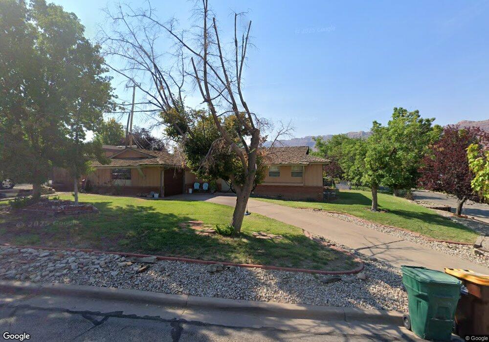
This home is located at 802 Locust Ln, Moab, UT 84532 and is currently estimated at $532,307, approximately $433 per square foot. 802 Locust Ln is a home located in Grand County with nearby schools including Helen M. Knight School, Grand County Middle School, and Grand County High School.
Ownership History
Date
Name
Owned For
Owner Type
Purchase Details
Closed on
Oct 22, 2014
Sold by
Jennifer Jennifer and Eatchel Justin J
Bought by
Hall Quinn W and Hall Leah L
Current Estimated Value
Purchase Details
Closed on
May 24, 2006
Sold by
Brooks Troy L and Brooks Michelle L
Bought by
Trujillo Damian Scott and Trujillo Camille
Home Financials for this Owner
Home Financials are based on the most recent Mortgage that was taken out on this home.
Original Mortgage
$195,700
Outstanding Balance
$113,133
Interest Rate
6.56%
Mortgage Type
New Conventional
Estimated Equity
$419,174
Create a Home Valuation Report for This Property
The Home Valuation Report is an in-depth analysis detailing your home's value as well as a comparison with similar homes in the area
Home Values in the Area
Average Home Value in this Area
Purchase History
| Date | Buyer | Sale Price | Title Company |
|---|---|---|---|
| Hall Quinn W | -- | South Eastern Utah Title Co | |
| Trujillo Damian Scott | -- | -- |
Source: Public Records
Mortgage History
| Date | Status | Borrower | Loan Amount |
|---|---|---|---|
| Open | Trujillo Damian Scott | $195,700 |
Source: Public Records
Tax History
| Year | Tax Paid | Tax Assessment Tax Assessment Total Assessment is a certain percentage of the fair market value that is determined by local assessors to be the total taxable value of land and additions on the property. | Land | Improvement |
|---|---|---|---|---|
| 2025 | $2,637 | $454,944 | $75,000 | $379,944 |
| 2024 | $2,637 | $454,944 | $75,000 | $379,944 |
| 2023 | $2,722 | $375,351 | $75,000 | $300,351 |
| 2022 | $1,889 | $366,603 | $75,000 | $291,603 |
| 2021 | $1,437 | $240,764 | $75,000 | $165,764 |
| 2020 | $1,491 | $240,764 | $75,000 | $165,764 |
| 2019 | $1,407 | $240,764 | $75,000 | $165,764 |
| 2018 | $1,395 | $240,764 | $75,000 | $165,764 |
| 2017 | $1,445 | $0 | $0 | $0 |
| 2016 | $1,430 | $0 | $0 | $0 |
| 2015 | $1,208 | $0 | $0 | $0 |
| 2014 | $1,164 | $0 | $0 | $0 |
| 2013 | $1,165 | $112,605 | $0 | $0 |
Source: Public Records
Map
Nearby Homes
- 248 Hillside Dr
- 738 Locust Ln
- 552 Nichols Ln
- 615 Rosetree Ln
- 499 E 200 S
- 151 Badgers Bend Unit 25
- 199 S 400 E
- 424 E Secret Cove Ct
- 494 E Kachina Way
- 115 Badgers Bend Unit 7
- 146 Badgers Bend Unit 29
- 346 E 200 S Unit A105
- 346 E 200 S Unit A208
- 346 E 200 S Unit A202
- 346 E 200 S Unit A203
- 346 E 200 S Unit A201
- 346 E 200 S Unit A206
- 346 E 200 S Unit A103
- 346 E 200 S Unit A107
- 346 E 200 S Unit A207
Your Personal Tour Guide
Ask me questions while you tour the home.