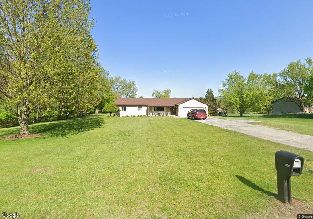
802 N Rogers Hwy Tecumseh, MI 49286
Estimated Value: $346,026 - $392,000
--
Bed
--
Bath
2,024
Sq Ft
$186/Sq Ft
Est. Value
About This Home
This home is located at 802 N Rogers Hwy, Tecumseh, MI 49286 and is currently estimated at $376,009, approximately $185 per square foot. 802 N Rogers Hwy is a home located in Lenawee County with nearby schools including Tecumseh Middle School, Tecumseh High School, and Lenawee Seventh-Day Adventist School.
Ownership History
Date
Name
Owned For
Owner Type
Purchase Details
Closed on
Jun 22, 2020
Sold by
Thomas Kenneth W and Thomas Helen S
Bought by
Thomas Ret
Current Estimated Value
Home Financials for this Owner
Home Financials are based on the most recent Mortgage that was taken out on this home.
Original Mortgage
$164,000
Outstanding Balance
$115,291
Interest Rate
3.2%
Mortgage Type
New Conventional
Estimated Equity
$260,718
Purchase Details
Closed on
Oct 23, 2013
Sold by
Thomas Kenneth W and Thomas Helen S
Bought by
Thomas Kenneth W and Thomas Helen S
Create a Home Valuation Report for This Property
The Home Valuation Report is an in-depth analysis detailing your home's value as well as a comparison with similar homes in the area
Home Values in the Area
Average Home Value in this Area
Purchase History
| Date | Buyer | Sale Price | Title Company |
|---|---|---|---|
| Thomas Ret | -- | None Available | |
| Thomas Kenneth W | -- | None Available | |
| Thomas Kenneth W | -- | None Available |
Source: Public Records
Mortgage History
| Date | Status | Borrower | Loan Amount |
|---|---|---|---|
| Open | Thomas Kenneth W | $164,000 |
Source: Public Records
Tax History Compared to Growth
Tax History
| Year | Tax Paid | Tax Assessment Tax Assessment Total Assessment is a certain percentage of the fair market value that is determined by local assessors to be the total taxable value of land and additions on the property. | Land | Improvement |
|---|---|---|---|---|
| 2025 | $4,708 | $169,400 | $0 | $0 |
| 2024 | $3,983 | $161,900 | $0 | $0 |
| 2023 | $4,631 | $149,400 | $0 | $0 |
| 2022 | $4,455 | $142,800 | $0 | $0 |
| 2021 | $6,650 | $134,500 | $0 | $0 |
| 2020 | $4,681 | $128,000 | $0 | $0 |
| 2019 | $4,600 | $122,100 | $24,000 | $98,100 |
| 2017 | $4,344 | $108,600 | $24,000 | $84,600 |
| 2016 | $4,335 | $104,700 | $24,000 | $80,700 |
| 2014 | $4,178 | $94,200 | $19,200 | $75,000 |
Source: Public Records
Map
Nearby Homes
- 799 War Bonnet Dr
- 797 War Bonnet Dr
- 798 War Bonnet Dr
- 796 War Bonnet Dr
- 700 E Russell Rd
- 215 S Oneida St
- 102 N Maumee St
- 210 S Ottawa St
- 601 S Pearl St
- 309 S Evans St
- 829 S Union St
- 600 Center Dr
- 820 Waskin Dr
- 816 Waskin Dr
- 800 Waskin Dr
- 207 S Union St
- 504 Spafford St
- 314 W Logan St
- 301 W Shawnee St
- 607 Shadow Brooke Ln
- 804 N Rogers Hwy
- 806 N Rogers Hwy
- 800 N Rogers Hwy
- 848 Bonner Dr
- 846 Bonner Dr
- 844 Bonner Dr
- 740 N Rogers Hwy
- 842 Bonner Dr
- 838 Bonner Dr
- 836 Bonner Dr
- 830 Bonner Dr Unit 40
- 828 Bonner Dr
- 828 Bonner Dr Unit 39
- 832 Bonner Dr
- 832 Bonner Dr Unit 41
- 826 Bonner Dr
- 826 Bonner Dr Unit 38
- 834 Bonner Dr
- 834 Bonner Dr Unit 42
- 822 Bonner Dr