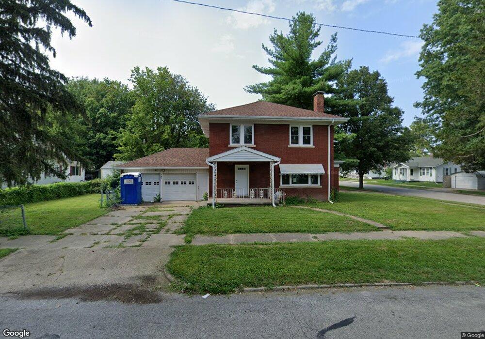
802 W Division St Decatur, IL 62526
Neighborhood Empowerment NeighborhoodEstimated Value: $44,000 - $59,000
3
Beds
2
Baths
2,349
Sq Ft
$21/Sq Ft
Est. Value
About This Home
This home is located at 802 W Division St, Decatur, IL 62526 and is currently estimated at $50,469, approximately $21 per square foot. 802 W Division St is a home located in Macon County with nearby schools including Stephen Decatur Middle School.
Ownership History
Date
Name
Owned For
Owner Type
Purchase Details
Closed on
Nov 15, 2022
Sold by
Central Illinois Land Bank Authority
Bought by
Habitat For Humanity Of Decatur Area Inc
Current Estimated Value
Purchase Details
Closed on
Jun 3, 2022
Sold by
Dcdf Inc
Bought by
Central Illinois Land Bank Authority
Purchase Details
Closed on
Mar 18, 2014
Sold by
Meeks Janet Louise
Bought by
Us Bank Na
Purchase Details
Closed on
Nov 27, 2006
Sold by
Rotz John Sidney
Bought by
Meeks Percy and Meeks Jenet Louise
Create a Home Valuation Report for This Property
The Home Valuation Report is an in-depth analysis detailing your home's value as well as a comparison with similar homes in the area
Home Values in the Area
Average Home Value in this Area
Purchase History
| Date | Buyer | Sale Price | Title Company |
|---|---|---|---|
| Habitat For Humanity Of Decatur Area Inc | -- | None Listed On Document | |
| Central Illinois Land Bank Authority | -- | None Listed On Document | |
| Us Bank Na | -- | None Available | |
| Meeks Percy | $53,500 | None Available |
Source: Public Records
Tax History
| Year | Tax Paid | Tax Assessment Tax Assessment Total Assessment is a certain percentage of the fair market value that is determined by local assessors to be the total taxable value of land and additions on the property. | Land | Improvement |
|---|---|---|---|---|
| 2024 | $1,807 | $18,671 | $436 | $18,235 |
| 2023 | $1,792 | $18,010 | $421 | $17,589 |
| 2022 | $714 | $16,665 | $389 | $16,276 |
| 2021 | $1,001 | $15,564 | $364 | $15,200 |
| 2020 | $1,035 | $14,842 | $348 | $14,494 |
| 2019 | $1,035 | $14,842 | $348 | $14,494 |
| 2018 | $1,088 | $16,360 | $202 | $16,158 |
| 2017 | $1,131 | $16,796 | $207 | $16,589 |
| 2016 | $1,159 | $16,967 | $209 | $16,758 |
| 2015 | $1,385 | $19,548 | $181 | $19,367 |
| 2014 | $1,290 | $19,354 | $179 | $19,175 |
| 2013 | $1,344 | $20,081 | $186 | $19,895 |
Source: Public Records
Map
Nearby Homes
- 1653 N Maple Ave
- 1659 N Maple Ave
- 1429 N Walnut Grove Ave
- 1329 N Walnut Grove Ave
- 1124 W Cushing St
- 777 W Harper Ave
- 1521 N Union St
- 1914 N Union St
- 2005 N Union St
- 1595 N Church St
- 18 Maple Ct
- 216 W Garfield Ave
- 2285 N Monroe St
- 2051 N Church St
- 254 W Leafland Ave
- 1034 N Oakland Ave
- 1568 N Main St
- 977 N Oakland Ave
- 1590 N Water St
- 240 E Olive St
- 1651 N Maple Ave
- 826 W Division St
- 770 W Division St
- 1645 N Maple Ave
- 834 W Division St
- 825 W Division St
- 1641 N Maple Ave
- 768 W Division St
- 1650 N Maple Ave
- 833 W Division St
- 791 W Division St
- 854 W Division St
- 760 W Division St
- 783 W Division St
- 1660 N Maple Ave
- 1665 N Maple Ave
- 1633 N Maple Ave
- 837 W Olive St
- 864 W Division St
- 752 W Division St
Your Personal Tour Guide
Ask me questions while you tour the home.