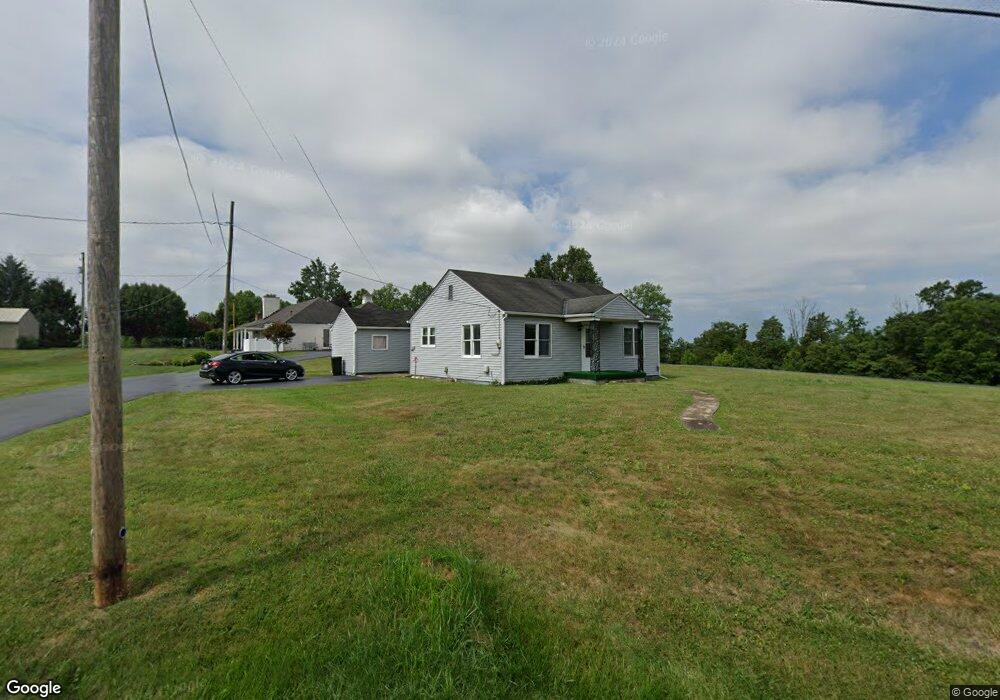
8025 State Route 125 West Union, OH 45693
Estimated Value: $86,581 - $114,000
2
Beds
1
Bath
880
Sq Ft
$119/Sq Ft
Est. Value
About This Home
This home is located at 8025 State Route 125, West Union, OH 45693 and is currently estimated at $104,645, approximately $118 per square foot. 8025 State Route 125 is a home located in Adams County with nearby schools including West Union Elementary School, West Union High School, and Adams County Christian School.
Ownership History
Date
Name
Owned For
Owner Type
Purchase Details
Closed on
Sep 26, 2014
Sold by
Condon John H and Condon Paulette R
Bought by
The Paulette R Condon Trust and Condon John H
Current Estimated Value
Purchase Details
Closed on
Apr 25, 2013
Sold by
Owens Sally A and Ellis Edmund R
Bought by
Condon John H and Condon Paulette R
Purchase Details
Closed on
Feb 17, 1999
Sold by
Ellis Edmund R
Bought by
Ellis Edmund R
Purchase Details
Closed on
Jan 1, 1990
Bought by
Ellis Edmund R
Create a Home Valuation Report for This Property
The Home Valuation Report is an in-depth analysis detailing your home's value as well as a comparison with similar homes in the area
Home Values in the Area
Average Home Value in this Area
Purchase History
| Date | Buyer | Sale Price | Title Company |
|---|---|---|---|
| The Paulette R Condon Trust | -- | None Available | |
| Condon John H | $225,000 | None Available | |
| Ellis Edmund R | -- | -- | |
| Ellis Edmund R | -- | -- |
Source: Public Records
Tax History Compared to Growth
Tax History
| Year | Tax Paid | Tax Assessment Tax Assessment Total Assessment is a certain percentage of the fair market value that is determined by local assessors to be the total taxable value of land and additions on the property. | Land | Improvement |
|---|---|---|---|---|
| 2024 | $561 | $16,520 | $3,360 | $13,160 |
| 2023 | $562 | $16,520 | $3,360 | $13,160 |
| 2022 | $560 | $14,210 | $2,590 | $11,620 |
| 2021 | $522 | $14,210 | $2,590 | $11,620 |
| 2020 | $534 | $14,210 | $2,590 | $11,620 |
| 2019 | $534 | $14,210 | $2,590 | $11,620 |
| 2018 | $469 | $12,710 | $2,590 | $10,120 |
| 2017 | $461 | $12,710 | $2,590 | $10,120 |
| 2016 | $460 | $12,710 | $2,590 | $10,120 |
| 2015 | $477 | $13,620 | $2,590 | $11,030 |
| 2014 | $477 | $13,620 | $2,590 | $11,030 |
Source: Public Records
Map
Nearby Homes
- 714 Panhandle Ave
- 0 State Route 41 1 Acre Lot
- 0 Cic Blvd
- 408 W South St
- 101 S Mound St
- 305 W Walnut St
- 302 W Main St
- 216 S Market St
- 286 & 290 S Market St
- 12196 State Route 41
- 204 E North St
- 70 Logans Ln
- 104 N Washington St
- 4700 Ohio 247
- 144 ac Pumpkin Ridge Rd
- 501 E Mulberry St
- 537 1st St
- 526 E Walnut St
- 585 High St
- 4423 Pumpkin Ridge Rd
- 8043 State Route 125
- 8037 State Route 125
- 8059 State Route 125
- 729 Panhandle Ave
- 737 Panhandle Ave
- 754 Panhandle Ave
- 721 Panhandle Ave
- 726 State Route 125
- 718 Panhandle Ave
- 111 Opal Dr
- 702 Panhandle Ave
- 95 Opal Dr
- 9639 State Route 125
- 9657 State Route 125
- 9675 State Route 125
- 684 Panhandle Ave
- 703 Panhandle Ave
- 7904 State Route 125
- 3951 Old Cincinnati Pike
- 4040 Old Cincinnati Pike