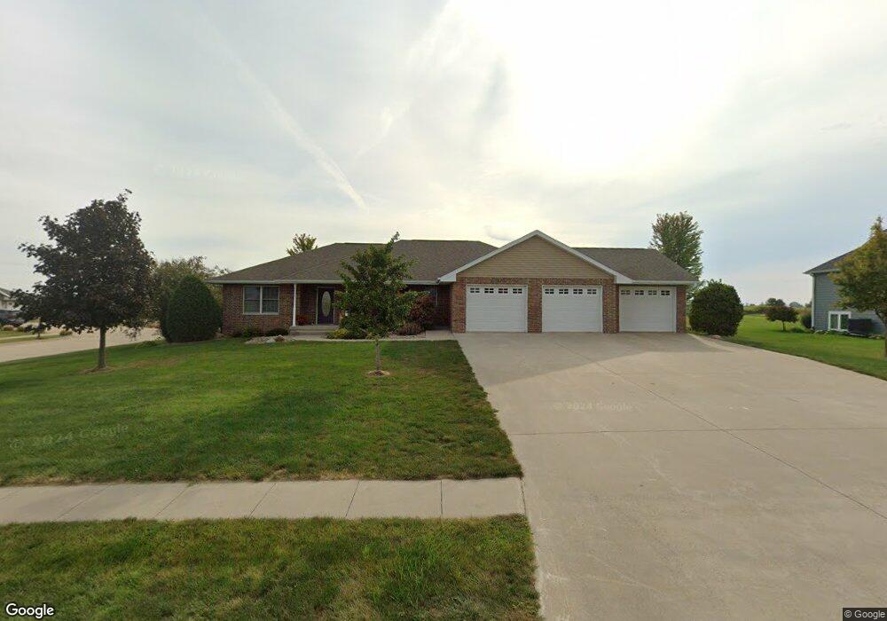
803 N Kennedy Wayland, IA 52654
Estimated Value: $351,000 - $393,797
4
Beds
5
Baths
1,892
Sq Ft
$197/Sq Ft
Est. Value
About This Home
This home is located at 803 N Kennedy, Wayland, IA 52654 and is currently estimated at $372,449, approximately $196 per square foot. 803 N Kennedy is a home with nearby schools including WACO Elementary School and WACO High School.
Ownership History
Date
Name
Owned For
Owner Type
Purchase Details
Closed on
Oct 14, 2020
Sold by
Gene S Wyse Trust
Bought by
Shelman Bryce T and Shelman Abigail L
Current Estimated Value
Home Financials for this Owner
Home Financials are based on the most recent Mortgage that was taken out on this home.
Original Mortgage
$200,000
Outstanding Balance
$177,565
Interest Rate
2.8%
Mortgage Type
New Conventional
Estimated Equity
$194,884
Create a Home Valuation Report for This Property
The Home Valuation Report is an in-depth analysis detailing your home's value as well as a comparison with similar homes in the area
Home Values in the Area
Average Home Value in this Area
Purchase History
| Date | Buyer | Sale Price | Title Company |
|---|---|---|---|
| Shelman Bryce T | $260,000 | None Available |
Source: Public Records
Mortgage History
| Date | Status | Borrower | Loan Amount |
|---|---|---|---|
| Open | Shelman Bryce T | $200,000 |
Source: Public Records
Tax History Compared to Growth
Tax History
| Year | Tax Paid | Tax Assessment Tax Assessment Total Assessment is a certain percentage of the fair market value that is determined by local assessors to be the total taxable value of land and additions on the property. | Land | Improvement |
|---|---|---|---|---|
| 2025 | $6,006 | $401,470 | $19,130 | $382,340 |
| 2024 | $5,736 | $368,080 | $19,130 | $348,950 |
| 2023 | $5,226 | $368,080 | $19,130 | $348,950 |
| 2022 | $5,108 | $282,770 | $19,130 | $263,640 |
| 2021 | $5,108 | $282,770 | $19,130 | $263,640 |
| 2020 | $4,970 | $265,190 | $19,130 | $246,060 |
| 2019 | $4,406 | $247,540 | $0 | $0 |
| 2018 | $4,222 | $247,540 | $0 | $0 |
| 2017 | $4,222 | $223,740 | $0 | $0 |
| 2016 | $3,926 | $223,740 | $0 | $0 |
| 2015 | $3,926 | $139,130 | $0 | $0 |
| 2014 | $2,498 | $139,130 | $0 | $0 |
Source: Public Records
Map
Nearby Homes
- 106 E Deaton Dr
- 402 E Railroad St
- 408 E Front St
- 204 W 3rd St
- 1083 Benton Ave
- 2604 330th St
- TBD 320th St
- 1326 150th St
- 0 Iowa Ave
- 1633 150th St
- 3327 Terrace Lake Rd
- 3329 Terrace Lake Rd
- 1750 140th St
- 201 S Adams St
- 208 S Main St
- 3300-1 Underwood Ave
- 3300 Underwood Ave
- 1953 115th St
- 205 N Chestnut St
- 0 305th St
- 801 N Kennedy
- 204 E Deaton Dr
- 709 N Kennedy
- 707 N Kennedy
- 708 N Kennedy
- 801 N Pearl St
- 204 E Marshall St
- 709 N Pearl St
- 104 E Deaton Dr
- 707 N Pearl St
- 705 N Pearl St
- 701 N Pearl St
- 1046 Dakota Ave
- 1044 Dakota Ave
- 605 N Pearl St
- 608 N Pearl St
- 605 N Parkway St
- 1040 Dakota Ave
- 605 Northridge Ct
- 603 N Pearl St