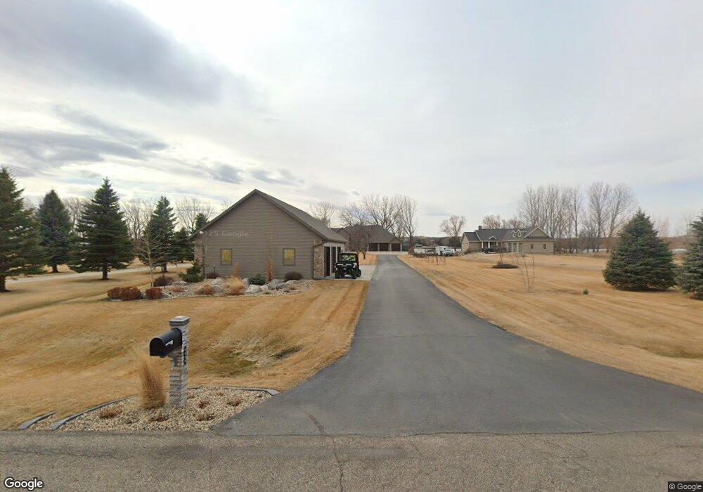
8030 Burnt Creek Island Rd Bismarck, ND 58503
Estimated Value: $642,000 - $915,000
5
Beds
3
Baths
3,254
Sq Ft
$246/Sq Ft
Est. Value
About This Home
This home is located at 8030 Burnt Creek Island Rd, Bismarck, ND 58503 and is currently estimated at $799,128, approximately $245 per square foot. 8030 Burnt Creek Island Rd is a home located in Burleigh County with nearby schools including Grimsrud Elementary School, Horizon Middle School, and Century High School.
Ownership History
Date
Name
Owned For
Owner Type
Purchase Details
Closed on
Dec 1, 2015
Sold by
Cymbaluk Holly and Cymbaluk Michael
Bought by
Kosel Colby C and Kosel Lisa
Current Estimated Value
Home Financials for this Owner
Home Financials are based on the most recent Mortgage that was taken out on this home.
Original Mortgage
$345,000
Outstanding Balance
$272,014
Interest Rate
3.78%
Mortgage Type
New Conventional
Estimated Equity
$527,114
Purchase Details
Closed on
Jun 28, 2012
Sold by
Suko Kelly
Bought by
Suko Holly
Create a Home Valuation Report for This Property
The Home Valuation Report is an in-depth analysis detailing your home's value as well as a comparison with similar homes in the area
Home Values in the Area
Average Home Value in this Area
Purchase History
| Date | Buyer | Sale Price | Title Company |
|---|---|---|---|
| Kosel Colby C | $645,000 | Bismarck Title Company | |
| Suko Holly | -- | None Available |
Source: Public Records
Mortgage History
| Date | Status | Borrower | Loan Amount |
|---|---|---|---|
| Open | Kosel Colby C | $345,000 |
Source: Public Records
Tax History Compared to Growth
Tax History
| Year | Tax Paid | Tax Assessment Tax Assessment Total Assessment is a certain percentage of the fair market value that is determined by local assessors to be the total taxable value of land and additions on the property. | Land | Improvement |
|---|---|---|---|---|
| 2024 | $5,894 | $406,200 | $0 | $0 |
| 2023 | $5,859 | $371,250 | $0 | $0 |
| 2022 | $5,301 | $349,250 | $0 | $0 |
| 2021 | $5,051 | $334,750 | $0 | $0 |
| 2020 | $4,932 | $324,950 | $0 | $0 |
| 2019 | $4,992 | $324,950 | $0 | $0 |
| 2018 | $4,567 | $324,950 | $50,300 | $274,650 |
| 2017 | $3,752 | $286,000 | $243,200 | $42,800 |
| 2016 | $3,752 | $273,300 | $34,300 | $239,000 |
| 2014 | -- | $481,500 | $85,600 | $395,900 |
Source: Public Records
Map
Nearby Homes
- On Ponderosa Ave
- 5706 Olive Tree Dr
- 9332 Island Rd
- 8460 Willow Rd N
- 6940 Horseshoe Bend
- 6501 Misty Waters Dr
- 8900 Willow Rd N
- 520 Rosie Ln N
- 508 Rosie Ln N
- 9255 Estancia Dr
- 9315 Estancia Dr
- 9205 Estancia Dr
- 4775 Estancia Dr
- 4800 Estancia Dr
- 4725 Estancia Dr
- 4750 Estancia Dr
- 4700 Estancia Dr
- 4625 Estancia Dr
- 4210 Blue Spruce Rd
- 4240 Blue Spruce Rd
- 8020 Burnt Creek Island Rd
- 8030 Burnt Cr Island Rd
- 8040 Burnt Creek Island Rd
- 8100 Burnt Creek Island Rd
- 8118 Burnt Creek Island Rd
- 8115 Burnt Creek Island Rd
- 8202 Burnt Creek Island Rd
- 8212 Burnt Creek Island Rd
- 8207 Burnt Creek Island Rd
- 8300 Burnt Creek Island Rd
- 8225 Burnt Creek Islnd Rd
- 00 Burnt Cr Island Rd
- 8310 Burnt Creek Island Rd
- 5938 Lariat Loop
- 5930 Lariat Loop
- 6601 Island Rd
- 8336 Burnt Creek Island Rd
- 8336 Burnt Creek Island Rd
- 6525 Island Rd
- 5918 Lariat Loop