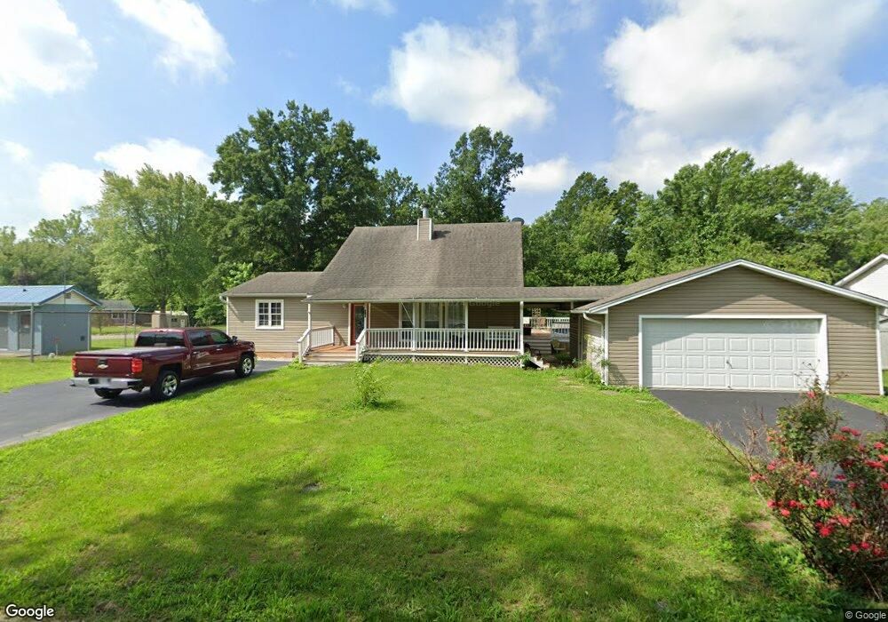
8032 Honeysuckle Dr Cedar Hill, MO 63016
Estimated Value: $211,398 - $302,000
--
Bed
--
Bath
896
Sq Ft
$281/Sq Ft
Est. Value
About This Home
This home is located at 8032 Honeysuckle Dr, Cedar Hill, MO 63016 and is currently estimated at $251,350, approximately $280 per square foot. 8032 Honeysuckle Dr is a home located in Jefferson County with nearby schools including Northwest High School.
Ownership History
Date
Name
Owned For
Owner Type
Purchase Details
Closed on
Dec 17, 2021
Sold by
Green Malcolm G and Colletti Deborah
Bought by
Green Malcolm G
Current Estimated Value
Home Financials for this Owner
Home Financials are based on the most recent Mortgage that was taken out on this home.
Original Mortgage
$166,000
Outstanding Balance
$152,676
Interest Rate
3.11%
Mortgage Type
New Conventional
Estimated Equity
$98,674
Purchase Details
Closed on
Jan 26, 2017
Sold by
Green Malcolm G and Colletti Deborah
Bought by
Green Malcolm G and Colletti Deborah
Purchase Details
Closed on
Mar 16, 2015
Sold by
Green Malcolm Glenn and Green Karen
Bought by
Green Malcolm Glenn
Home Financials for this Owner
Home Financials are based on the most recent Mortgage that was taken out on this home.
Original Mortgage
$129,213
Interest Rate
3.73%
Mortgage Type
Future Advance Clause Open End Mortgage
Create a Home Valuation Report for This Property
The Home Valuation Report is an in-depth analysis detailing your home's value as well as a comparison with similar homes in the area
Home Values in the Area
Average Home Value in this Area
Purchase History
| Date | Buyer | Sale Price | Title Company |
|---|---|---|---|
| Green Malcolm G | $35,000 | None Available | |
| Green Malcolm G | -- | None Available | |
| Green Malcolm Glenn | -- | Htc |
Source: Public Records
Mortgage History
| Date | Status | Borrower | Loan Amount |
|---|---|---|---|
| Open | Green Malcolm G | $166,000 | |
| Previous Owner | Green Malcolm Glenn | $129,213 |
Source: Public Records
Tax History Compared to Growth
Tax History
| Year | Tax Paid | Tax Assessment Tax Assessment Total Assessment is a certain percentage of the fair market value that is determined by local assessors to be the total taxable value of land and additions on the property. | Land | Improvement |
|---|---|---|---|---|
| 2025 | $1,902 | $27,400 | $1,300 | $26,100 |
| 2024 | $1,902 | $25,100 | $1,300 | $23,800 |
| 2023 | $1,902 | $25,100 | $1,300 | $23,800 |
| 2022 | $1,894 | $25,100 | $1,300 | $23,800 |
| 2021 | $1,875 | $25,100 | $1,300 | $23,800 |
| 2020 | $1,733 | $22,500 | $1,000 | $21,500 |
| 2019 | $1,732 | $22,500 | $1,000 | $21,500 |
| 2018 | $1,727 | $22,500 | $1,000 | $21,500 |
| 2017 | $1,645 | $22,500 | $1,000 | $21,500 |
| 2016 | $1,478 | $20,200 | $1,000 | $19,200 |
| 2015 | -- | $20,200 | $1,000 | $19,200 |
| 2013 | -- | $19,900 | $1,000 | $18,900 |
Source: Public Records
Map
Nearby Homes
- 6012 Cedar Glen Dr
- 5917 Creek Side Place
- 5815 Lookout View
- 8271 Obrien Dr
- 6905 Scenic View Dr
- 511 Arrowhead
- 524 Arrowhead Point
- 764 Red Clover Dr
- 6 Walnut Park Dr
- 6195 Cedar Springs Rd
- 7191 Callie Ln
- 8115 Graham Rd
- 8438 High St
- 7648 Local Hillsboro Rd
- 6229 Twin Springs Blvd
- 0 Yates Ave Unit MAR25017971
- 8528 Red Rose Ct
- 8600 High St
- 0 Twin Ridge Rd
- 7516 Scott Ln
- 8040 Honeysuckle Dr
- 8060 Honeysuckle Dr
- 8063 Brookside Dr
- 5893 Azelea Dr
- 5892 Azelea Dr
- 8054 Brookside Dr
- 8050 Brookside Dr
- 8067 Brookside Dr
- 5883 Azelea Dr
- 8045 Honeysuckle Dr
- 8000 Brookside Dr
- 8052 Brookside Dr
- 8071 Brookside Dr
- 5881 Azelea Dr
- 7998 Brookside Dr
- 8065 Honeysuckle Dr
- 8070 Honeysuckle Dr
- 5876 Azelea Dr
- 7996 Brookside Dr
- 5877 Azelea Dr