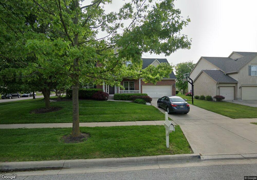
8033 Townsend Rd Dublin, OH 43016
Estimated Value: $567,477 - $666,000
4
Beds
3
Baths
2,800
Sq Ft
$223/Sq Ft
Est. Value
About This Home
This home is located at 8033 Townsend Rd, Dublin, OH 43016 and is currently estimated at $624,619, approximately $223 per square foot. 8033 Townsend Rd is a home located in Franklin County with nearby schools including Deer Run Elementary School, Willard Grizzell Middle School, and Dublin Jerome High School.
Ownership History
Date
Name
Owned For
Owner Type
Purchase Details
Closed on
Mar 22, 2000
Sold by
Trinity Home Builders Inc
Bought by
Potts Dustin L and Potts Tammy S
Current Estimated Value
Home Financials for this Owner
Home Financials are based on the most recent Mortgage that was taken out on this home.
Original Mortgage
$196,000
Outstanding Balance
$62,948
Interest Rate
8.43%
Estimated Equity
$561,671
Create a Home Valuation Report for This Property
The Home Valuation Report is an in-depth analysis detailing your home's value as well as a comparison with similar homes in the area
Home Values in the Area
Average Home Value in this Area
Purchase History
| Date | Buyer | Sale Price | Title Company |
|---|---|---|---|
| Potts Dustin L | $245,100 | -- |
Source: Public Records
Mortgage History
| Date | Status | Borrower | Loan Amount |
|---|---|---|---|
| Open | Potts Dustin L | $196,000 |
Source: Public Records
Tax History
| Year | Tax Paid | Tax Assessment Tax Assessment Total Assessment is a certain percentage of the fair market value that is determined by local assessors to be the total taxable value of land and additions on the property. | Land | Improvement |
|---|---|---|---|---|
| 2025 | $10,376 | $159,710 | $49,000 | $110,710 |
| 2024 | $10,376 | $159,710 | $49,000 | $110,710 |
| 2023 | $10,232 | $159,705 | $49,000 | $110,705 |
| 2022 | $7,647 | $109,100 | $28,880 | $80,220 |
| 2021 | $7,666 | $109,100 | $28,880 | $80,220 |
| 2020 | $7,729 | $109,100 | $28,880 | $80,220 |
| 2019 | $7,895 | $98,560 | $26,250 | $72,310 |
| 2018 | $7,979 | $98,560 | $26,250 | $72,310 |
| 2017 | $7,347 | $98,560 | $26,250 | $72,310 |
| 2016 | $7,978 | $100,490 | $21,810 | $78,680 |
| 2015 | $8,030 | $100,490 | $21,810 | $78,680 |
| 2014 | $8,039 | $100,490 | $21,810 | $78,680 |
| 2013 | $3,896 | $95,690 | $20,755 | $74,935 |
Source: Public Records
Map
Nearby Homes
- 6298 Belvedere Green Blvd
- 7645 Fulmar Dr
- 8101 Oaktree Dr S
- 7012 Primrose Ct
- 7029 Snowdrop Ct
- 6498 Wyndburne Dr
- 6050 Kentigern Ct S
- 6031 Cromdale Dr
- 5987 Dunabbey Loop
- 8886 Winemack Ln
- 8670 Craigston Ct
- 6775 Royal Plume Dr
- 7886 Nassau Loop
- 9071 Portofino Place
- 9029 Terrazza South Ct
- 6258 Wexford Woods Dr
- 7246 Sundown Ct
- 6341 Tara Hill Dr
- 7029 Post Preserve Blvd
- 6938 Stillhouse Ln
- 6610 Castleforbes Ct
- 8017 Townsend Rd
- 8049 Townsend Rd
- 6611 Drury Rd
- 6618 Castleforbes Ct
- 8032 Townsend Rd
- 8040 Townsend Rd
- 6609 Castleforbes Ct
- 8024 Townsend Rd
- 8048 Townsend Rd
- 6619 Drury Rd
- 6617 Castleforbes Ct
- 6550 Camden Row Rd
- 6626 Castleforbes Ct
- 8056 Townsend Rd
- 6543 Greensway Loop
- 6627 Drury Rd
- 6551 Greensway Loop
- 8063 Townsend Rd
- 6542 Camden Row Rd
Your Personal Tour Guide
Ask me questions while you tour the home.