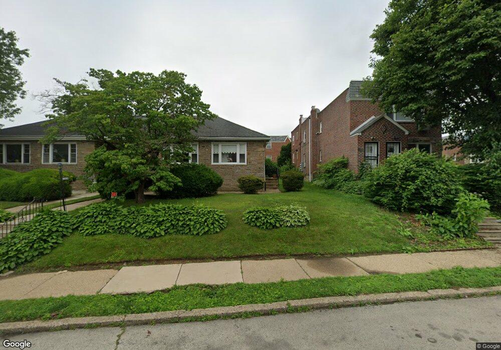
8034 Mansfield Ave Philadelphia, PA 19150
Cedarbrook NeighborhoodEstimated Value: $354,000 - $383,000
4
Beds
2
Baths
2,180
Sq Ft
$169/Sq Ft
Est. Value
About This Home
This home is located at 8034 Mansfield Ave, Philadelphia, PA 19150 and is currently estimated at $368,500, approximately $169 per square foot. 8034 Mansfield Ave is a home located in Philadelphia County with nearby schools including Franklin S Edmonds School, Martin Luther King High School, and West Oak Lane Charter School.
Ownership History
Date
Name
Owned For
Owner Type
Purchase Details
Closed on
Nov 1, 2021
Sold by
Unknown
Bought by
Honore Sandy Jenny
Current Estimated Value
Home Financials for this Owner
Home Financials are based on the most recent Mortgage that was taken out on this home.
Original Mortgage
$340,505
Interest Rate
3.92%
Mortgage Type
New Conventional
Purchase Details
Closed on
Jun 20, 1988
Bought by
Grant Eva P
Create a Home Valuation Report for This Property
The Home Valuation Report is an in-depth analysis detailing your home's value as well as a comparison with similar homes in the area
Home Values in the Area
Average Home Value in this Area
Purchase History
| Date | Buyer | Sale Price | Title Company |
|---|---|---|---|
| Honore Sandy Jenny | $330,000 | Stewart Title | |
| Grant Eva P | $82,300 | -- |
Source: Public Records
Mortgage History
| Date | Status | Borrower | Loan Amount |
|---|---|---|---|
| Previous Owner | Honore Sandy Jenny | $340,505 |
Source: Public Records
Tax History Compared to Growth
Tax History
| Year | Tax Paid | Tax Assessment Tax Assessment Total Assessment is a certain percentage of the fair market value that is determined by local assessors to be the total taxable value of land and additions on the property. | Land | Improvement |
|---|---|---|---|---|
| 2026 | $2,976 | $324,700 | $64,900 | $259,800 |
| 2025 | $2,976 | $324,700 | $64,900 | $259,800 |
| 2024 | $2,976 | $324,700 | $64,900 | $259,800 |
| 2023 | $2,976 | $212,600 | $42,520 | $170,080 |
| 2022 | $2,844 | $212,600 | $42,520 | $170,080 |
| 2021 | $2,844 | $0 | $0 | $0 |
| 2020 | $2,844 | $0 | $0 | $0 |
| 2019 | $2,807 | $0 | $0 | $0 |
| 2018 | $2,480 | $0 | $0 | $0 |
| 2017 | $2,480 | $0 | $0 | $0 |
| 2016 | $2,480 | $0 | $0 | $0 |
| 2015 | $2,374 | $0 | $0 | $0 |
| 2014 | -- | $177,200 | $29,572 | $147,628 |
| 2012 | -- | $26,816 | $3,946 | $22,870 |
Source: Public Records
Map
Nearby Homes
- 932 E Ellet St
- 937 E Gorgas Ln
- 1038 E Mount Pleasant Ave
- 8038 Lowber Ave
- 933 E Slocum St
- 1007 Dorset St
- 940 E Allens Ln
- 8309 Lynnewood Rd
- 725 E Vernon Rd
- 506 E Gorgas Ln
- 1148 E Slocum St
- 501 E Sedgwick St
- 1151 E Dorset St
- 1167 E Dorset St
- 1122 E Phil Ellena St
- 715 E Dorset St
- 8004 Gilbert St
- 1204 E Mount Airy Ave
- 802 E Phil Ellena St
- 1159 E Hortter St
- 8034 Mansfield Ave Unit B 2bedroom 1bat
- 8034 Mansfield Ave
- 8034 Mansfield Ave Unit B
- 944 E Durard St
- 8032 Mansfield Ave
- 944 AKA 946 E Durard St
- 8030 Mansfield Ave
- 947 E Durard St
- 945 E Durard St
- 942 E Durard St
- 8028 Mansfield Ave
- 943 E Durard St
- 940 E Durard St
- 941 E Durard St
- 8039 Mansfield Ave
- 8041 Mansfield Ave
- 8037 Mansfield Ave
- 8043 Mansfield Ave
- 938 Durard St Unit 2
- 949 E Gorgas Ln