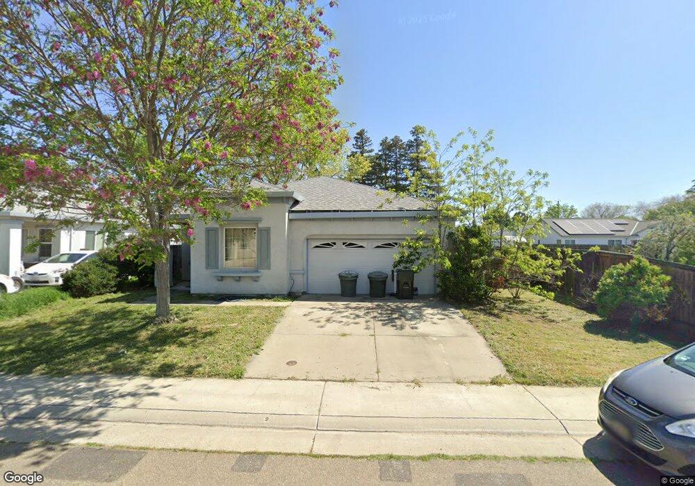
8035 Neisa Way Sacramento, CA 95828
Estimated Value: $397,000 - $557,000
4
Beds
2
Baths
1,810
Sq Ft
$277/Sq Ft
Est. Value
About This Home
This home is located at 8035 Neisa Way, Sacramento, CA 95828 and is currently estimated at $502,030, approximately $277 per square foot. 8035 Neisa Way is a home located in Sacramento County with nearby schools including Anna Kirchgater Elementary School, James Rutter Middle School, and Florin High School.
Ownership History
Date
Name
Owned For
Owner Type
Purchase Details
Closed on
Oct 25, 2018
Sold by
Baker Deidre and Milton Baker Revocalbe Trust
Bought by
Baker Deidre and Milton Baker Irrevocalbe Trust
Current Estimated Value
Purchase Details
Closed on
Oct 12, 2018
Sold by
Baker Deidre and Milton Baker Revocable Trust
Bought by
Baker Deidre and Milton Baker Irrevocable Trust
Purchase Details
Closed on
Aug 11, 2005
Sold by
Baker Milton and Baker Hester
Bought by
Baker Deidre
Create a Home Valuation Report for This Property
The Home Valuation Report is an in-depth analysis detailing your home's value as well as a comparison with similar homes in the area
Home Values in the Area
Average Home Value in this Area
Purchase History
| Date | Buyer | Sale Price | Title Company |
|---|---|---|---|
| Baker Deidre | -- | None Available | |
| Baker Deidre | -- | None Available | |
| Baker Deidre | -- | -- |
Source: Public Records
Tax History Compared to Growth
Tax History
| Year | Tax Paid | Tax Assessment Tax Assessment Total Assessment is a certain percentage of the fair market value that is determined by local assessors to be the total taxable value of land and additions on the property. | Land | Improvement |
|---|---|---|---|---|
| 2025 | $4,857 | $451,780 | $21,314 | $430,466 |
| 2024 | $4,857 | $442,923 | $20,897 | $422,026 |
| 2023 | $4,734 | $434,239 | $20,488 | $413,751 |
| 2022 | $4,653 | $425,726 | $20,087 | $405,639 |
| 2021 | $4,600 | $417,380 | $19,694 | $397,686 |
| 2020 | $4,131 | $374,593 | $93,648 | $280,945 |
| 2019 | $3,945 | $356,756 | $89,189 | $267,567 |
| 2018 | $3,734 | $339,768 | $84,942 | $254,826 |
| 2017 | $3,475 | $314,600 | $78,650 | $235,950 |
| 2016 | $2,996 | $278,408 | $69,602 | $208,806 |
| 2015 | $2,727 | $253,099 | $63,275 | $189,824 |
| 2014 | $2,521 | $180,816 | $45,204 | $135,612 |
Source: Public Records
Map
Nearby Homes
- 8346 Floxtree Ct
- 7905 Springarden Way
- 8186 Gustine Way
- 8266 Summer Sunset Dr
- 8336 Cutler Way
- 8077 Goran Ct
- 8282 Union Creek Way
- 8336 Summer Sunset Dr
- 8012 Northern Oak Cir
- 8016 Stevenson Ave
- 8437 Yermo Way
- 4.13 ACR Lenhart Rd
- 8205 Weyburn Ct
- 7901 Stevenson Ave
- 8317 Honeycomb Way
- 8510 Cavendish Way
- 8095 E Stockton Blvd
- 7711 Lenhart Rd
- 7855 Cottonwood Ln Unit 54
- 7855 Cottonwood Ln Unit 35
- 8031 Neisa Way
- 8315 Stevenson Ave
- 8300 Daisy Hollow Ct
- 8317 Stevenson Ave
- 8036 Neisa Way
- 8030 Neisa Way
- 8025 Neisa Way
- 8304 Daisy Hollow Ct
- 8040 Neisa Way
- 8321 Stevenson Ave
- 8301 Daisy Hollow Ct
- 8294 Sannam Way
- 8299 Sannam Way
- 8323 Stevenson Ave
- 8019 Neisa Way
- 8269 Stevenson Ave
- 8310 Daisy Hollow Ct
- 8305 Daisy Hollow Ct
- 8290 Sannam Way
- 8267 Stevenson Ave