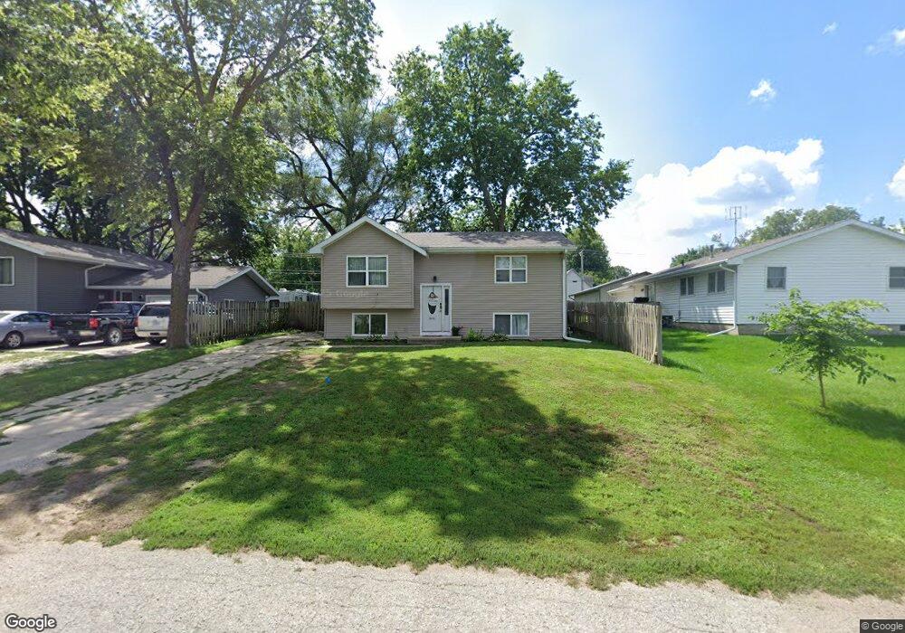
804 Clinton St Dunlap, IA 51529
Estimated Value: $140,000 - $186,000
4
Beds
2
Baths
1,720
Sq Ft
$94/Sq Ft
Est. Value
About This Home
This home is located at 804 Clinton St, Dunlap, IA 51529 and is currently estimated at $162,376, approximately $94 per square foot. 804 Clinton St is a home located in Harrison County with nearby schools including Boyer Valley Elementary School and Boyer Valley Middle/High School.
Ownership History
Date
Name
Owned For
Owner Type
Purchase Details
Closed on
Jun 13, 2021
Sold by
Greenwood Colby J
Bought by
Hatterman Tristan
Current Estimated Value
Purchase Details
Closed on
Sep 2, 2009
Sold by
Crown View Development Llc
Bought by
Greenwood Colby J
Home Financials for this Owner
Home Financials are based on the most recent Mortgage that was taken out on this home.
Original Mortgage
$86,000
Outstanding Balance
$56,244
Interest Rate
5.27%
Mortgage Type
New Conventional
Estimated Equity
$106,132
Create a Home Valuation Report for This Property
The Home Valuation Report is an in-depth analysis detailing your home's value as well as a comparison with similar homes in the area
Home Values in the Area
Average Home Value in this Area
Purchase History
| Date | Buyer | Sale Price | Title Company |
|---|---|---|---|
| Hatterman Tristan | $12,200 | None Available | |
| Greenwood Colby J | $85,000 | None Available |
Source: Public Records
Mortgage History
| Date | Status | Borrower | Loan Amount |
|---|---|---|---|
| Open | Greenwood Colby J | $86,000 |
Source: Public Records
Tax History Compared to Growth
Tax History
| Year | Tax Paid | Tax Assessment Tax Assessment Total Assessment is a certain percentage of the fair market value that is determined by local assessors to be the total taxable value of land and additions on the property. | Land | Improvement |
|---|---|---|---|---|
| 2025 | $2,230 | $135,910 | $11,340 | $124,570 |
| 2024 | $2,142 | $123,830 | $11,340 | $112,490 |
| 2023 | $2,142 | $123,830 | $11,340 | $112,490 |
| 2022 | $2,036 | $106,484 | $11,340 | $95,144 |
| 2021 | $2,036 | $106,484 | $11,340 | $95,144 |
| 2020 | $1,842 | $91,151 | $11,340 | $79,811 |
| 2019 | $1,344 | $91,151 | $11,340 | $79,811 |
| 2018 | $1,338 | $62,447 | $0 | $0 |
| 2017 | $1,374 | $62,447 | $0 | $0 |
| 2016 | $1,356 | $62,447 | $0 | $0 |
| 2015 | $1,356 | $56,258 | $0 | $0 |
| 2014 | $1,134 | $56,258 | $0 | $0 |
Source: Public Records
Map
Nearby Homes
- 202 Y St
- 1403 Eaton St
- 32055 Spruce Ave
- 1110 Street F16
- 2074 U Ave
- 211 Brookview Dr
- 37 10th St
- 2590 220th St
- 808 Park St
- 42 6th St
- 406 Weare St
- 102 Bluegrass Ln
- 101 Bluegrass Ln
- 907 Harvest Hills Dr
- 106 Bluegrass Ln
- 905 Harvest Hills Dr
- 903 Harvest Hills Dr
- 111 Ridgeline Rd
- 906 Harvest Hills Dr
- 305 Normal St