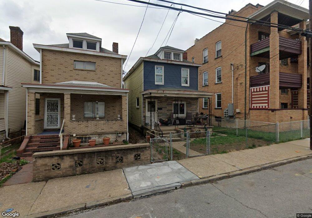
804 Dohrman St Mc Kees Rocks, PA 15136
Stowe Township NeighborhoodEstimated Value: $71,000 - $109,000
3
Beds
1
Bath
1,288
Sq Ft
$68/Sq Ft
Est. Value
About This Home
This home is located at 804 Dohrman St, Mc Kees Rocks, PA 15136 and is currently estimated at $87,629, approximately $68 per square foot. 804 Dohrman St is a home located in Allegheny County with nearby schools including Sto-Rox Upper Elementary School, Sto-Rox Primary Center, and Sto-Rox Junior/Senior High School.
Ownership History
Date
Name
Owned For
Owner Type
Purchase Details
Closed on
May 18, 2021
Sold by
Wilson
Bought by
West Communities Property Developmentllc
Current Estimated Value
Purchase Details
Closed on
Jan 22, 2021
Sold by
Gordon Lucinda R
Bought by
Wilson and Wilson
Purchase Details
Closed on
Jan 24, 2001
Sold by
Gordon Lucinda R and Gordon Jerome
Bought by
Gordon Lucinda R
Purchase Details
Closed on
Aug 5, 1999
Sold by
Cooke William J and Cooke Christine S
Bought by
Gordon Jerome and Gordon Lucinda R
Create a Home Valuation Report for This Property
The Home Valuation Report is an in-depth analysis detailing your home's value as well as a comparison with similar homes in the area
Home Values in the Area
Average Home Value in this Area
Purchase History
| Date | Buyer | Sale Price | Title Company |
|---|---|---|---|
| West Communities Property Developmentllc | $10,000 | -- | |
| West Communities Property Develop L L | $10,000 | None Available | |
| Wilson | $500 | -- | |
| Wilson | $500 | None Available | |
| Gordon Lucinda R | -- | -- | |
| Gordon Jerome | $24,000 | -- |
Source: Public Records
Tax History Compared to Growth
Tax History
| Year | Tax Paid | Tax Assessment Tax Assessment Total Assessment is a certain percentage of the fair market value that is determined by local assessors to be the total taxable value of land and additions on the property. | Land | Improvement |
|---|---|---|---|---|
| 2025 | $1,439 | $33,300 | $9,000 | $24,300 |
| 2024 | $1,439 | $33,300 | $9,000 | $24,300 |
| 2023 | $1,383 | $33,300 | $9,000 | $24,300 |
| 2022 | $1,339 | $33,300 | $9,000 | $24,300 |
| 2021 | $158 | $33,300 | $9,000 | $24,300 |
| 2020 | $1,309 | $33,300 | $9,000 | $24,300 |
| 2019 | $1,309 | $33,300 | $9,000 | $24,300 |
| 2018 | $158 | $33,300 | $9,000 | $24,300 |
| 2017 | $1,279 | $33,300 | $9,000 | $24,300 |
| 2016 | $158 | $33,300 | $9,000 | $24,300 |
| 2015 | $158 | $33,300 | $9,000 | $24,300 |
| 2014 | $1,279 | $33,300 | $9,000 | $24,300 |
Source: Public Records
Map
Nearby Homes
- 813 8th St
- 815 Broadway Ave
- 837 Benwood Ave
- 815 10th St
- 813 10th St
- 705 Broadway Ave
- 810 10th St
- 802 10th St
- 713 Russellwood Ave
- 705 Russellwood Ave
- 908 Russellwood Ave
- 809 11th St
- 932 Ridge Ave
- 125 Frazier Ave
- 634 Broadway Ave
- 620 Broadway Ave
- 1144 1/2 Race St
- 82 Harlem Ave
- 1212 Woodward Ave
- 851 Hober Ave