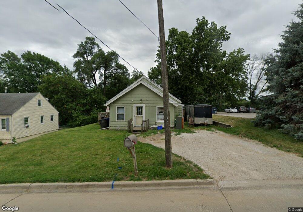
804 Philip St Des Moines, IA 50315
Watrous Heights NeighborhoodEstimated Value: $107,000 - $150,178
3
Beds
1
Bath
826
Sq Ft
$164/Sq Ft
Est. Value
About This Home
This home is located at 804 Philip St, Des Moines, IA 50315 and is currently estimated at $135,795, approximately $164 per square foot. 804 Philip St is a home located in Polk County with nearby schools including South Union Elementary School, Brody Middle School, and Lincoln High School.
Ownership History
Date
Name
Owned For
Owner Type
Purchase Details
Closed on
Nov 22, 2023
Sold by
Gourd Robert G
Bought by
City Of Des Moines
Current Estimated Value
Purchase Details
Closed on
Mar 31, 2018
Sold by
Belcher Chris and Belcher Marsha
Bought by
Gourd Robert G
Home Financials for this Owner
Home Financials are based on the most recent Mortgage that was taken out on this home.
Original Mortgage
$56,000
Interest Rate
4.4%
Mortgage Type
Future Advance Clause Open End Mortgage
Purchase Details
Closed on
Aug 4, 2011
Sold by
Lair Jack W and Lair Janiece E
Bought by
Belcher Christopher P
Create a Home Valuation Report for This Property
The Home Valuation Report is an in-depth analysis detailing your home's value as well as a comparison with similar homes in the area
Home Values in the Area
Average Home Value in this Area
Purchase History
| Date | Buyer | Sale Price | Title Company |
|---|---|---|---|
| City Of Des Moines | $1,250 | None Listed On Document | |
| City Of Des Moines | $1,250 | None Listed On Document | |
| Gourd Robert G | $70,000 | None Available | |
| Belcher Christopher P | $29,500 | None Available |
Source: Public Records
Mortgage History
| Date | Status | Borrower | Loan Amount |
|---|---|---|---|
| Previous Owner | Gourd Robert G | $56,000 |
Source: Public Records
Tax History Compared to Growth
Tax History
| Year | Tax Paid | Tax Assessment Tax Assessment Total Assessment is a certain percentage of the fair market value that is determined by local assessors to be the total taxable value of land and additions on the property. | Land | Improvement |
|---|---|---|---|---|
| 2025 | $1,690 | $114,500 | $35,900 | $78,600 |
| 2024 | $1,690 | $99,900 | $31,300 | $68,600 |
| 2023 | $1,690 | $100,100 | $31,500 | $68,600 |
| 2022 | $2,721 | $80,600 | $25,900 | $54,700 |
| 2021 | $1,650 | $80,600 | $25,900 | $54,700 |
| 2020 | $1,708 | $74,700 | $24,200 | $50,500 |
| 2019 | $1,580 | $74,700 | $24,200 | $50,500 |
| 2018 | $1,558 | $67,300 | $21,200 | $46,100 |
| 2017 | $1,484 | $67,300 | $21,200 | $46,100 |
| 2016 | $1,440 | $63,400 | $19,600 | $43,800 |
| 2015 | $1,440 | $63,400 | $19,600 | $43,800 |
| 2014 | $1,662 | $64,900 | $19,500 | $45,400 |
Source: Public Records
Map
Nearby Homes
- 518 Maxwelton Dr
- 612 Emma Ave
- 930 Emma Ave
- 515 Emma Ave
- 606 Marion St
- 936 Mckinley Ave Unit 14
- 1109 Herold Ave
- 3903 SW 9th St
- 1116 Herold Ave
- 1204 Elder Ln
- 1207 Emma Ave
- 4108 SW 12th St
- 1219 Elder Ln
- 3712 SW 8th St
- 115 Mckinley Ave
- 1222 Watrous Ave
- 3824 SW 12th St
- 3811 SW 3rd St
- 520 Hackley Ave
- 3618 SW 9th St
- 808 Philip St
- 802 Philip St
- 825 Maxwelton Dr
- 827 Maxwelton Dr
- 713 Maxwelton Dr
- 809 Philip St
- 710 Philip St
- 807 Philip St
- 805 Philip St
- 4407 SW 9th St
- 709 Maxwelton Dr
- 803 Philip St
- 4411 SW 9th St
- 706 Philip St
- 4307 SW 9th St
- 707 Maxwelton Dr
- 4324 SW 7th St
- 800 Trowbridge St
- 802 Trowbridge St
- 720 Maxwelton Dr