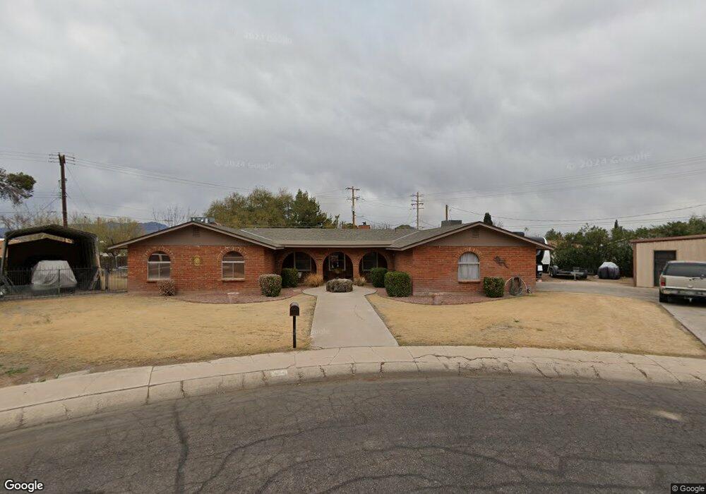
804 W Kimball Ln Safford, AZ 85546
Estimated Value: $393,605 - $465,000
--
Bed
--
Bath
2,404
Sq Ft
$174/Sq Ft
Est. Value
About This Home
This home is located at 804 W Kimball Ln, Safford, AZ 85546 and is currently estimated at $417,651, approximately $173 per square foot. 804 W Kimball Ln is a home located in Graham County with nearby schools including Dorothy Stinson School, Ruth Powell Elementary School, and Lafe Nelson School.
Ownership History
Date
Name
Owned For
Owner Type
Purchase Details
Closed on
Aug 13, 2008
Sold by
Sirva Relocation Credit Llc
Bought by
Gurtler Mark S and Gurtler Tina L
Current Estimated Value
Home Financials for this Owner
Home Financials are based on the most recent Mortgage that was taken out on this home.
Original Mortgage
$152,000
Interest Rate
6.27%
Mortgage Type
New Conventional
Purchase Details
Closed on
Mar 12, 2008
Sold by
Gilmore Gary D and Gilmore Dana D
Bought by
Sirva Relocation Credit Llc
Purchase Details
Closed on
Sep 27, 2005
Sold by
Moore Michael Wayne and Moore Donna Marie
Bought by
Gilmore Gary D and Gilmore Dana D
Home Financials for this Owner
Home Financials are based on the most recent Mortgage that was taken out on this home.
Original Mortgage
$166,400
Interest Rate
5.72%
Mortgage Type
New Conventional
Create a Home Valuation Report for This Property
The Home Valuation Report is an in-depth analysis detailing your home's value as well as a comparison with similar homes in the area
Home Values in the Area
Average Home Value in this Area
Purchase History
| Date | Buyer | Sale Price | Title Company |
|---|---|---|---|
| Gurtler Mark S | $218,000 | Safford Title Agency | |
| Sirva Relocation Credit Llc | $255,100 | Safford Title Agency | |
| Gilmore Gary D | $208,000 | Pioneer Title Agency |
Source: Public Records
Mortgage History
| Date | Status | Borrower | Loan Amount |
|---|---|---|---|
| Closed | Gurtler Mark S | $152,000 | |
| Previous Owner | Gilmore Gary D | $166,400 |
Source: Public Records
Tax History Compared to Growth
Tax History
| Year | Tax Paid | Tax Assessment Tax Assessment Total Assessment is a certain percentage of the fair market value that is determined by local assessors to be the total taxable value of land and additions on the property. | Land | Improvement |
|---|---|---|---|---|
| 2026 | $1,861 | -- | -- | -- |
| 2025 | $1,861 | $35,236 | $3,044 | $32,192 |
| 2024 | $1,934 | $33,033 | $3,044 | $29,989 |
| 2023 | $1,934 | $26,358 | $3,044 | $23,314 |
| 2022 | $1,899 | $23,614 | $3,044 | $20,570 |
| 2021 | $2,176 | $0 | $0 | $0 |
| 2020 | $2,092 | $0 | $0 | $0 |
| 2019 | $2,203 | $0 | $0 | $0 |
| 2018 | $2,110 | $0 | $0 | $0 |
| 2017 | $1,906 | $0 | $0 | $0 |
| 2016 | $1,750 | $0 | $0 | $0 |
| 2015 | $1,598 | $0 | $0 | $0 |
Source: Public Records
Map
Nearby Homes
- 1302 S 7th Ave
- 1309 S Bingham Place
- 514 W 15th St
- 1217 S 7th Ave
- 1209 S 6th Ave
- 1108 S 9th Ave
- 1108 S 9th Place
- 1115 W Relation St
- 832 W Stirrup Dr
- 1609 S 12th Ave
- 1785 Camilla Cir
- 120 Relation St Unit 2
- 1210 S 1st Ave
- 1204 S 1st Ave
- 1105 S 1st Ave
- 2204 S 10th Ave
- 716 S 11th Ave
- 550 W Burrell Ln
- 1006 W Palm Cir
- 10 Santa fe Place
- 810 W Kimball Ln
- 803 W Kimball Ln
- 809 W Kimball Ln
- 1403 S 8th Ave
- 1400 S 8th Ave
- 727 W Relation St
- 816 W Kimball Ln
- 815 W Relation St
- 711 W Relation St
- 810 W Navajo Ln
- 1318 S 8th Ave
- 802 W Navajo Ln
- 720 W 15th St
- 707 W Relation St
- 829 W Kimball Ln
- 816 W Navajo Ln
- 718 W 15th St
- 828 W Kimball Ln
- 821 W Relation St
- 795 W 15th St