S
Seller's Agent in 2025
Spencer Walz
Walz Realty, LLC
(734) 972-0911
1 in this area
32 Total Sales
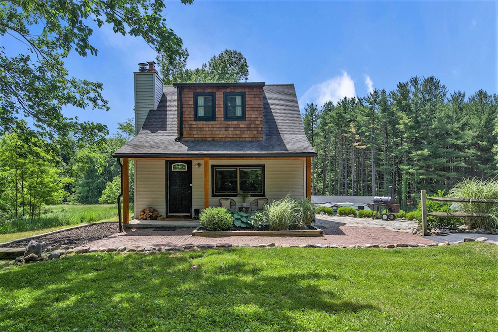
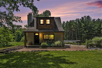
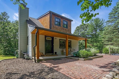
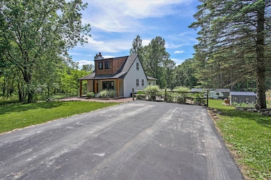
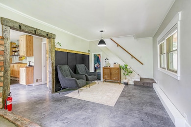
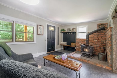
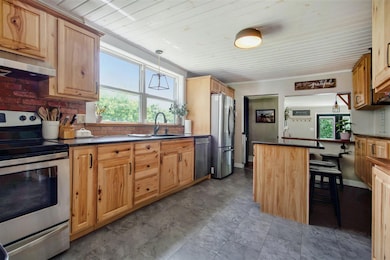
Move-in ready home on over two beautiful acres offers the best of both worlds with a private setting and close proximity to downtown Dexter. This three bed, two full bath farmhouse has been thoughtfully updated throughout the years and is ready for its next owner. The cozy living room features a wood burning stove and opens up to a spacious kitchen with plenty of storage space and newer granite countertops. A recently updated first floor bathroom features a zellige-tiled shower/tub combo and roomy vanity. The open family room lets in plenty of natural light and leads to a first floor bedroom. Upstairs boasts two freshly painted bedrooms and a newer full bathroom with a stand-up shower and tile flooring. The basement has ample room for storage and a finished rec space. Outside you'll find a hobby farmer's dream with multiple outbuildings and infrastructure for a wide range of endeavors. Award winning Dexter schools and low Webster Township taxes make this a can't miss opportunity!
Last Agent to Sell the Property
Walz Realty, LLC License #6501423211 Listed on: 07/05/2025
| Date | Type | Sale Price | Title Company |
|---|---|---|---|
| Warranty Deed | $425,000 | Liberty Title | |
| Warranty Deed | $425,000 | Liberty Title | |
| Interfamily Deed Transfer | -- | None Available | |
| Warranty Deed | $110,000 | None Available |
| Date | Status | Loan Amount | Loan Type |
|---|---|---|---|
| Open | $412,250 | New Conventional | |
| Previous Owner | $98,000 | New Conventional |
| Date | Event | Price | List to Sale | Price per Sq Ft |
|---|---|---|---|---|
| 08/15/2025 08/15/25 | Sold | $425,000 | 0.0% | $249 / Sq Ft |
| 06/19/2025 06/19/25 | For Sale | $425,000 | -- | $249 / Sq Ft |
| Year | Tax Paid | Tax Assessment Tax Assessment Total Assessment is a certain percentage of the fair market value that is determined by local assessors to be the total taxable value of land and additions on the property. | Land | Improvement |
|---|---|---|---|---|
| 2025 | $947 | $145,000 | $0 | $0 |
| 2024 | $920 | $119,200 | $0 | $0 |
| 2023 | $876 | $106,400 | $0 | $0 |
| 2022 | $2,698 | $93,500 | $0 | $0 |
| 2021 | $2,335 | $83,200 | $0 | $0 |
| 2020 | $2,306 | $80,400 | $0 | $0 |
| 2019 | $2,293 | $75,200 | $75,200 | $0 |
| 2018 | $2,247 | $76,100 | $0 | $0 |
| 2017 | $2,152 | $74,600 | $0 | $0 |
| 2016 | $628 | $59,095 | $0 | $0 |
| 2015 | -- | $58,420 | $0 | $0 |
| 2014 | -- | $53,448 | $0 | $0 |
| 2013 | -- | $53,448 | $0 | $0 |
S
Seller's Agent in 2025
Spencer Walz
Walz Realty, LLC
(734) 972-0911
1 in this area
32 Total Sales
E
Seller Co-Listing Agent in 2025
Eric Walz
Walz Realty, LLC
(734) 657-3361
3 in this area
88 Total Sales
M
Buyer's Agent in 2025
Matthew Strozeski
Howard Hanna Real Estate
(734) 780-6967
1 in this area
15 Total Sales
Source: MichRIC
MLS Number: 25028836
APN: 03-09-300-003
Disclaimer: Certain information contained herein is derived from information provided by parties other than Homes.com. All information provided is deemed reliable, but is not guaranteed to be accurate and should be independently verified.
![]() Information is deemed reliable but not guaranteed.
Information is deemed reliable but not guaranteed.
Copyright 2026 MichRIC, LLC. All rights reserved.
Ask me questions while you tour the home.
