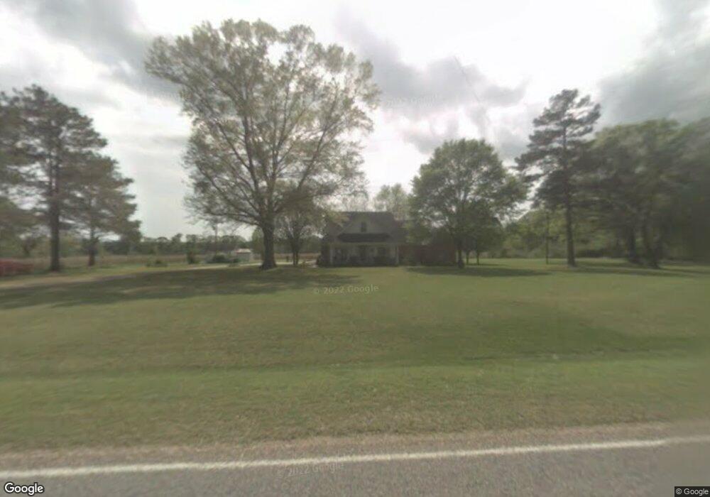
8043 River Rd S Summit, MS 39666
Estimated Value: $163,000 - $389,027
Studio
1
Bath
4,252
Sq Ft
$65/Sq Ft
Est. Value
About This Home
This home is located at 8043 River Rd S, Summit, MS 39666 and is currently estimated at $278,007, approximately $65 per square foot. 8043 River Rd S is a home located in Pike County with nearby schools including North Pike Elementary School, North Pike Middle School, and North Pike Senior High School.
Ownership History
Date
Name
Owned For
Owner Type
Purchase Details
Closed on
Mar 17, 2010
Sold by
Beam Laverne F and Beam Frank G
Bought by
Blanton Charles R and Blanton Suzette
Current Estimated Value
Home Financials for this Owner
Home Financials are based on the most recent Mortgage that was taken out on this home.
Original Mortgage
$180,408
Interest Rate
5.01%
Mortgage Type
New Conventional
Purchase Details
Closed on
Mar 15, 2010
Sold by
Danforth David Beam and Khayat Kathryn Beam
Bought by
Beam Laverne F and Beam Frank G
Home Financials for this Owner
Home Financials are based on the most recent Mortgage that was taken out on this home.
Original Mortgage
$180,408
Interest Rate
5.01%
Mortgage Type
New Conventional
Create a Home Valuation Report for This Property
The Home Valuation Report is an in-depth analysis detailing your home's value as well as a comparison with similar homes in the area
Purchase History
| Date | Buyer | Sale Price | Title Company |
|---|---|---|---|
| Blanton Charles R | -- | None Available | |
| Beam Laverne F | -- | None Available |
Source: Public Records
Mortgage History
| Date | Status | Borrower | Loan Amount |
|---|---|---|---|
| Closed | Blanton Charles R | $180,408 |
Source: Public Records
Tax History
| Year | Tax Paid | Tax Assessment Tax Assessment Total Assessment is a certain percentage of the fair market value that is determined by local assessors to be the total taxable value of land and additions on the property. | Land | Improvement |
|---|---|---|---|---|
| 2025 | $2,826 | $32,560 | $0 | $0 |
| 2024 | $2,756 | $27,566 | $0 | $0 |
| 2023 | $2,697 | $27,566 | $0 | $0 |
| 2022 | $2,659 | $27,566 | $0 | $0 |
| 2021 | $2,652 | $27,566 | $0 | $0 |
| 2020 | $3,384 | $27,760 | $0 | $0 |
| 2019 | $3,295 | $27,760 | $0 | $0 |
| 2018 | $3,271 | $27,760 | $0 | $0 |
| 2017 | $3,195 | $27,760 | $0 | $0 |
| 2016 | $2,761 | $27,535 | $0 | $0 |
| 2015 | $2,584 | $26,559 | $0 | $0 |
| 2014 | $2,521 | $26,559 | $0 | $0 |
| 2013 | -- | $20,174 | $0 | $0 |
Source: Public Records
Map
Nearby Homes
- Tbd Hwy 570 River Road N and S
- 1021 Austin Smith Rd
- 0 Lucille Ln
- 1022 Friendship Cir
- 1073 Hillcrest Farms Ln
- 2075 Hartwell Rd
- 0 River Rd N
- TBD River Rd N
- 1086 Stewart Mill Rd
- 8001 W Topisaw S
- 1024 Sabrina Dr
- Tbd Atkinson Rd
- 0 Rolling Oaks Dr
- 1011 Rolling Oaks Dr
- 3174 W Topisaw N
- 2194 Brandi Rd
- 1037 Boone Rd
- 1033 Spike Ln
- 1028 Chester Reeves Rd
- 3037 Brandi Rd
- 8086 River Rd S
- 8074 River Rd S
- 8118 River Rd S
- 8048 River Rd S
- 8137 River Rd S
- 8078 River Rd S
- 8020 River Rd S
- 639 Moaks Creek Rd
- 8172 River Rd S
- 8135 River Rd S
- 8181 River Rd S
- 7190 River Rd S
- 7102 Highway 570 E
- 7033 Highway 570 E
- 7159 River Rd S
- 7160 River Rd S
- 1040 Garner Rd
- 7162 River Rd S
- 1053 Garner Rd
- 7009 Highway 570 E
Your Personal Tour Guide
Ask me questions while you tour the home.