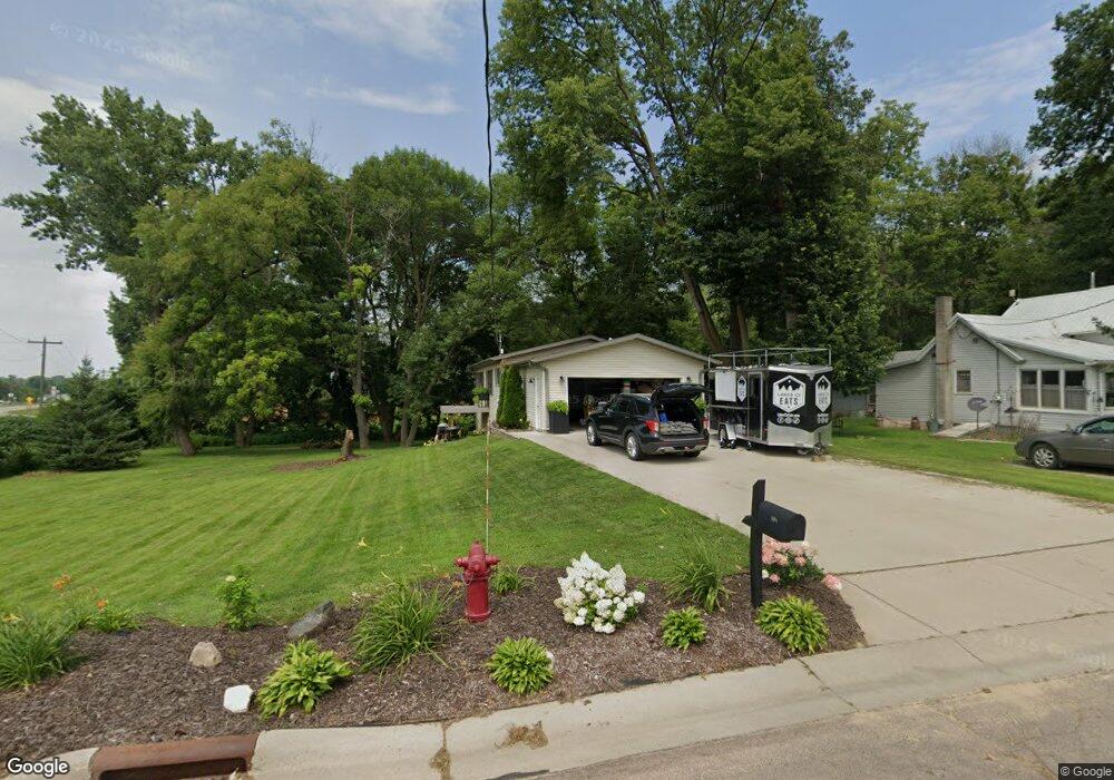
805 Clinton St Waterville, MN 56096
Estimated Value: $212,000 - $237,000
2
Beds
1
Bath
936
Sq Ft
$243/Sq Ft
Est. Value
About This Home
This home is located at 805 Clinton St, Waterville, MN 56096 and is currently estimated at $227,904, approximately $243 per square foot. 805 Clinton St is a home located in Le Sueur County with nearby schools including Waterville Elementary School, Morristown Elementary School, and Waterville-Elysian-Morristown Junior High School.
Ownership History
Date
Name
Owned For
Owner Type
Purchase Details
Closed on
Jan 20, 2015
Sold by
Michelle Lea Michelle Lea and Kuball Michelle Lea
Bought by
Deno Tony W and Mathias Aric
Current Estimated Value
Purchase Details
Closed on
Sep 9, 2013
Sold by
Kuball Kaleb John
Bought by
Deno Tony W and Mathias Aric
Purchase Details
Closed on
Mar 2, 2011
Sold by
The Secretary Of Veterans Affairs Of Was
Bought by
Mathias Aric and Deno Tony
Purchase Details
Closed on
Aug 20, 2007
Sold by
Federal Home Loan Mortgage Corporation
Bought by
Edelman Jeremy
Create a Home Valuation Report for This Property
The Home Valuation Report is an in-depth analysis detailing your home's value as well as a comparison with similar homes in the area
Home Values in the Area
Average Home Value in this Area
Purchase History
| Date | Buyer | Sale Price | Title Company |
|---|---|---|---|
| Deno Tony W | -- | -- | |
| Deno Tony W | -- | -- | |
| Mathias Aric | $63,000 | -- | |
| Edelman Jeremy | $121,500 | -- |
Source: Public Records
Tax History Compared to Growth
Tax History
| Year | Tax Paid | Tax Assessment Tax Assessment Total Assessment is a certain percentage of the fair market value that is determined by local assessors to be the total taxable value of land and additions on the property. | Land | Improvement |
|---|---|---|---|---|
| 2025 | $2,512 | $207,400 | $39,700 | $167,700 |
| 2024 | $2,310 | $204,800 | $39,700 | $165,100 |
| 2023 | $2,242 | $192,800 | $31,700 | $161,100 |
| 2022 | $2,002 | $185,100 | $31,700 | $153,400 |
| 2021 | $1,772 | $148,400 | $31,700 | $116,700 |
| 2020 | $1,660 | $130,600 | $28,700 | $101,900 |
| 2019 | $1,472 | $96,900 | $22,592 | $74,308 |
| 2018 | $1,457 | $83,000 | $20,092 | $62,908 |
| 2017 | $1,235 | $75,600 | $19,503 | $56,097 |
| 2016 | $1,194 | $68,600 | $18,863 | $49,737 |
| 2015 | $1,179 | $68,600 | $18,863 | $49,737 |
| 2014 | $1,061 | $68,600 | $18,863 | $49,737 |
| 2013 | $1,128 | $73,100 | $19,286 | $53,814 |
Source: Public Records
Map
Nearby Homes
- 124 4th St S
- 124 124 S 4th St
- 212 212 S 2nd St
- 212 2nd St S
- 130 1st St N
- 314 314 S Buchannon St
- 314 Buchannon St S
- 617 1st St N
- 705 1st St N
- 709 1st St N
- 730 1st St N
- XXXX Southridge Ln
- 902 Marion St
- 921 Lillian St
- 921 921 Lillian
- 624 Tetonka View Dr
- 114 114 S Reed
- 13262 Sakatah Lake Rd
- 11698 Morristown Blvd
- 48004 State Highway 13
- 805 805 Clinton St
- 815 Clinton St
- 827 Clinton St
- 804 Fremont St E
- 828 Clinton St
- 807 807 N Fremont St
- 807 807 Fremont St E
- 427 Division St
- 427 427 S Division St
- 425 425 S Division St
- 425 Division St
- 725 Clinton St
- 526 Hamilton St S
- 801 Fremont St E
- 801 Freemont St E
- 421 Division St
- 421 421 Division St
- 505 Division St
- 505 505 Division-Street-
- 809 Freemont St E