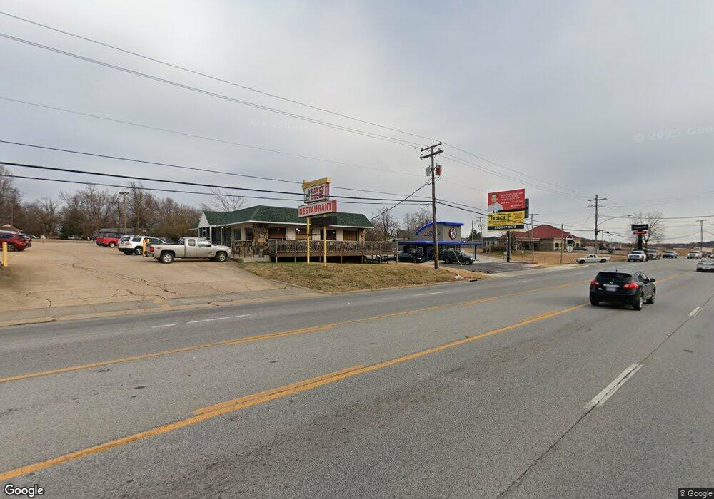
805 Highway 62 65 N Harrison, AR 72601
Estimated Value: $167,866 - $235,000
Studio
1
Bath
1,292
Sq Ft
$151/Sq Ft
Est. Value
About This Home
This home is located at 805 Highway 62 65 N, Harrison, AR 72601 and is currently estimated at $195,717, approximately $151 per square foot. 805 Highway 62 65 N is a home located in Boone County with nearby schools including Harrison Kindergarten, Harrison Jr. High School, and Harrison High School.
Ownership History
Date
Name
Owned For
Owner Type
Purchase Details
Closed on
Aug 10, 2022
Sold by
Brewer Steve and Berneace Crawford Living Trust
Bought by
Barnett Claty
Current Estimated Value
Home Financials for this Owner
Home Financials are based on the most recent Mortgage that was taken out on this home.
Original Mortgage
$141,550
Outstanding Balance
$135,353
Interest Rate
5.7%
Mortgage Type
New Conventional
Estimated Equity
$60,364
Create a Home Valuation Report for This Property
The Home Valuation Report is an in-depth analysis detailing your home's value as well as a comparison with similar homes in the area
Purchase History
| Date | Buyer | Sale Price | Title Company |
|---|---|---|---|
| Barnett Claty | $149,000 | Lenders Title Company |
Source: Public Records
Mortgage History
| Date | Status | Borrower | Loan Amount |
|---|---|---|---|
| Open | Barnett Claty | $141,550 |
Source: Public Records
Tax History Compared to Growth
Tax History
| Year | Tax Paid | Tax Assessment Tax Assessment Total Assessment is a certain percentage of the fair market value that is determined by local assessors to be the total taxable value of land and additions on the property. | Land | Improvement |
|---|---|---|---|---|
| 2025 | $1,238 | $24,030 | $3,140 | $20,890 |
| 2024 | $1,072 | $24,030 | $3,140 | $20,890 |
| 2023 | $1,238 | $24,030 | $3,140 | $20,890 |
| 2022 | $256 | $22,090 | $1,200 | $20,890 |
| 2021 | $256 | $22,090 | $1,200 | $20,890 |
| 2020 | $256 | $13,890 | $1,200 | $12,690 |
| 2019 | $274 | $13,890 | $1,200 | $12,690 |
| 2018 | $299 | $13,890 | $1,200 | $12,690 |
| 2017 | $196 | $13,890 | $1,200 | $12,690 |
| 2016 | $196 | $12,250 | $1,200 | $11,050 |
| 2015 | $546 | $12,250 | $1,200 | $11,050 |
| 2014 | $196 | $12,250 | $1,200 | $11,050 |
Source: Public Records
Map
Nearby Homes
- 303 Dogwood St
- 0 W Hwy 43 Unit 1298701
- 115 Russell Dr
- 0 U S Highway 62
- 118 Rose St
- 1825 Forward Dr
- 1615 N Spring Rd Unit 5
- 1615 N Spring Rd
- 804 Smith Dr
- 0 N Sutton
- 12976 Arkansas 43
- 1105 Maria Dr
- 815 W Smythe Ave
- 3000 Belmont Ave
- 3008 Belmont Ave
- 3101 Belmont Ave
- 3107 Belmont Ave Unit 7
- 1220 W Holt Ave
- 5751 Rock Springs Rd
- 45 acres Inman Rd
- 805 U S 65
- 801 Highway 65 S
- 801 Highway 62 65 N
- 801 Highway 62 65 N
- 801 N Hwy 62-65
- 801 U S 62
- 807 Highway 62 65 N
- 800 Highway 62 65 N
- 0 Highway 62-65 Unit 18024279
- 710 Highway 62 65 N
- 111 Adams St
- 117 Adams St
- 117 N Adams St
- 117 Beene Ave
- 115 Adams St
- 710 U S 65
- 0 U S Hwy 62-65 Unit 16036336
- 112 Lincoln Ave
- 119 Adams St
- 223 Lincoln Ave
