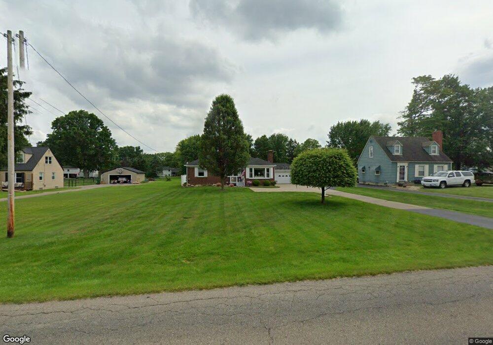
805 Mathews Rd Youngstown, OH 44512
Estimated Value: $179,896 - $194,000
2
Beds
2
Baths
1,316
Sq Ft
$143/Sq Ft
Est. Value
About This Home
This home is located at 805 Mathews Rd, Youngstown, OH 44512 and is currently estimated at $187,724, approximately $142 per square foot. 805 Mathews Rd is a home located in Mahoning County with nearby schools including Robinwood Lane Elementary School, Boardman Glenwood Junior High School, and Boardman High School.
Ownership History
Date
Name
Owned For
Owner Type
Purchase Details
Closed on
Jun 30, 2025
Sold by
Ridarsky Linda L
Bought by
Koch Tyler
Current Estimated Value
Home Financials for this Owner
Home Financials are based on the most recent Mortgage that was taken out on this home.
Original Mortgage
$159,800
Outstanding Balance
$159,525
Interest Rate
6.77%
Mortgage Type
New Conventional
Estimated Equity
$28,199
Purchase Details
Closed on
Dec 20, 1972
Bought by
Ridarsky James A and Ridarsky Linda
Create a Home Valuation Report for This Property
The Home Valuation Report is an in-depth analysis detailing your home's value as well as a comparison with similar homes in the area
Home Values in the Area
Average Home Value in this Area
Purchase History
| Date | Buyer | Sale Price | Title Company |
|---|---|---|---|
| Koch Tyler | $188,000 | None Listed On Document | |
| Koch Tyler | $188,000 | None Listed On Document | |
| Ridarsky James A | -- | -- |
Source: Public Records
Mortgage History
| Date | Status | Borrower | Loan Amount |
|---|---|---|---|
| Open | Koch Tyler | $159,800 | |
| Closed | Koch Tyler | $159,800 |
Source: Public Records
Tax History Compared to Growth
Tax History
| Year | Tax Paid | Tax Assessment Tax Assessment Total Assessment is a certain percentage of the fair market value that is determined by local assessors to be the total taxable value of land and additions on the property. | Land | Improvement |
|---|---|---|---|---|
| 2024 | $1,355 | $36,070 | $5,800 | $30,270 |
| 2023 | $1,369 | $36,070 | $5,800 | $30,270 |
| 2022 | $1,185 | $26,470 | $5,800 | $20,670 |
| 2021 | $1,185 | $26,470 | $5,800 | $20,670 |
| 2020 | $1,191 | $26,470 | $5,800 | $20,670 |
| 2019 | $1,240 | $24,940 | $5,800 | $19,140 |
| 2018 | $1,033 | $24,940 | $5,800 | $19,140 |
| 2017 | $1,204 | $24,940 | $5,800 | $19,140 |
| 2016 | $1,378 | $30,230 | $6,440 | $23,790 |
| 2015 | $1,351 | $30,230 | $6,440 | $23,790 |
| 2014 | $1,355 | $30,230 | $6,440 | $23,790 |
| 2013 | $1,337 | $30,230 | $6,440 | $23,790 |
Source: Public Records
Map
Nearby Homes
- 796 Edenridge Dr
- 0 Moyer Ave
- 424 Mathews Rd
- 928 Edenridge Dr
- 792 Forest Ridge Dr
- 6229 Appleridge Dr
- 732 Forest Ridge Dr
- 857 Maple Ridge Dr
- 6278 Appleridge Dr
- 0 Mulberry Ln Unit 5119623
- 772 Teakwood Dr
- 707 Oakridge Dr
- 0 Cranberry Ln Unit 5119702
- 642 Oakridge Dr
- 0 Mathews Rd Unit 5038026
- 6001 Applecrest Dr
- 6785 Tanglewood Dr
- 323 Melrose Ave
- 0 Mathews Rd Unit 5149232
- 0 Mathews Rd Unit 5143059
- 495 Mathews Rd
- 815 Mathews Rd
- 491 Mathews Rd
- 823 Mathews Rd Unit 825
- 825 Mathews Rd
- 856 Larkridge Ave
- 496 Mathews Rd
- 866 Larkridge Ave
- 827 Mathews Rd
- 483 Mathews Rd
- 918 Mathews Rd
- 490 Mathews Rd
- 872 Larkridge Ave
- 844 Larkridge Ave
- 850 Larkridge Ave
- 829 Mathews Rd
- 878 Larkridge Ave
- 838 Larkridge Ave
- 510 Mathews Rd
- 482 Mathews Rd