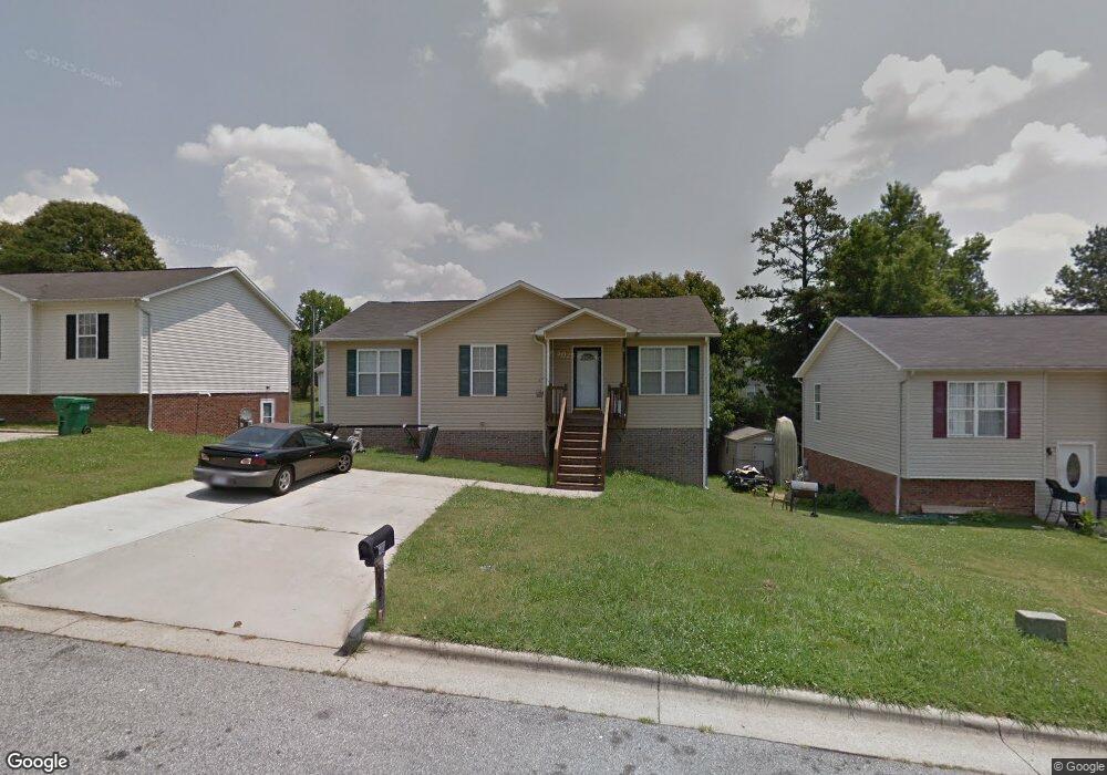
805 Paramount St High Point, NC 27260
Greater High Point NeighborhoodEstimated Value: $206,000 - $305,000
3
Beds
2
Baths
1,288
Sq Ft
$189/Sq Ft
Est. Value
About This Home
This home is located at 805 Paramount St, High Point, NC 27260 and is currently estimated at $243,741, approximately $189 per square foot. 805 Paramount St is a home located in Guilford County with nearby schools including Union Hill Elementary School, Jamestown Middle School, and Ragsdale High School.
Ownership History
Date
Name
Owned For
Owner Type
Purchase Details
Closed on
Jul 19, 2004
Sold by
A M E Builders Inc
Bought by
Mcgregor Vincent E and Mcgregor Sharon M
Current Estimated Value
Home Financials for this Owner
Home Financials are based on the most recent Mortgage that was taken out on this home.
Original Mortgage
$96,000
Outstanding Balance
$47,339
Interest Rate
6.24%
Mortgage Type
Purchase Money Mortgage
Estimated Equity
$196,402
Create a Home Valuation Report for This Property
The Home Valuation Report is an in-depth analysis detailing your home's value as well as a comparison with similar homes in the area
Home Values in the Area
Average Home Value in this Area
Purchase History
| Date | Buyer | Sale Price | Title Company |
|---|---|---|---|
| Mcgregor Vincent E | $120,000 | -- |
Source: Public Records
Mortgage History
| Date | Status | Borrower | Loan Amount |
|---|---|---|---|
| Open | Mcgregor Vincent E | $96,000 |
Source: Public Records
Tax History
| Year | Tax Paid | Tax Assessment Tax Assessment Total Assessment is a certain percentage of the fair market value that is determined by local assessors to be the total taxable value of land and additions on the property. | Land | Improvement |
|---|---|---|---|---|
| 2025 | $2,334 | $169,400 | $22,000 | $147,400 |
| 2024 | $2,334 | $169,400 | $22,000 | $147,400 |
| 2023 | $2,334 | $169,400 | $22,000 | $147,400 |
| 2022 | $2,284 | $169,400 | $22,000 | $147,400 |
| 2021 | $1,643 | $119,200 | $9,400 | $109,800 |
| 2020 | $1,643 | $119,200 | $9,400 | $109,800 |
| 2019 | $1,643 | $119,200 | $0 | $0 |
| 2018 | $1,634 | $119,200 | $0 | $0 |
| 2017 | $1,643 | $119,200 | $0 | $0 |
| 2016 | $1,707 | $121,700 | $0 | $0 |
| 2015 | $1,716 | $121,700 | $0 | $0 |
| 2014 | $1,745 | $121,700 | $0 | $0 |
Source: Public Records
Map
Nearby Homes
- 928 Marlboro St
- 3003 #REAR Oakcrest Ave
- 210 Paramount St
- 930 & 928 R1 Marlboro St
- 3304 Central Ave
- 2715 Central Ave
- 709 Habersham Rd
- 627 Spring Garden Cir
- 404 Hickory Chapel Rd
- 1900-1922 Baker Rd
- 206 Paramount St
- 2305 Delaware Place
- 737 Hendrix St
- 735 Hendrix St
- 430 New St
- 2317 Purdy Ave
- 1111 Winslow St
- 1809 Franklin Ave
- 1908 Leonard Ave
- 1806 Franklin Ave
- 803 Paramount St
- 807 Paramount St
- 2801 Grand Tri Ct
- 2800 Grand Tri Ct
- 2712 Reginald Ct
- 729 Paramount St
- 2933 Triangle Lake Rd
- 2802 Grand Tri Ct
- 2803 Grand Tri Ct
- 2927 Triangle Lake Rd
- 2935 Triangle Lake Rd
- 2710 Reginald Ct
- 2711 Reginald Ct
- 721 Paramount St
- 2704 Reginald Ct
- 2702 Reginald Ct
- 2925 Triangle Lake Rd
- 2804 Grand Tri Ct
- 2805 Grand Tri Ct
- 2937 Triangle Lake Rd
Your Personal Tour Guide
Ask me questions while you tour the home.