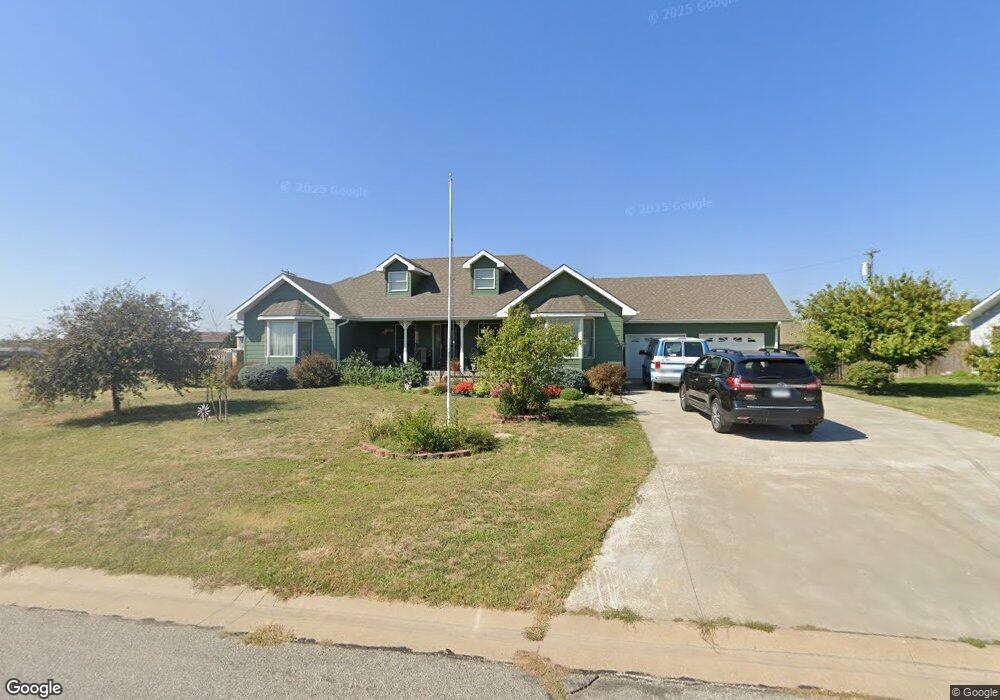
805 Robin St Minneapolis, KS 67467
Estimated Value: $270,041 - $298,000
3
Beds
3
Baths
1,673
Sq Ft
$170/Sq Ft
Est. Value
About This Home
This home is located at 805 Robin St, Minneapolis, KS 67467 and is currently estimated at $284,021, approximately $169 per square foot. 805 Robin St is a home located in Ottawa County with nearby schools including Minneapolis Elementary School and Minneapolis High School.
Ownership History
Date
Name
Owned For
Owner Type
Purchase Details
Closed on
Nov 12, 2008
Sold by
Wade Charles Raymond and Long Wade Joyce
Bought by
Wade Charles Raymond and Long Wade Joyce
Current Estimated Value
Purchase Details
Closed on
Mar 23, 2006
Sold by
City Of Minneapolis Kansas
Bought by
Brown Dwayne L and Brown Renda R
Home Financials for this Owner
Home Financials are based on the most recent Mortgage that was taken out on this home.
Original Mortgage
$150,000
Interest Rate
6.22%
Mortgage Type
Construction
Create a Home Valuation Report for This Property
The Home Valuation Report is an in-depth analysis detailing your home's value as well as a comparison with similar homes in the area
Home Values in the Area
Average Home Value in this Area
Purchase History
| Date | Buyer | Sale Price | Title Company |
|---|---|---|---|
| Wade Charles Raymond | -- | -- | |
| Brown Dwayne L | -- | -- |
Source: Public Records
Mortgage History
| Date | Status | Borrower | Loan Amount |
|---|---|---|---|
| Previous Owner | Brown Dwayne L | $150,000 |
Source: Public Records
Tax History Compared to Growth
Tax History
| Year | Tax Paid | Tax Assessment Tax Assessment Total Assessment is a certain percentage of the fair market value that is determined by local assessors to be the total taxable value of land and additions on the property. | Land | Improvement |
|---|---|---|---|---|
| 2025 | $6,327 | $36,334 | $829 | $35,505 |
| 2024 | $6,327 | $35,431 | $829 | $34,602 |
| 2023 | $5,506 | $31,433 | $829 | $30,604 |
| 2022 | $5,126 | $27,818 | $829 | $26,989 |
| 2021 | $4,233 | $23,517 | $829 | $22,688 |
| 2020 | $4,233 | $21,882 | $829 | $21,053 |
| 2019 | $4,310 | $21,882 | $829 | $21,053 |
| 2018 | $4,277 | $21,697 | $829 | $20,868 |
| 2017 | $4,283 | $21,482 | $829 | $20,653 |
| 2016 | $4,337 | $21,482 | $829 | $20,653 |
| 2015 | -- | $21,206 | $829 | $20,377 |
| 2014 | -- | $20,573 | $752 | $19,821 |
Source: Public Records
Map
Nearby Homes
- 716 N Rothsay Ave
- 725 Argyle Ave
- 813 N Rock St
- 116 E 3rd St
- 529 N Sheridan St
- 116 W 4th St
- 110 Spruce Ave
- 608 N Concord St
- 222 Mackenzie St
- 532 Laurel St
- 432 Mockingbird Ln
- 00000 Frontier Rd
- 1059 N 190th Rd
- 1027 N 190th Rd
- 1009 N 190th Rd
- 00000 N 190th Rd
- 0 Ivy Rd
- 751 N 190th Rd
- 325 N Nelson St
- 321 N Nelson St
- 809 Robin St
- 804 Marilyn St
- 720 Marilyn St
- 808 Marilyn St
- 711 Robin St
- 810 Robin St
- 710 Robin St
- 710 Marilyn St
- 949 Morning Glory St
- 760 Robin St
- 805 Marilyn St
- 959 Morning Glory St
- 723 Marilyn St
- 809 Marilyn St
- 939 Morning Glory St
- 929 Morning Glory St
- 711 Marilyn St
- 948 Starshine St
- 938 Starshine St
- 928 Starshine St