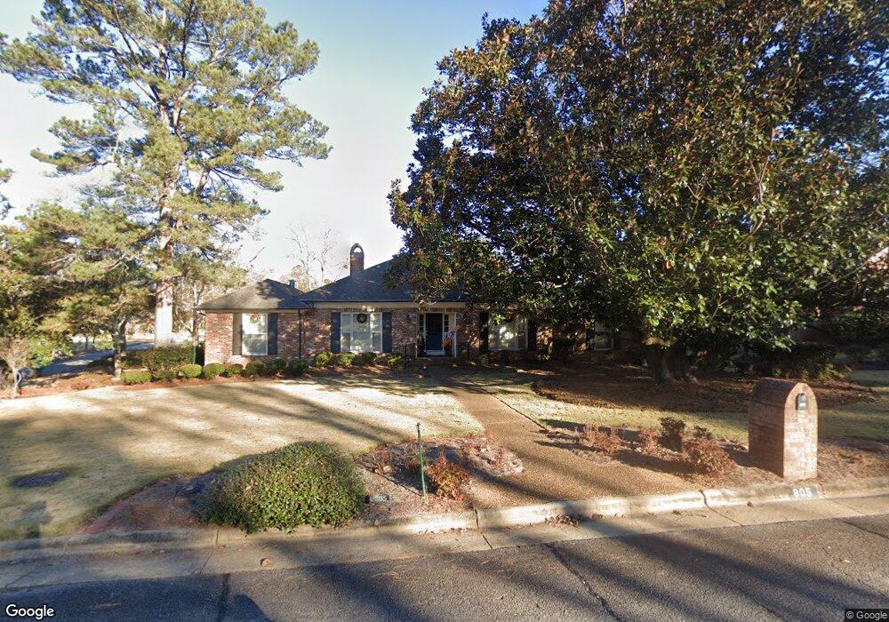
805 Rudgate Rd Columbus, GA 31904
North Columbus NeighborhoodEstimated Value: $376,857 - $473,000
--
Bed
5
Baths
2,275
Sq Ft
$187/Sq Ft
Est. Value
About This Home
This home is located at 805 Rudgate Rd, Columbus, GA 31904 and is currently estimated at $424,964, approximately $186 per square foot. 805 Rudgate Rd is a home located in Muscogee County with nearby schools including River Road Elementary School, Double Churches Middle School, and Northside High School.
Ownership History
Date
Name
Owned For
Owner Type
Purchase Details
Closed on
Jun 28, 2012
Sold by
Ray Christopher Henri
Bought by
Martin Scott D and Martin Laura C
Current Estimated Value
Home Financials for this Owner
Home Financials are based on the most recent Mortgage that was taken out on this home.
Original Mortgage
$227,000
Outstanding Balance
$33,455
Interest Rate
2.97%
Mortgage Type
New Conventional
Estimated Equity
$391,509
Create a Home Valuation Report for This Property
The Home Valuation Report is an in-depth analysis detailing your home's value as well as a comparison with similar homes in the area
Home Values in the Area
Average Home Value in this Area
Purchase History
| Date | Buyer | Sale Price | Title Company |
|---|---|---|---|
| Martin Scott D | $284,500 | -- |
Source: Public Records
Mortgage History
| Date | Status | Borrower | Loan Amount |
|---|---|---|---|
| Open | Martin Scott D | $227,000 |
Source: Public Records
Tax History
| Year | Tax Paid | Tax Assessment Tax Assessment Total Assessment is a certain percentage of the fair market value that is determined by local assessors to be the total taxable value of land and additions on the property. | Land | Improvement |
|---|---|---|---|---|
| 2025 | $3,939 | $137,832 | $24,356 | $113,476 |
| 2024 | $3,937 | $137,832 | $24,356 | $113,476 |
| 2023 | $3,268 | $137,832 | $24,356 | $113,476 |
| 2022 | $4,107 | $121,772 | $24,356 | $97,416 |
| 2021 | $4,100 | $110,896 | $24,356 | $86,540 |
| 2020 | $4,101 | $110,896 | $24,356 | $86,540 |
| 2019 | $4,116 | $110,896 | $24,356 | $86,540 |
| 2018 | $4,116 | $110,896 | $24,356 | $86,540 |
| 2017 | $4,131 | $110,896 | $24,356 | $86,540 |
| 2016 | $4,147 | $113,800 | $11,619 | $102,181 |
| 2015 | $4,152 | $113,800 | $11,619 | $102,181 |
| 2014 | $4,158 | $113,800 | $11,619 | $102,181 |
| 2013 | -- | $113,800 | $11,619 | $102,181 |
Source: Public Records
Map
Nearby Homes
- 6333 Cape Cod Dr
- 6390 Cape Cod Dr
- 6101 River Rd Unit 14
- 6101 River Rd Unit 13
- 6101 River Rd Unit 2
- 16 Kylemore Ct
- 5616 Morris Ave
- 5602 Morris Ave
- 831 53rd St
- 6400 Green Island Dr Unit 42
- 6400 Green Island Dr Unit 11
- 6400 Green Island Dr Unit 43
- 7281 Mobley Walk Dr
- 5472 Roaring Branch Rd
- 222 Cascade Rd
- 1021 53rd St
- 254 Cascade Rd
- 5431 Roaring Branch Rd
- 1016 53rd St
- 306 Cascade Rd
- 815 Rudgate Rd
- 6034 Bristol Blvd
- 6112 Cape Cod Dr
- 757 Rudgate Rd
- 806 Rudgate Rd
- 823 Rudgate Rd
- 816 Rudgate Rd
- 6101 Cape Cod Ct
- 756 Rudgate Rd
- 6120 Cape Cod Dr
- 747 Rudgate Rd
- 824 Rudgate Rd
- 6100 Bristol Blvd
- 831 Rudgate Rd
- 6115 Cape Cod Dr
- 746 Rudgate Rd
- 6111 Cape Cod Ct
- 6109 Marlowe Dr
- 6101 Bristol Blvd
- 6124 Cape Cod Dr
Your Personal Tour Guide
Ask me questions while you tour the home.