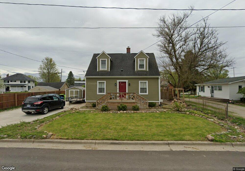
8051 Maple St Swartz Creek, MI 48473
Estimated Value: $130,000 - $141,000
2
Beds
1
Bath
1,078
Sq Ft
$126/Sq Ft
Est. Value
About This Home
This home is located at 8051 Maple St, Swartz Creek, MI 48473 and is currently estimated at $135,869, approximately $126 per square foot. 8051 Maple St is a home located in Genesee County with nearby schools including Syring Elementary School, Elms Road Elementary School, and Morrish Elementary School.
Ownership History
Date
Name
Owned For
Owner Type
Purchase Details
Closed on
Nov 4, 2022
Sold by
Bailey Andrew
Bought by
Bailey Andrew and Shaver Brianna
Current Estimated Value
Purchase Details
Closed on
Jan 10, 2020
Sold by
Shaver Bethany A and Shaver Alyssa
Bought by
Bailey Andrew
Purchase Details
Closed on
Feb 7, 2011
Sold by
Phh Mortgage Corporation
Bought by
Fannie Mae
Purchase Details
Closed on
Feb 2, 2011
Sold by
Baker Amy E and Anderson Allen R
Bought by
Phh Mortgage Corporation
Purchase Details
Closed on
Jan 22, 2007
Sold by
Baker Amy E
Bought by
Anderson Allen R and Baker Amy E
Home Financials for this Owner
Home Financials are based on the most recent Mortgage that was taken out on this home.
Original Mortgage
$97,623
Interest Rate
6.19%
Mortgage Type
New Conventional
Purchase Details
Closed on
Apr 28, 1999
Sold by
Phillips H Scott
Bought by
Baker Amy E
Create a Home Valuation Report for This Property
The Home Valuation Report is an in-depth analysis detailing your home's value as well as a comparison with similar homes in the area
Home Values in the Area
Average Home Value in this Area
Purchase History
| Date | Buyer | Sale Price | Title Company |
|---|---|---|---|
| Bailey Andrew | -- | -- | |
| Bailey Andrew | $71,000 | Liberty Title | |
| Fannie Mae | -- | None Available | |
| Phh Mortgage Corporation | $107,953 | None Available | |
| Anderson Allen R | -- | First American Title Ins Co | |
| Baker Amy E | $84,900 | Sargents Title Company Llc |
Source: Public Records
Mortgage History
| Date | Status | Borrower | Loan Amount |
|---|---|---|---|
| Previous Owner | Anderson Allen R | $97,623 |
Source: Public Records
Tax History Compared to Growth
Tax History
| Year | Tax Paid | Tax Assessment Tax Assessment Total Assessment is a certain percentage of the fair market value that is determined by local assessors to be the total taxable value of land and additions on the property. | Land | Improvement |
|---|---|---|---|---|
| 2025 | $1,665 | $44,100 | $0 | $0 |
| 2024 | $1,347 | $41,100 | $0 | $0 |
| 2023 | $1,285 | $36,300 | $0 | $0 |
| 2022 | $1,509 | $32,300 | $0 | $0 |
| 2021 | $1,475 | $30,600 | $0 | $0 |
| 2020 | $770 | $28,000 | $0 | $0 |
| 2019 | $760 | $24,000 | $0 | $0 |
| 2018 | $827 | $25,500 | $0 | $0 |
| 2017 | $793 | $25,500 | $0 | $0 |
| 2016 | $786 | $24,200 | $0 | $0 |
| 2015 | $606 | $22,500 | $0 | $0 |
| 2014 | $463 | $18,000 | $0 | $0 |
| 2012 | -- | $17,900 | $17,900 | $0 |
Source: Public Records
Map
Nearby Homes
- 5032 Brady St
- 8247 Miller Rd
- V/L Morrish Rd
- 5200 Morrish Rd
- 5402 Raubinger Rd
- 6434 Bristol Rd
- 4534 Raubinger Rd
- 5328 Don Shenk Dr
- 57 Ashley Cir
- 72 Ashley Cir
- 7257 Miller Rd
- 7352 Cross Creek Dr
- 5409 Durwood Dr
- 5380 Durwood Dr
- 9148 Chelmsford Dr
- 9091 Miller Rd
- 0 S Seymour Rd
- 8571 Miller Rd
- V/L Miller Rd
- 4062 Morrish Rd