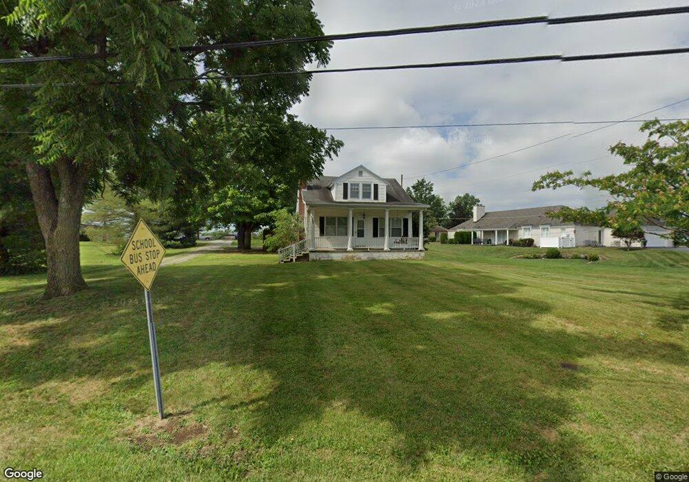
8059 State Route 125 West Union, OH 45693
Estimated Value: $132,000 - $143,000
4
Beds
1
Bath
1,299
Sq Ft
$106/Sq Ft
Est. Value
About This Home
This home is located at 8059 State Route 125, West Union, OH 45693 and is currently estimated at $137,240, approximately $105 per square foot. 8059 State Route 125 is a home located in Adams County with nearby schools including West Union Elementary School, West Union High School, and Adams County Christian School.
Ownership History
Date
Name
Owned For
Owner Type
Purchase Details
Closed on
Aug 19, 2025
Sold by
Aldridge Elizabeth A
Bought by
Dalton Jay Matthew and Fields Molly Ann
Current Estimated Value
Home Financials for this Owner
Home Financials are based on the most recent Mortgage that was taken out on this home.
Original Mortgage
$112,000
Outstanding Balance
$111,903
Interest Rate
6.72%
Mortgage Type
New Conventional
Estimated Equity
$25,337
Purchase Details
Closed on
Aug 31, 2017
Sold by
Back Carol J and Back Lowell T
Bought by
Aldridge Elizabeth A
Home Financials for this Owner
Home Financials are based on the most recent Mortgage that was taken out on this home.
Original Mortgage
$53,200
Interest Rate
3.89%
Mortgage Type
Future Advance Clause Open End Mortgage
Purchase Details
Closed on
Apr 1, 1977
Bought by
Hattan Harriett E
Create a Home Valuation Report for This Property
The Home Valuation Report is an in-depth analysis detailing your home's value as well as a comparison with similar homes in the area
Home Values in the Area
Average Home Value in this Area
Purchase History
| Date | Buyer | Sale Price | Title Company |
|---|---|---|---|
| Dalton Jay Matthew | $140,000 | Preferred Midwest Title | |
| Aldridge Elizabeth A | $56,000 | None Available | |
| Hattan Harriett E | $26,000 | -- |
Source: Public Records
Mortgage History
| Date | Status | Borrower | Loan Amount |
|---|---|---|---|
| Open | Dalton Jay Matthew | $112,000 | |
| Previous Owner | Aldridge Elizabeth A | $53,200 |
Source: Public Records
Tax History Compared to Growth
Tax History
| Year | Tax Paid | Tax Assessment Tax Assessment Total Assessment is a certain percentage of the fair market value that is determined by local assessors to be the total taxable value of land and additions on the property. | Land | Improvement |
|---|---|---|---|---|
| 2024 | $740 | $21,810 | $2,770 | $19,040 |
| 2023 | $740 | $21,810 | $2,770 | $19,040 |
| 2022 | $740 | $20,860 | $2,100 | $18,760 |
| 2021 | $767 | $20,860 | $2,100 | $18,760 |
| 2020 | $784 | $20,860 | $2,100 | $18,760 |
| 2019 | $784 | $20,860 | $2,100 | $18,760 |
| 2018 | $679 | $18,410 | $2,100 | $16,310 |
| 2017 | $668 | $18,410 | $2,100 | $16,310 |
| 2016 | $666 | $18,410 | $2,100 | $16,310 |
| 2015 | $593 | $16,940 | $2,100 | $14,840 |
| 2014 | $279 | $16,940 | $2,100 | $14,840 |
Source: Public Records
Map
Nearby Homes
- 714 Panhandle Ave
- 0 State Route 41 1 Acre Lot
- 0 Cic Blvd
- 408 W South St
- 101 S Mound St
- 305 W Walnut St
- 302 W Main St
- 216 S Market St
- 286 & 290 S Market St
- 12196 State Route 41
- 204 E North St
- 70 Logans Ln
- 4700 Ohio 247
- 104 N Washington St
- 144 ac Pumpkin Ridge Rd
- 501 E Mulberry St
- 537 1st St
- 526 E Walnut St
- 585 High St
- 601 E Main St
- 729 Panhandle Ave
- 737 Panhandle Ave
- 721 Panhandle Ave
- 8025 State Route 125
- 8043 State Route 125
- 8037 State Route 125
- 726 State Route 125
- 754 Panhandle Ave
- 718 Panhandle Ave
- 702 Panhandle Ave
- 703 Panhandle Ave
- 684 Panhandle Ave
- 675 Panhandle Ave
- 9639 State Route 125
- 9657 State Route 125
- 9675 State Route 125
- 664 Panhandle Ave
- 656 Panhandle Ave
- 111 Opal Dr
- 7904 State Route 125