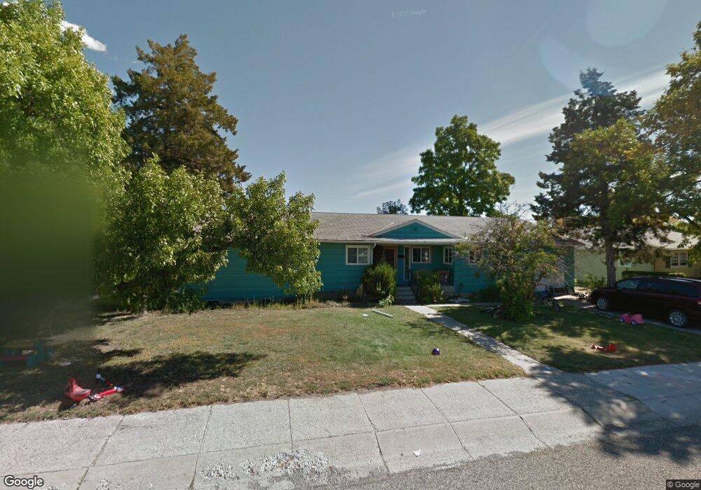
807 3rd Ave Laurel, MT 59044
Estimated Value: $333,000 - $387,000
3
Beds
3
Baths
1,750
Sq Ft
$205/Sq Ft
Est. Value
About This Home
This home is located at 807 3rd Ave, Laurel, MT 59044 and is currently estimated at $359,614, approximately $205 per square foot. 807 3rd Ave is a home located in Yellowstone County with nearby schools including Fred W. Graff School, West School, and Laurel Middle School.
Ownership History
Date
Name
Owned For
Owner Type
Purchase Details
Closed on
May 17, 2023
Sold by
Foley Michelle Lee
Bought by
Patrick Michael H
Current Estimated Value
Purchase Details
Closed on
May 21, 2008
Sold by
Krank Wendy J and Wilson Dorothy M
Bought by
Patrick Michael H and Patrick Paulette J
Home Financials for this Owner
Home Financials are based on the most recent Mortgage that was taken out on this home.
Original Mortgage
$140,760
Interest Rate
5.88%
Mortgage Type
Purchase Money Mortgage
Purchase Details
Closed on
Nov 20, 2007
Sold by
Krank Wendy J
Bought by
Krank Wendy J and Wilson Dorothy M
Create a Home Valuation Report for This Property
The Home Valuation Report is an in-depth analysis detailing your home's value as well as a comparison with similar homes in the area
Home Values in the Area
Average Home Value in this Area
Purchase History
| Date | Buyer | Sale Price | Title Company |
|---|---|---|---|
| Patrick Michael H | -- | None Listed On Document | |
| Patrick Michael H | -- | None Available | |
| Krank Wendy J | -- | None Available |
Source: Public Records
Mortgage History
| Date | Status | Borrower | Loan Amount |
|---|---|---|---|
| Previous Owner | Patrick Michael H | $140,760 |
Source: Public Records
Tax History
| Year | Tax Paid | Tax Assessment Tax Assessment Total Assessment is a certain percentage of the fair market value that is determined by local assessors to be the total taxable value of land and additions on the property. | Land | Improvement |
|---|---|---|---|---|
| 2025 | $3,172 | $386,400 | $68,532 | $317,868 |
| 2024 | $3,172 | $310,800 | $44,784 | $266,016 |
| 2023 | $2,934 | $310,800 | $44,784 | $266,016 |
| 2022 | $2,630 | $262,800 | $0 | $0 |
| 2021 | $2,651 | $262,800 | $0 | $0 |
| 2020 | $2,449 | $240,000 | $0 | $0 |
| 2019 | $2,488 | $240,000 | $0 | $0 |
| 2018 | $2,557 | $240,800 | $0 | $0 |
| 2017 | $2,051 | $240,800 | $0 | $0 |
| 2016 | $2,011 | $201,000 | $0 | $0 |
| 2015 | $1,989 | $201,000 | $0 | $0 |
| 2014 | $1,994 | $106,265 | $0 | $0 |
Source: Public Records
Map
Nearby Homes
- 603 5th Ave
- 110 E 5th St
- 516 Pennsylvania Ave
- 319 6th Ave
- 414 Wyoming Ave
- 116 4th Ave
- 310 (and 814 w 4) 8th Ave
- 601 E 5th St
- 1109 10th Ave
- 1216 W 12th Street Cir
- 1254 W Beartooth Dr
- 1319 Valley Dr
- 717 E 5th St
- 717 E 5th, 506 Alder Ave
- 1013 W 12th St
- 102 8th Ave Unit B
- 801 E 4th St
- 120 Forrest Ave
- 211 Woodland Ave
- 1104 E 8th St
Your Personal Tour Guide
Ask me questions while you tour the home.