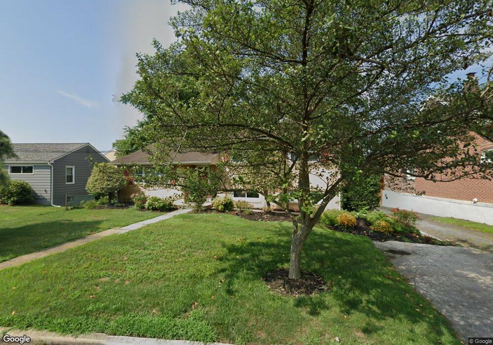
807 Amosland Rd Morton, PA 19070
Estimated Value: $423,000 - $474,000
4
Beds
2
Baths
2,120
Sq Ft
$210/Sq Ft
Est. Value
About This Home
This home is located at 807 Amosland Rd, Morton, PA 19070 and is currently estimated at $444,770, approximately $209 per square foot. 807 Amosland Rd is a home located in Delaware County with nearby schools including Amosland El School, Ridley Middle School, and Ridley High School.
Ownership History
Date
Name
Owned For
Owner Type
Purchase Details
Closed on
Dec 16, 1994
Sold by
Reisinger Julia C
Bought by
Miller Paul H and Miller Victoria H
Current Estimated Value
Home Financials for this Owner
Home Financials are based on the most recent Mortgage that was taken out on this home.
Original Mortgage
$102,800
Interest Rate
9.12%
Create a Home Valuation Report for This Property
The Home Valuation Report is an in-depth analysis detailing your home's value as well as a comparison with similar homes in the area
Home Values in the Area
Average Home Value in this Area
Purchase History
| Date | Buyer | Sale Price | Title Company |
|---|---|---|---|
| Miller Paul H | $128,500 | First American Title Ins Co |
Source: Public Records
Mortgage History
| Date | Status | Borrower | Loan Amount |
|---|---|---|---|
| Closed | Miller Paul H | $102,800 |
Source: Public Records
Tax History Compared to Growth
Tax History
| Year | Tax Paid | Tax Assessment Tax Assessment Total Assessment is a certain percentage of the fair market value that is determined by local assessors to be the total taxable value of land and additions on the property. | Land | Improvement |
|---|---|---|---|---|
| 2025 | $8,917 | $256,820 | $80,520 | $176,300 |
| 2024 | $8,917 | $256,820 | $80,520 | $176,300 |
| 2023 | $8,071 | $251,080 | $80,520 | $170,560 |
| 2022 | $8,071 | $251,080 | $80,520 | $170,560 |
| 2021 | $12,494 | $251,080 | $80,520 | $170,560 |
| 2020 | $7,528 | $133,260 | $48,280 | $84,980 |
| 2019 | $7,390 | $133,260 | $48,280 | $84,980 |
| 2018 | $7,298 | $133,260 | $0 | $0 |
| 2017 | $7,298 | $133,260 | $0 | $0 |
| 2016 | $731 | $133,260 | $0 | $0 |
| 2015 | $746 | $133,260 | $0 | $0 |
| 2014 | $746 | $133,260 | $0 | $0 |
Source: Public Records
Map
Nearby Homes
- 742 Agnes Ave
- 136 Linden Ave
- 216-218 President Ave
- 31 Silver Lake Terrace Unit 32
- 916 Brooke Ave
- 810 Quince Ln
- 115 President Ave
- 668 Hutchinson Terrace
- 2 Yale Ave
- 2330 Poe Rd
- 7 & 0 Woodland Ave
- 120 Bridge St
- 226 W Sylvan Ave
- 601 Country Ln
- 15 Sycamore Ave
- 339 Sutton Ave
- 1828 5th Ave
- 880 Quaint St
- 357 Cedar Ave
- 111 Broad St
- 815 Amosland Rd
- 803 Amosland Rd
- 1919 Elder Ave
- 1922 Pershing Ave
- 810 Amosland Rd
- 806 Amosland Rd
- 825 Amosland Rd
- 1915 Elder Ave
- 1916 Pershing Ave
- 1928 Elder Ave
- 826 Amosland Rd
- 1924 Elder Ave
- 1909 Elder Ave
- 1914 Pershing Ave
- 1920 Elder Ave
- 1916 Elder Ave
- 802 Amosland Rd
- 828 Amosland Rd
- 1935 Pershing Ave
- 1906 Pershing Ave