Estimated Value: $55,000 - $115,000
3
Beds
1
Bath
1,403
Sq Ft
$58/Sq Ft
Est. Value
About This Home
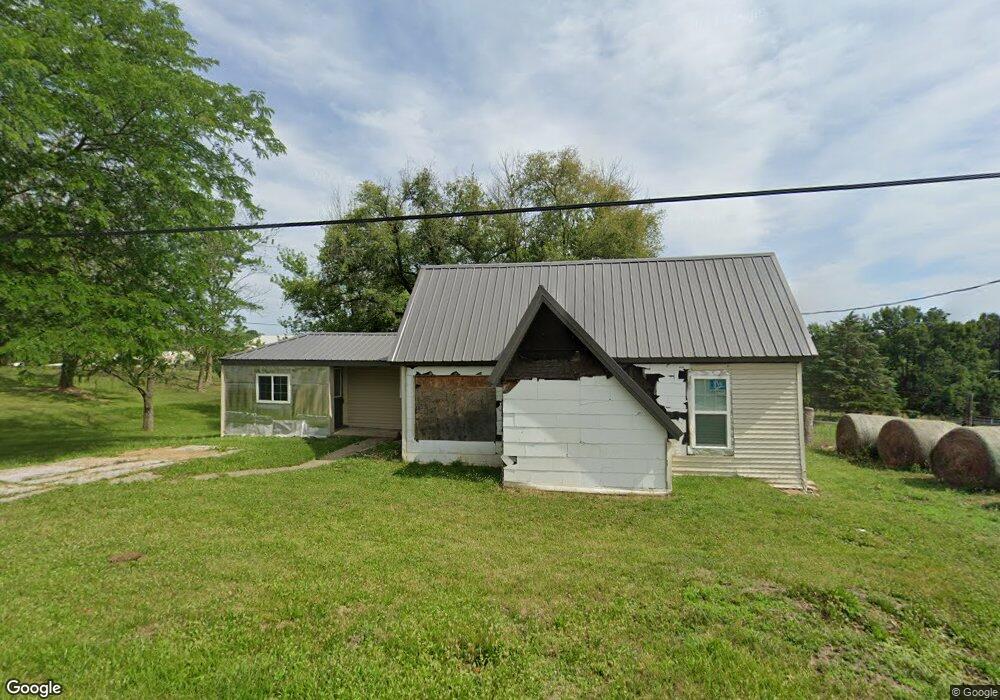
This home is located at 807 Riggs St, Macon, MO 63552 and is currently estimated at $81,186, approximately $57 per square foot. 807 Riggs St is a home located in Macon County with nearby schools including Macon Elementary School, Family Literacy Center, and Macon Middle School.
Ownership History
Date
Name
Owned For
Owner Type
Purchase Details
Closed on
Nov 5, 2024
Sold by
Norton Ronda
Bought by
Burgard Carrie
Current Estimated Value
Home Financials for this Owner
Home Financials are based on the most recent Mortgage that was taken out on this home.
Original Mortgage
$64,000
Outstanding Balance
$61,253
Interest Rate
0.68%
Mortgage Type
Construction
Estimated Equity
$19,933
Purchase Details
Closed on
Jul 19, 2023
Sold by
Barnhill Dana M
Bought by
Baker Ronda K
Purchase Details
Closed on
Nov 22, 2017
Sold by
Parrish Gerald R and Parrish Linda M
Bought by
Barnhill Dana Marie
Create a Home Valuation Report for This Property
The Home Valuation Report is an in-depth analysis detailing your home's value as well as a comparison with similar homes in the area
Home Values in the Area
Average Home Value in this Area
Purchase History
| Date | Buyer | Sale Price | Title Company |
|---|---|---|---|
| Burgard Carrie | $80,000 | Macon Cnty Title Llc | |
| Baker Ronda K | -- | Macon Cnty Title Llc | |
| Barnhill Dana Marie | -- | Macon Cnty Title Llc |
Source: Public Records
Mortgage History
| Date | Status | Borrower | Loan Amount |
|---|---|---|---|
| Open | Burgard Carrie | $64,000 |
Source: Public Records
Tax History
| Year | Tax Paid | Tax Assessment Tax Assessment Total Assessment is a certain percentage of the fair market value that is determined by local assessors to be the total taxable value of land and additions on the property. | Land | Improvement |
|---|---|---|---|---|
| 2025 | $300 | $6,500 | $700 | $5,800 |
| 2024 | $3 | $5,810 | $0 | $0 |
| 2023 | $299 | $7,110 | $0 | $0 |
| 2022 | $352 | $7,110 | $0 | $0 |
| 2021 | $351 | $6,870 | $0 | $0 |
| 2020 | $352 | $6,870 | $0 | $0 |
| 2019 | $351 | $6,870 | $6,870 | $0 |
| 2018 | $267 | $6,870 | $6,870 | $0 |
| 2017 | $275 | $32,040 | $6,690 | $25,350 |
| 2016 | $269 | $6,090 | $0 | $0 |
| 2015 | -- | $5,910 | $0 | $0 |
| 2014 | -- | $5,910 | $0 | $0 |
| 2012 | -- | $5,910 | $0 | $0 |
Source: Public Records
Map
Nearby Homes
- 205 S Rutherford St
- 902 S Rollins St
- 102 W 2nd St
- 302 Jackson St
- 803 Coates St
- 000 State Highway Pp
- 501 Spruce St
- 203 S Hudson St
- 919 Coates St
- 608 N Rollins St
- 805 Jackson St
- 802 W Bourke St
- 801 Overbrook Dr
- 506 Western Dr
- 601 Roe Ln
- 1004 Meadow Ln
- 509 Western Dr
- 1604 Sherwood Dr
- 29601 Cottonwood Ln
- 29601 Cottenwood Ln
Your Personal Tour Guide
Ask me questions while you tour the home.