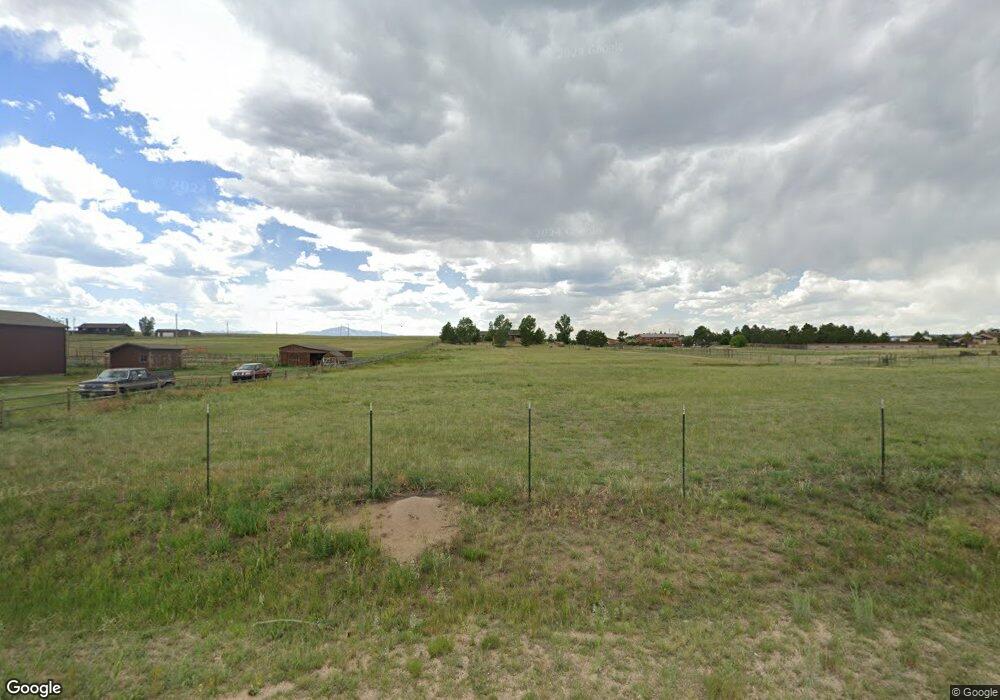
8070 Curtis Rd Peyton, CO 80831
Falcon NeighborhoodEstimated Value: $521,988 - $573,000
3
Beds
2
Baths
1,428
Sq Ft
$387/Sq Ft
Est. Value
About This Home
This home is located at 8070 Curtis Rd, Peyton, CO 80831 and is currently estimated at $551,996, approximately $386 per square foot. 8070 Curtis Rd is a home located in El Paso County with nearby schools including Falcon Elementary School Of Technology, Falcon Middle School, and Falcon High School.
Ownership History
Date
Name
Owned For
Owner Type
Purchase Details
Closed on
Sep 26, 2003
Sold by
Crites Brenda Lee
Bought by
Platt Robert L C and Platt Julie L
Current Estimated Value
Home Financials for this Owner
Home Financials are based on the most recent Mortgage that was taken out on this home.
Original Mortgage
$147,200
Outstanding Balance
$66,534
Interest Rate
6.22%
Mortgage Type
Purchase Money Mortgage
Estimated Equity
$485,462
Purchase Details
Closed on
Feb 22, 1990
Bought by
Platt Robert L C
Purchase Details
Closed on
Oct 31, 1980
Bought by
Platt Robert L C
Create a Home Valuation Report for This Property
The Home Valuation Report is an in-depth analysis detailing your home's value as well as a comparison with similar homes in the area
Home Values in the Area
Average Home Value in this Area
Purchase History
| Date | Buyer | Sale Price | Title Company |
|---|---|---|---|
| Platt Robert L C | -- | -- | |
| Platt Robert L C | -- | -- | |
| Platt Robert L C | -- | -- |
Source: Public Records
Mortgage History
| Date | Status | Borrower | Loan Amount |
|---|---|---|---|
| Open | Platt Robert L C | $147,200 | |
| Closed | Platt Robert L C | $36,800 |
Source: Public Records
Tax History Compared to Growth
Tax History
| Year | Tax Paid | Tax Assessment Tax Assessment Total Assessment is a certain percentage of the fair market value that is determined by local assessors to be the total taxable value of land and additions on the property. | Land | Improvement |
|---|---|---|---|---|
| 2025 | $2,212 | $37,760 | -- | -- |
| 2024 | $2,103 | $34,910 | $8,180 | $26,730 |
| 2023 | $2,103 | $34,910 | $8,180 | $26,730 |
| 2022 | $1,590 | $22,900 | $6,720 | $16,180 |
| 2021 | $1,654 | $23,570 | $6,920 | $16,650 |
| 2020 | $1,430 | $20,280 | $5,400 | $14,880 |
| 2019 | $1,417 | $20,280 | $5,400 | $14,880 |
| 2018 | $1,155 | $16,250 | $4,900 | $11,350 |
| 2017 | $1,058 | $16,250 | $4,900 | $11,350 |
| 2016 | $1,035 | $15,690 | $5,180 | $10,510 |
| 2015 | $1,036 | $15,690 | $5,180 | $10,510 |
| 2014 | $959 | $14,260 | $4,780 | $9,480 |
Source: Public Records
Map
Nearby Homes
- 8071 Estacado Place
- 14470 Seminole Ln
- 7854 Truchas Trail
- 7776 Truchas Trail
- 7698 Truchas Trail
- 7621 Truchas Trail
- Summit Plan at Saddlehorn Ranch
- Dolores Peak Plan at Saddlehorn Ranch
- Durango Plan at Saddlehorn Ranch
- Haven Plan at Saddlehorn Ranch
- Monarch Plan at Saddlehorn Ranch
- 8815 Jae Lynn Dr
- 7464 Truchas Trail
- 15150 Del Cerro Trail
- 15381 Oscuro Trail
- 14891 Oscuro Trail
- 14961 Oscuro Trail
- 15101 Oscuro Trail
- 14550 U S 24
- 0 E Judge Orr Rd Unit 2955069
- 8110 Curtis Rd
- 8030 Curtis Rd
- 8030 Curtis Rd
- 8150 Curtis Rd
- 7990 Curtis Rd
- 8190 Curtis Rd
- 7950 Curtis Rd
- 14510 Seminole Ln
- 14515 Seminole Ln
- 7920 Curtis Rd
- 8230 Curtis Rd
- 8280 Curtis Rd
- 14475 Seminole Ln
- 7880 Curtis Rd
- 8320 Curtis Rd
- 7830 Curtis Rd
- 8225 Aerostar Dr
- 8370 Curtis Rd
- 8125 Aerostar Dr
- 8025 Aerostar Dr
