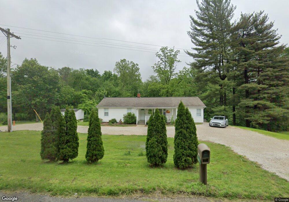
8076 Us Highway 231 Loogootee, IN 47553
Estimated Value: $202,000 - $254,000
2
Beds
1
Bath
1,466
Sq Ft
$157/Sq Ft
Est. Value
About This Home
This home is located at 8076 Us Highway 231, Loogootee, IN 47553 and is currently estimated at $230,015, approximately $156 per square foot. 8076 Us Highway 231 is a home located in Martin County with nearby schools including Loogootee Elementary School, Loogootee Middle School, and Loogootee Junior/Senior High School.
Ownership History
Date
Name
Owned For
Owner Type
Purchase Details
Closed on
Jul 29, 2022
Sold by
Allen Otto Mark and Joy Marjorie
Bought by
Stoll Joshua Keith and Stoll Jennifer L
Current Estimated Value
Home Financials for this Owner
Home Financials are based on the most recent Mortgage that was taken out on this home.
Original Mortgage
$220,924
Outstanding Balance
$211,529
Interest Rate
5.7%
Mortgage Type
FHA
Estimated Equity
$18,486
Purchase Details
Closed on
Nov 22, 2013
Sold by
Slaubaugh John A
Bought by
Hershberger Ammon L and Hershberger Deborah F
Create a Home Valuation Report for This Property
The Home Valuation Report is an in-depth analysis detailing your home's value as well as a comparison with similar homes in the area
Purchase History
| Date | Buyer | Sale Price | Title Company |
|---|---|---|---|
| Stoll Joshua Keith | -- | Jones Mark J | |
| Hershberger Ammon L | $79,000 | -- |
Source: Public Records
Mortgage History
| Date | Status | Borrower | Loan Amount |
|---|---|---|---|
| Open | Stoll Joshua Keith | $220,924 |
Source: Public Records
Tax History
| Year | Tax Paid | Tax Assessment Tax Assessment Total Assessment is a certain percentage of the fair market value that is determined by local assessors to be the total taxable value of land and additions on the property. | Land | Improvement |
|---|---|---|---|---|
| 2024 | $929 | $173,500 | $14,700 | $158,800 |
| 2023 | $929 | $162,000 | $14,000 | $148,000 |
| 2022 | $703 | $147,700 | $13,400 | $134,300 |
| 2021 | $681 | $128,100 | $12,500 | $115,600 |
| 2020 | $626 | $124,200 | $12,000 | $112,200 |
| 2019 | $573 | $119,000 | $11,500 | $107,500 |
| 2018 | $555 | $114,800 | $11,100 | $103,700 |
| 2017 | $224 | $65,200 | $10,800 | $54,400 |
| 2016 | $184 | $64,100 | $10,600 | $53,500 |
| 2014 | $160 | $61,100 | $10,000 | $51,100 |
| 2013 | -- | $59,400 | $10,000 | $49,400 |
Source: Public Records
Map
Nearby Homes
- 0 Bledsoe Ln
- Lot# 1 Bledsoe Ln
- 0 Friends Creek Rd
- 0 Us Hwy 231 Unit 24642438
- 0 Us Hwy 231 Unit 202534654
- 4607 Beard Rd
- 701 Park St
- 214 Cedar St
- 803 & 805 Reason Ave Unit INCLUDES 111 TRUELOV
- 205 S Oak St
- 513 Park St
- 309 SE 1st St
- 0 Cr 600 S Unit 202541420
- 108 SW 2nd St
- 102 Eastgate Ave
- 207 Church St
- 90+/- Acres U S 231
- 305 Walker St
- 106 Queen St
- 1559 Scenic Hill Rd
- 8076 Us Highway 231
- 8124 Us Highway 231
- 8124 Us Highway 231
- 8108 Arvin Ln
- 7912 Us Highway 231
- 8103 Elliot Ln
- 8246 Us Highway 231
- 8252 Arvin Ln
- 8272 Us Highway 231
- 8019 Arvin Ln
- 8097 Arvin Ln
- 7992 Arvin Ln
- 8300 Arvin Ln
- 8117 Elliot Ln
- 8153 Elliot Ln
- 8153 Elliot Ln
- 8353 Elliot Ln
- 8314 Us Highway 231
- 627 Brooks Bridge Rd
- 520 Whitfield Rd
Your Personal Tour Guide
Ask me questions while you tour the home.