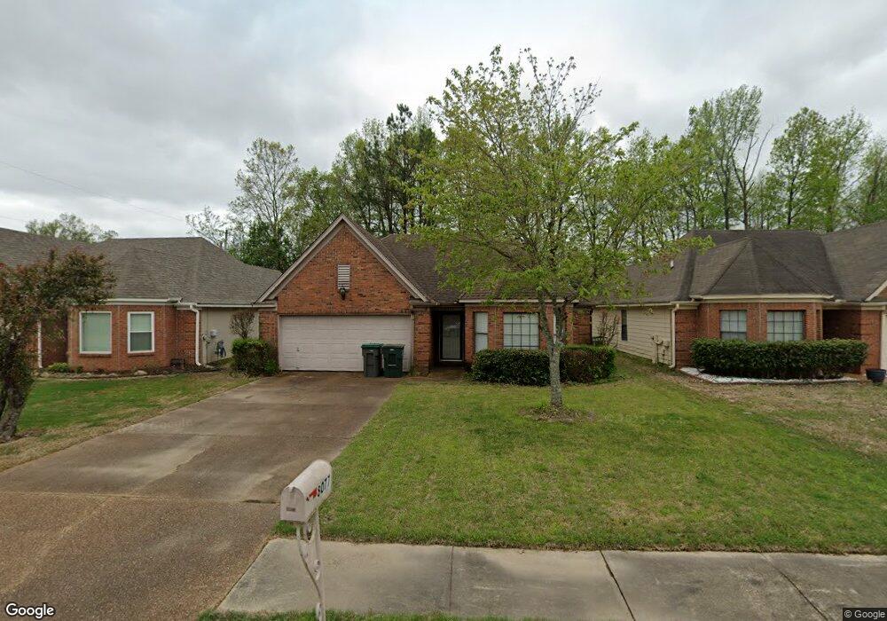
8077 Port Douglas Dr Cordova, TN 38018
Cordova NeighborhoodEstimated Value: $220,000 - $237,000
3
Beds
2
Baths
1,357
Sq Ft
$169/Sq Ft
Est. Value
About This Home
This home is located at 8077 Port Douglas Dr, Cordova, TN 38018 and is currently estimated at $228,729, approximately $168 per square foot. 8077 Port Douglas Dr is a home located in Shelby County with nearby schools including Cordova Elementary School, Germantown Middle School, and Germantown High School.
Ownership History
Date
Name
Owned For
Owner Type
Purchase Details
Closed on
Jun 4, 2007
Sold by
Graves Suzanne M
Bought by
Huggins Edwin Todd
Current Estimated Value
Home Financials for this Owner
Home Financials are based on the most recent Mortgage that was taken out on this home.
Original Mortgage
$88,000
Outstanding Balance
$53,642
Interest Rate
6.12%
Mortgage Type
Purchase Money Mortgage
Estimated Equity
$175,087
Purchase Details
Closed on
Jan 11, 2002
Sold by
Certain John N and Certain Sue C
Bought by
Long Jason H and Long Sharon P
Home Financials for this Owner
Home Financials are based on the most recent Mortgage that was taken out on this home.
Original Mortgage
$80,000
Interest Rate
6.85%
Purchase Details
Closed on
Aug 11, 1997
Sold by
Delisle Robert A and Delisle Norma J
Bought by
Certain John N and Certain Sue C
Create a Home Valuation Report for This Property
The Home Valuation Report is an in-depth analysis detailing your home's value as well as a comparison with similar homes in the area
Home Values in the Area
Average Home Value in this Area
Purchase History
| Date | Buyer | Sale Price | Title Company |
|---|---|---|---|
| Huggins Edwin Todd | $117,000 | None Available | |
| Long Jason H | $100,000 | -- | |
| Certain John N | $85,000 | -- |
Source: Public Records
Mortgage History
| Date | Status | Borrower | Loan Amount |
|---|---|---|---|
| Open | Huggins Edwin Todd | $88,000 | |
| Previous Owner | Long Jason H | $80,000 |
Source: Public Records
Tax History Compared to Growth
Tax History
| Year | Tax Paid | Tax Assessment Tax Assessment Total Assessment is a certain percentage of the fair market value that is determined by local assessors to be the total taxable value of land and additions on the property. | Land | Improvement |
|---|---|---|---|---|
| 2025 | $1,160 | $53,950 | $11,250 | $42,700 |
| 2024 | $1,160 | $34,225 | $6,750 | $27,475 |
| 2023 | $2,085 | $34,225 | $6,750 | $27,475 |
| 2022 | $2,085 | $34,225 | $6,750 | $27,475 |
| 2021 | $2,109 | $34,225 | $6,750 | $27,475 |
| 2020 | $2,065 | $28,500 | $6,750 | $21,750 |
| 2019 | $2,065 | $28,500 | $6,750 | $21,750 |
| 2018 | $2,065 | $28,500 | $6,750 | $21,750 |
| 2017 | $1,171 | $28,500 | $6,750 | $21,750 |
| 2016 | $1,161 | $26,575 | $0 | $0 |
| 2014 | $1,161 | $26,575 | $0 | $0 |
Source: Public Records
Map
Nearby Homes
- 218 S Walnut Bend Rd
- 250 Bendigo Dr
- 337 Almstead Cove
- 402 Lillehammer Cove
- 8228 Planters Grove Dr
- 90 W Viking Dr
- 8225 Walnut Grove Rd
- 241 Ericson Rd
- 8488 Loften Cove
- 00 Walnut Grove Rd
- 8492 Loften Cove
- 1506 Wolf Bend Rd
- 11 W Viking Dr
- 167 Ericson Rd
- 439 Spruce Glen Dr
- 179 Mysen Cir
- 8575 Bazemore Rd
- 178 Mysen Cir
- 1603 Kimbrook Cove
- 334 Brook Ridge Dr
- 8081 Port Douglas Dr
- 8073 Port Douglas Dr
- 8087 Port Douglas Dr
- 8069 Port Douglas Dr
- 8097 Port Douglas Dr
- 354 Bendigo Dr
- 8067 Port Douglas Dr
- 8090 Port Douglas Dr
- 8103 Port Douglas Dr
- 459 Dirks Cairn Cove
- 8063 Port Douglas Dr
- 348 Bendigo Dr
- 8096 Port Douglas Dr
- 8068 Port Douglas Dr
- 467 Dirks Cairn Cove
- 8107 Port Douglas Dr
- 8061 Port Douglas Dr
- 8100 Port Douglas Dr
- 8062 Port Douglas Dr
- 344 Bendigo Dr