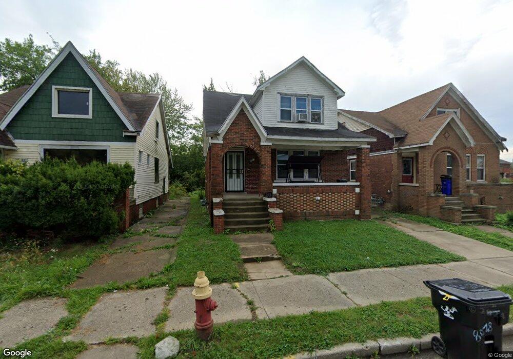
8078 E Robinwood St Detroit, MI 48234
Mount Olivet NeighborhoodEstimated Value: $85,000 - $111,000
--
Bed
1
Bath
1,464
Sq Ft
$64/Sq Ft
Est. Value
About This Home
This home is located at 8078 E Robinwood St, Detroit, MI 48234 and is currently estimated at $94,000, approximately $64 per square foot. 8078 E Robinwood St is a home located in Wayne County with nearby schools including Marion Law Academy, Edward 'Duke' Ellington Conservatory of Music and Art, and Charles L. Spain Elementary-Middle School.
Ownership History
Date
Name
Owned For
Owner Type
Purchase Details
Closed on
Apr 3, 2025
Sold by
Ellis Markeisha
Bought by
City Of Detroit
Current Estimated Value
Purchase Details
Closed on
Mar 4, 2021
Sold by
Detroit Land Bank Authority
Bought by
Ellis Markeisha
Purchase Details
Closed on
Jan 23, 2014
Sold by
Wayne County Treasurer
Bought by
Detroit Landbank Authority
Purchase Details
Closed on
Oct 24, 2007
Sold by
Brown Godfrey
Bought by
Gordon Yvonne
Create a Home Valuation Report for This Property
The Home Valuation Report is an in-depth analysis detailing your home's value as well as a comparison with similar homes in the area
Home Values in the Area
Average Home Value in this Area
Purchase History
| Date | Buyer | Sale Price | Title Company |
|---|---|---|---|
| City Of Detroit | -- | Chirco Title Agency | |
| Ellis Markeisha | $1,000 | None Available | |
| Detroit Landbank Authority | -- | None Available | |
| Gordon Yvonne | -- | None Available |
Source: Public Records
Tax History Compared to Growth
Tax History
| Year | Tax Paid | Tax Assessment Tax Assessment Total Assessment is a certain percentage of the fair market value that is determined by local assessors to be the total taxable value of land and additions on the property. | Land | Improvement |
|---|---|---|---|---|
| 2025 | $12 | $600 | $0 | $0 |
| 2024 | $12 | $200 | $0 | $0 |
| 2023 | $12 | $200 | $0 | $0 |
| 2022 | $14 | $200 | $0 | $0 |
| 2021 | $24 | $0 | $0 | $0 |
| 2020 | $0 | $0 | $0 | $0 |
| 2019 | $0 | $0 | $0 | $0 |
| 2018 | $0 | $0 | $0 | $0 |
| 2017 | -- | $0 | $0 | $0 |
| 2016 | $240 | $0 | $0 | $0 |
| 2015 | $1,203 | $0 | $0 | $0 |
| 2013 | $1,203 | $20,360 | $0 | $0 |
| 2010 | -- | $29,850 | $663 | $29,187 |
Source: Public Records
Map
Nearby Homes
- 8119 E Hildale St
- 8291 E Brentwood St
- 8100 Stockton St
- 8062 Stockton St
- 19126 Stotter St
- 8095 Orion St
- 7483 E Brentwood St
- 18666 Carrie St
- 8022 Yolanda St
- 5727 E Outer Dr
- 19190 Rogge St
- 19202 Rogge St
- 19161 Rogge St
- 8063 Yolanda St
- 19363 Packard St
- 19357 Packard St
- 18824 Helen St
- 19423 Spencer St
- 19320 Rogge St
- 19340 Rogge St
- 8084 E Robinwood St
- 8092 E Robinwood St
- 8070 E Robinwood St
- 8064 E Robinwood St
- 8098 E Robinwood St
- 8077 Quinn St
- 8083 Quinn St
- 8069 Quinn St
- 8056 E Robinwood St
- 8091 Quinn St
- 8063 Quinn St
- 8071 E Robinwood St
- 8093 E Robinwood St
- 8065 E Robinwood St
- 8055 Quinn St
- 8050 E Robinwood St
- 8099 E Robinwood St
- 8057 E Robinwood St
- 8105 Quinn St
- 8111 E Robinwood St