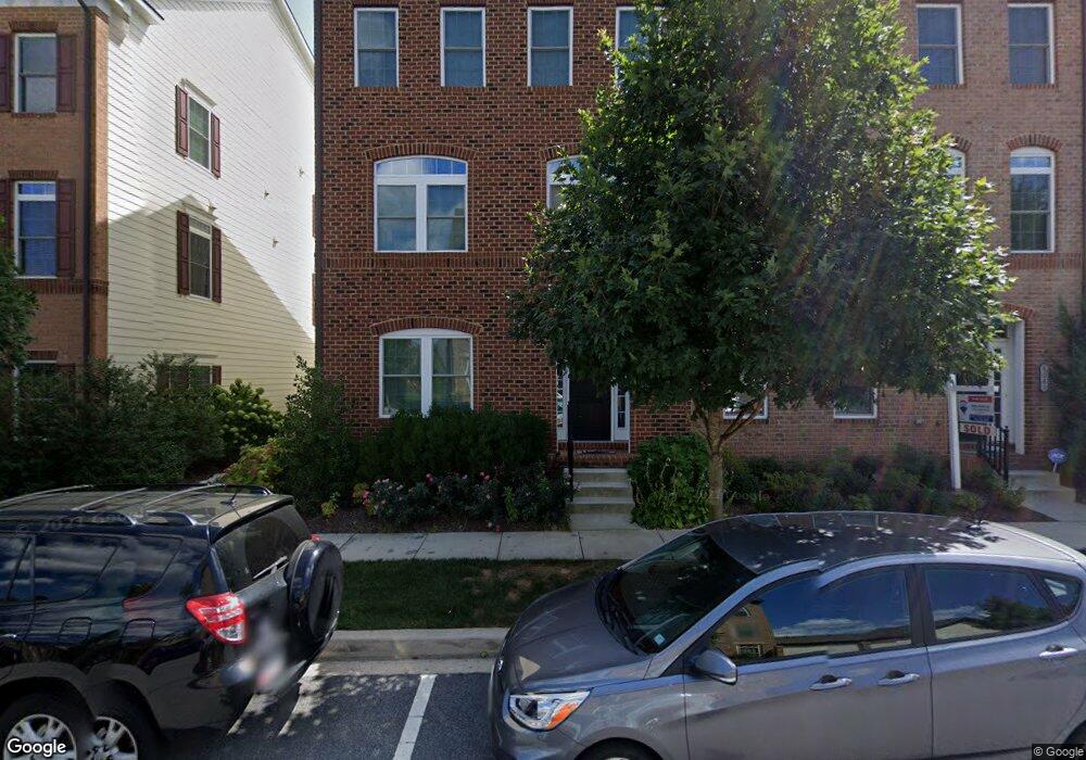
8079 Westside Blvd Fulton, MD 20759
Estimated Value: $840,138 - $893,000
--
Bed
3
Baths
3,120
Sq Ft
$277/Sq Ft
Est. Value
About This Home
This home is located at 8079 Westside Blvd, Fulton, MD 20759 and is currently estimated at $864,785, approximately $277 per square foot. 8079 Westside Blvd is a home located in Howard County with nearby schools including Fulton Elementary School, Lime Kiln Middle School, and Reservoir High School.
Ownership History
Date
Name
Owned For
Owner Type
Purchase Details
Closed on
Nov 26, 2013
Sold by
Nvr Inc
Bought by
Dehaan Robert W and Kim Diana L
Current Estimated Value
Home Financials for this Owner
Home Financials are based on the most recent Mortgage that was taken out on this home.
Original Mortgage
$58,900
Outstanding Balance
$16,406
Interest Rate
4.14%
Mortgage Type
Stand Alone Second
Estimated Equity
$848,379
Purchase Details
Closed on
Aug 12, 2013
Sold by
Greenebaum Development Inc
Bought by
Nvr Inc
Create a Home Valuation Report for This Property
The Home Valuation Report is an in-depth analysis detailing your home's value as well as a comparison with similar homes in the area
Home Values in the Area
Average Home Value in this Area
Purchase History
| Date | Buyer | Sale Price | Title Company |
|---|---|---|---|
| Dehaan Robert W | $589,170 | Stewart Title Guaranty Co | |
| Nvr Inc | $720,000 | None Available |
Source: Public Records
Mortgage History
| Date | Status | Borrower | Loan Amount |
|---|---|---|---|
| Open | Dehaan Robert W | $58,900 | |
| Open | Dehaan Robert W | $471,335 |
Source: Public Records
Tax History Compared to Growth
Tax History
| Year | Tax Paid | Tax Assessment Tax Assessment Total Assessment is a certain percentage of the fair market value that is determined by local assessors to be the total taxable value of land and additions on the property. | Land | Improvement |
|---|---|---|---|---|
| 2025 | $9,872 | $687,500 | $255,000 | $432,500 |
| 2024 | $9,872 | $658,167 | $0 | $0 |
| 2023 | $9,401 | $628,833 | $0 | $0 |
| 2022 | $8,939 | $599,500 | $235,000 | $364,500 |
| 2021 | $8,531 | $585,300 | $0 | $0 |
| 2020 | $8,531 | $571,100 | $0 | $0 |
| 2019 | $8,327 | $556,900 | $187,500 | $369,400 |
| 2018 | $7,686 | $539,867 | $0 | $0 |
| 2017 | $7,424 | $556,900 | $0 | $0 |
| 2016 | -- | $505,800 | $0 | $0 |
| 2015 | -- | $485,433 | $0 | $0 |
| 2014 | -- | $465,067 | $0 | $0 |
Source: Public Records
Map
Nearby Homes
- 11342 Market St
- 11347 Market St
- 7734 Tilghman St
- 11246 1 Chase St Unit 141
- 7704 Water St
- 7676 Maple Lawn Blvd Unit 2
- 8976 Tawes St
- 8237 S Maple Lawn Blvd
- 8229 White Pine Ct
- 8224 White Pine Ct
- 11540 Iager Blvd
- 8208 Sandy Stream Rd
- 7937 Hammond Pkwy
- 10948 Scaggsville Rd
- 8200 Splashing Brook Ct
- 7405 Oakcrest Ln
- 10774 W Crestview Ln
- 8445 Early Bud Way
- 8061 Hunterbrooke Ln
- 10725 E Crestview Ln
- 8081 Westside Blvd
- 8077 Westside Blvd
- 8083 Westside Blvd
- 8075 Westside Blvd
- 8085 Westside Blvd
- 8073 Westside Blvd
- 8202 Ports Ln
- 8204 Ports Ln
- 11305 Market St
- 8206 Ports Ln
- 11307 Market St
- 8069 Westside Blvd
- 11311 Market St
- 11315 Market St
- 11309 Market St
- 11293 Market St
- 8208 Ports Ln
- 11295 Market St
- 8067 Westside Blvd
- 11317 Market St