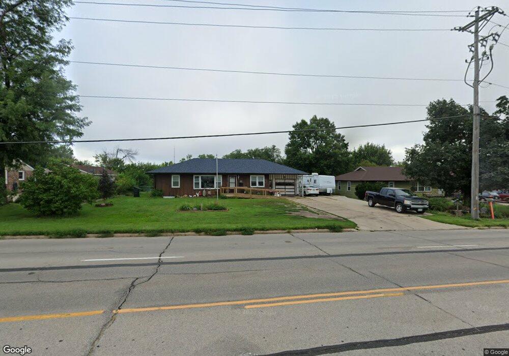
808 Blairs Ferry Rd NE Cedar Rapids, IA 52402
Estimated Value: $174,000 - $227,049
3
Beds
1
Bath
2,138
Sq Ft
$97/Sq Ft
Est. Value
About This Home
This home is located at 808 Blairs Ferry Rd NE, Cedar Rapids, IA 52402 and is currently estimated at $208,262, approximately $97 per square foot. 808 Blairs Ferry Rd NE is a home located in Linn County with nearby schools including Echo Hill Elementary School, Oak Ridge School, and Linn-Mar High School.
Ownership History
Date
Name
Owned For
Owner Type
Purchase Details
Closed on
Feb 17, 2009
Sold by
Mcelmeel Sharron L and Hanson Helen A
Bought by
Anderson Brian Gene and Anderson Tina Marie
Current Estimated Value
Home Financials for this Owner
Home Financials are based on the most recent Mortgage that was taken out on this home.
Original Mortgage
$88,800
Outstanding Balance
$58,779
Interest Rate
6%
Mortgage Type
Purchase Money Mortgage
Estimated Equity
$149,483
Purchase Details
Closed on
Feb 12, 2009
Sold by
Hanson Dwayne L and Hanson Belinda
Bought by
Hanson Helen A
Home Financials for this Owner
Home Financials are based on the most recent Mortgage that was taken out on this home.
Original Mortgage
$88,800
Outstanding Balance
$58,779
Interest Rate
6%
Mortgage Type
Purchase Money Mortgage
Estimated Equity
$149,483
Create a Home Valuation Report for This Property
The Home Valuation Report is an in-depth analysis detailing your home's value as well as a comparison with similar homes in the area
Home Values in the Area
Average Home Value in this Area
Purchase History
| Date | Buyer | Sale Price | Title Company |
|---|---|---|---|
| Anderson Brian Gene | $110,500 | None Available | |
| Hanson Helen A | -- | None Available |
Source: Public Records
Mortgage History
| Date | Status | Borrower | Loan Amount |
|---|---|---|---|
| Open | Anderson Brian Gene | $88,800 |
Source: Public Records
Tax History Compared to Growth
Tax History
| Year | Tax Paid | Tax Assessment Tax Assessment Total Assessment is a certain percentage of the fair market value that is determined by local assessors to be the total taxable value of land and additions on the property. | Land | Improvement |
|---|---|---|---|---|
| 2025 | $3,236 | $192,600 | $42,900 | $149,700 |
| 2024 | $3,414 | $165,200 | $32,200 | $133,000 |
| 2023 | $3,414 | $165,200 | $32,200 | $133,000 |
| 2022 | $3,050 | $149,400 | $29,500 | $119,900 |
| 2021 | $3,066 | $137,800 | $29,500 | $108,300 |
| 2020 | $3,066 | $130,600 | $26,800 | $103,800 |
| 2019 | $3,206 | $138,000 | $24,700 | $113,300 |
| 2018 | $3,070 | $138,000 | $24,700 | $113,300 |
| 2017 | $3,020 | $131,800 | $24,700 | $107,100 |
| 2016 | $2,948 | $131,800 | $24,700 | $107,100 |
| 2015 | $2,880 | $128,583 | $21,470 | $107,113 |
| 2014 | $2,880 | $128,583 | $21,470 | $107,113 |
| 2013 | $2,784 | $128,583 | $21,470 | $107,113 |
Source: Public Records
Map
Nearby Homes
- 5794 Oakwood Ave NE Unit 2
- 5703 Golden Ct NE Unit 34
- 5712 Golden Ct NE Unit 60
- 6040 Purple Dr NE
- 327 Meadows Field Dr NE
- 406 Teakwood Ln NE Unit 20
- 431 Teakwood Ln NE
- 396 Teakwood Ln NE Unit C
- 396 Teakwood Ln NE
- 733 Broderick Dr NE Unit B
- 5915 Flagstone Dr NE
- 201 Teakwood Ln NE
- 6410 Creekside Dr NE Unit 1
- 6410 Creekside Dr NE
- 6430 Creekside Dr NE Unit 4
- 0 Council St NE
- 6715 Creekside Dr NE Unit 2
- 0 C Ave NE
- 1048 Clifton St NE
- 1008 Doubletree Ct NE Unit 1008
- 722 Blairs Ferry Rd NE
- 818 Blairs Ferry Rd NE
- 809 Suburban St NE
- 826 Blairs Ferry Rd NE
- 723 Suburban St NE
- 819 Suburban St NE
- 827 Suburban St NE
- 715 Suburban St NE
- 706 Blairs Ferry Rd NE
- 5712 Addison Ave NE
- 5735 Oakwood Ave NE
- 5730 Addison Ave NE
- 5747 Oakwood Ave NE
- 5740 Addison Ave NE
- 806 Suburban St NE
- 814 Suburban St NE
- 901 Blairs Ferry Rd NE Unit 3A
- 901 Blairs Ferry Rd NE Unit 2B
- 901 Blairs Ferry Rd NE Unit 2A
- 822 Suburban St NE