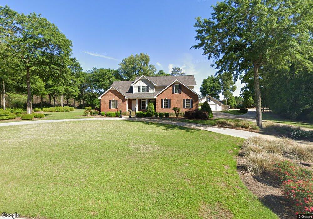
808 Bobby Jones Dr Dublin, GA 31021
Estimated Value: $490,000 - $665,000
3
Beds
4
Baths
2,722
Sq Ft
$203/Sq Ft
Est. Value
About This Home
This home is located at 808 Bobby Jones Dr, Dublin, GA 31021 and is currently estimated at $551,337, approximately $202 per square foot. 808 Bobby Jones Dr is a home located in Laurens County with nearby schools including Northwest Laurens Elementary School, Southwest Laurens Elementary School, and East Laurens Primary School.
Ownership History
Date
Name
Owned For
Owner Type
Purchase Details
Closed on
Jan 19, 2005
Sold by
Perry Double Yoke Farms Lc
Bought by
Clark Robert B
Current Estimated Value
Create a Home Valuation Report for This Property
The Home Valuation Report is an in-depth analysis detailing your home's value as well as a comparison with similar homes in the area
Home Values in the Area
Average Home Value in this Area
Purchase History
| Date | Buyer | Sale Price | Title Company |
|---|---|---|---|
| Clark Robert B | $20,000 | -- |
Source: Public Records
Tax History Compared to Growth
Tax History
| Year | Tax Paid | Tax Assessment Tax Assessment Total Assessment is a certain percentage of the fair market value that is determined by local assessors to be the total taxable value of land and additions on the property. | Land | Improvement |
|---|---|---|---|---|
| 2024 | $3,397 | $163,388 | $12,000 | $151,388 |
| 2023 | $3,148 | $150,224 | $12,000 | $138,224 |
| 2022 | $3,198 | $150,224 | $12,000 | $138,224 |
| 2021 | $3,047 | $137,478 | $18,586 | $118,892 |
| 2020 | $3,051 | $137,478 | $18,586 | $118,892 |
| 2019 | $3,064 | $137,971 | $18,586 | $119,385 |
| 2018 | $3,067 | $137,971 | $18,586 | $119,385 |
| 2017 | $3,064 | $137,971 | $18,586 | $119,385 |
| 2016 | $3,068 | $137,971 | $18,586 | $119,385 |
| 2015 | $3,069 | $137,971 | $18,586 | $119,385 |
| 2014 | $2,309 | $100,722 | $4,389 | $96,333 |
Source: Public Records
Map
Nearby Homes
- 550 Masters Cir
- 912 Sussex Ct
- 157 Lakeview Ln
- 415 Willa Ln
- 256 Wells Cir
- 719 Jones Ln
- 446 Willow Point Dr
- 522 Clearwater Cir
- 1400 Peach St
- 209 Plum St
- 108 Plum St
- 105 Palisade Dr
- 603 Old Toomsboro Rd
- 214 Holly Dr
- 305 Lassiter Dr
- 209 Rollingwood Dr
- 211 Palisade Dr
- 1328 Buckeye Rd
- 0 Flanders Ct N Unit 30069
- 0 Flanders Ct N Unit 10554837
- 505 Masters Cir
- 505 Masters Cir Unit 12
- 511 Masters Cir
- 807 W Bobby Jones Dr
- 822 Bobby Jones Dr
- 517 Masters Cir
- 815 Bobby Jones Dr
- 0 Masters Cir Lot 14 Unit 20033196
- 828 Bobby Jones Dr
- 520 Masters Cir
- 0000 Masters Cir
- 525 Masters Cir
- 827 Bobby Jones Dr
- 509 Blackshear Ferry Rd W
- 564 Masters Cir
- 833 Bobby Jones Dr Unit 17 & 18
- 833 Bobby Jones Dr
- 531 Masters Cir
- 517 Blackshear Ferry Rd W
- 667 Saxony Dr