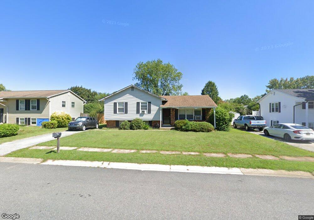
808 Broadfield Dr Newark, DE 19713
Estimated Value: $299,000 - $376,000
3
Beds
2
Baths
1,016
Sq Ft
$338/Sq Ft
Est. Value
About This Home
This home is located at 808 Broadfield Dr, Newark, DE 19713 and is currently estimated at $343,468, approximately $338 per square foot. 808 Broadfield Dr is a home located in New Castle County with nearby schools including Smith (Jennie E.) Elementary School, Gauger-Cobbs Middle School, and Newark High School.
Ownership History
Date
Name
Owned For
Owner Type
Purchase Details
Closed on
Mar 20, 2006
Sold by
Weiner Norman D
Bought by
Dehart Joseph D and Dehart Danielle
Current Estimated Value
Home Financials for this Owner
Home Financials are based on the most recent Mortgage that was taken out on this home.
Original Mortgage
$199,900
Outstanding Balance
$113,708
Interest Rate
6.28%
Mortgage Type
Fannie Mae Freddie Mac
Estimated Equity
$229,760
Purchase Details
Closed on
May 3, 2005
Sold by
Haas Francis X
Bought by
Weiner Norman D
Create a Home Valuation Report for This Property
The Home Valuation Report is an in-depth analysis detailing your home's value as well as a comparison with similar homes in the area
Home Values in the Area
Average Home Value in this Area
Purchase History
| Date | Buyer | Sale Price | Title Company |
|---|---|---|---|
| Dehart Joseph D | $199,900 | None Available | |
| Weiner Norman D | $154,000 | -- |
Source: Public Records
Mortgage History
| Date | Status | Borrower | Loan Amount |
|---|---|---|---|
| Open | Dehart Joseph D | $199,900 |
Source: Public Records
Tax History
| Year | Tax Paid | Tax Assessment Tax Assessment Total Assessment is a certain percentage of the fair market value that is determined by local assessors to be the total taxable value of land and additions on the property. | Land | Improvement |
|---|---|---|---|---|
| 2024 | $2,408 | $54,800 | $10,600 | $44,200 |
| 2023 | $2,345 | $54,800 | $10,600 | $44,200 |
| 2022 | $2,329 | $54,800 | $10,600 | $44,200 |
| 2021 | $2,279 | $54,800 | $10,600 | $44,200 |
| 2020 | $2,216 | $54,800 | $10,600 | $44,200 |
| 2019 | $2,673 | $54,800 | $10,600 | $44,200 |
| 2018 | $1,922 | $54,800 | $10,600 | $44,200 |
| 2017 | $1,856 | $54,800 | $10,600 | $44,200 |
| 2016 | $1,841 | $54,800 | $10,600 | $44,200 |
| 2015 | $1,684 | $54,800 | $10,600 | $44,200 |
| 2014 | $1,685 | $54,800 | $10,600 | $44,200 |
Source: Public Records
Map
Nearby Homes
- 831 Broadfield Dr
- 886 Broadfield Dr
- 1202 Pinefield Rd
- 26 Kensington Ln
- 11 Kensington Ln
- 600 Judy Way
- 3 Merry Rd
- 119 Felix Dr
- 148 Brookside Blvd
- 20 Ardmore Rd
- 40 E Shady Dr
- 42 Lynch Farm Dr
- 6 Fleming St
- 17 Pearson Dr
- 11 Carnegie Ct
- 22 Alwyn Rd
- 317 Cannons Way
- 1000 Fountainview Cir Unit 309
- 3000 Fountainview Cir Unit 3411
- 25 Glyn Dr
- 806 Broadfield Dr
- 810 Broadfield Dr
- 711 Manfield Rd
- 709 Manfield Rd
- 804 Broadfield Dr
- 713 Manfield Rd
- 807 Broadfield Dr
- 707 Manfield Rd
- 805 Broadfield Dr
- 809 Broadfield Dr
- 715 Manfield Rd
- 814 Broadfield Dr
- 803 Broadfield Dr
- 811 Broadfield Dr
- 705 Manfield Rd
- 717 Manfield Rd
- 813 Broadfield Dr
- 801 Broadfield Dr
- 710 Manfield Rd
- 816 Broadfield Dr
Your Personal Tour Guide
Ask me questions while you tour the home.