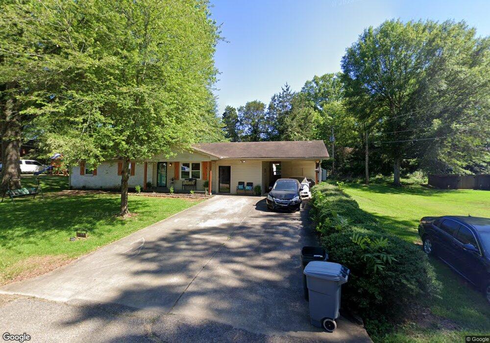
808 Byrne St New Albany, MI 38652
Estimated Value: $166,000 - $230,000
3
Beds
2
Baths
2,129
Sq Ft
$88/Sq Ft
Est. Value
About This Home
This home is located at 808 Byrne St, New Albany, MI 38652 and is currently estimated at $186,737, approximately $87 per square foot. 808 Byrne St is a home located in Union County with nearby schools including New Albany Elementary School, New Albany/S.Tippah/Union County Alternative School, and New Albany Middle School.
Ownership History
Date
Name
Owned For
Owner Type
Purchase Details
Closed on
Oct 4, 2019
Sold by
Downs David E
Bought by
Earl Rhonda R
Current Estimated Value
Purchase Details
Closed on
May 8, 2017
Sold by
Cousar Helen and Hall Janice L
Bought by
Downs David E
Home Financials for this Owner
Home Financials are based on the most recent Mortgage that was taken out on this home.
Original Mortgage
$93,279
Interest Rate
4.1%
Mortgage Type
Unknown
Purchase Details
Closed on
Jun 21, 2012
Sold by
Cousar Ernest and Cousar Helen
Bought by
Ernest Cousar Life Estate
Create a Home Valuation Report for This Property
The Home Valuation Report is an in-depth analysis detailing your home's value as well as a comparison with similar homes in the area
Home Values in the Area
Average Home Value in this Area
Purchase History
| Date | Buyer | Sale Price | Title Company |
|---|---|---|---|
| Earl Rhonda R | -- | None Available | |
| Downs David E | -- | None Available | |
| Ernest Cousar Life Estate | -- | -- |
Source: Public Records
Mortgage History
| Date | Status | Borrower | Loan Amount |
|---|---|---|---|
| Previous Owner | Downs David E | $93,279 |
Source: Public Records
Tax History Compared to Growth
Tax History
| Year | Tax Paid | Tax Assessment Tax Assessment Total Assessment is a certain percentage of the fair market value that is determined by local assessors to be the total taxable value of land and additions on the property. | Land | Improvement |
|---|---|---|---|---|
| 2025 | $1,128 | $9,979 | $0 | $0 |
| 2024 | $1,128 | $9,979 | $0 | $0 |
| 2023 | $1,133 | $9,979 | $0 | $0 |
| 2022 | $876 | $8,163 | $0 | $0 |
| 2021 | $844 | $8,163 | $0 | $0 |
| 2020 | $844 | $8,163 | $0 | $0 |
| 2019 | $1,140 | $8,139 | $0 | $0 |
| 2018 | $1,080 | $7,710 | $0 | $0 |
| 2017 | $0 | $7,472 | $0 | $0 |
| 2016 | $0 | $7,472 | $0 | $0 |
| 2015 | -- | $7,472 | $0 | $0 |
| 2014 | -- | $7,059 | $0 | $0 |
Source: Public Records
Map
Nearby Homes
- Lot 82 Sarah Grace Ln
- 0 Cr 371 Unit 22-3931
- Lot 18 Sarah Grace Ln
- Lot 84 Sara Grace Ln
- Lot 81 Sarah Grace Ln
- 917 N Acre Dr
- 504 Hobson St
- 410 Pineridge Dr
- 0 Denmill Rd
- 0 North St
- 313 Garfield St
- 0 Mississippi 348
- 409 Broad St
- 211 E Main St
- 400 Alabama St
- 111 Cleveland St
- 203 Alabama St
- 810 Brookwood St
- 1034 Morgan Dr
- 828 Brookwood St